There are two streams named Salmon Trout River in the Upper Peninsula of the U.S. state of Michigan.
Contents

There are two streams named Salmon Trout River in the Upper Peninsula of the U.S. state of Michigan.
46°51′47″N87°46′16″W / 46.86306°N 87.77111°W
The Salmon Trout River in the Huron Mountains of Marquette County is home to the "coaster" brook trout. The 20.8-mile-long (33.5 km) [1] river flows into Lake Superior several miles northwest of Big Bay. The river rises in the northern portions of Michigamme Township and Marquette Township and flows through Powell Township. The headwaters of this river are in the Yellow Dog Plains.
The Huron Mountain Club (HMC) owns a large tract of land in the mountains, including a portion of the Salmon Trout River. However, the private club restricts access to its property.
This river has received attention lately as its headwaters are located near a proposed sulfide mine. Groups opposed to this claim sulfide mining may lead to acid mine drainage that can adversely affect water systems, while proponents claim that sulfide mining can be done without adverse environmental effects.
47°09′10″N88°46′22″W / 47.15278°N 88.77278°W
The Salmon Trout River in Houghton County, 17.5 miles (28.2 km) long, [1] flows into Lake Superior on the west side of the Keweenaw Peninsula near Redridge. The river rises in Adams Township, just north of M-26, between Painesdale and Toivola. The river flows over the Redridge Steel Dam before emptying into Lake Superior.

The Upper Peninsulaof Michigan – also known as Upper Michigan or colloquially the U.P. – is the northern and more elevated of the two major landmasses that make up the U.S. state of Michigan; it is separated from the Lower Peninsula by the Straits of Mackinac. It is bounded primarily by Lake Superior to the north, separated from the Canadian province of Ontario at the east end by the St. Marys River, and flanked by Lake Huron and Lake Michigan along much of its south. Although the peninsula extends as a geographic feature into the state of Wisconsin, the state boundary follows the Montreal and Menominee rivers and a line connecting them.

Marquette County is a county located in the Upper Peninsula of the US state of Michigan. As of the 2020 Census, the population was 66,017. The county seat is Marquette. The county is named for Father Marquette, a Jesuit missionary. It was set off in 1843 and organized in 1851. Marquette County is the largest county in land area in Michigan, and the most populous county in the Upper Peninsula of Michigan.

Houghton County is a county in the Upper Peninsula in the U.S. state of Michigan. As of the 2020 Census, the population was 37,361. The county seat and largest city is Houghton. Both the county and the city were named for Michigan State geologist and Detroit Mayor Douglass Houghton.

Baraga County is a county in the Upper Peninsula in the U.S. state of Michigan. As of the 2020 Census, the population was 8,158, making it Michigan's fifth-least populous county. The county seat is L'Anse. The county is named after Bishop Frederic Baraga, a Catholic missionary who ministered to the Ojibwa Indians in the Michigan Territory.

Powell Township is a civil township of Marquette County in the U.S. state of Michigan. The population was 816 at the 2010 census.
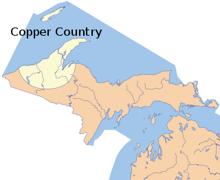
The Copper Country is an area in the Upper Peninsula of Michigan in the United States, including Keweenaw County, Michigan, Houghton, Baraga and Ontonagon counties as well as part of Marquette County. The area is so named as copper mining was prevalent there from 1845 until the late 1960s, with one mine continuing through 1995. In its heyday in the latter half of the 19th century and the early 20th century, the area was the world's greatest producer of copper.

The Huron River is a 130-mile-long (210 km) river in southeastern Michigan, rising out of the Huron Swamp in Springfield Township in northern Oakland County and flowing into Lake Erie, as it forms the boundary between present-day Wayne and Monroe counties. Thirteen parks, game areas, and recreation areas are associated with the river, which passes through the cities of Dexter, Ann Arbor, Ypsilanti, Belleville, Flat Rock and Rockwood that were developed along its banks.
The Huron Mountains are located in the Upper Peninsula of the U.S. state of Michigan, mostly in Marquette and Baraga counties, overlooking Lake Superior. Their highest peak is Mount Arvon which, at 1,979 feet (603 m) above sea level, is the highest point in the state of Michigan. Nearby Mt. Curwood, Michigan's second highest mountain at 1,978 feet (603 m), is also a part of the Huron Mountains.
The Little Huron River is an 8.0-mile-long (12.9 km) stream that flows entirely within Powell Township in northwest Marquette County, Michigan, in the United States. It rises on the slopes of Mount Benison and Superior Mountain in the west end of the Huron Mountains. For almost half of its length it flows generally southwesterly then westerly as it is joined by creeks from other arms of its valley. It then turns north, flowing through gentler terrain to its mouth on the south shore of Lake Superior. The Little Huron River drainage basin is 15.8 square miles (41 km2).
Gull Island is the name of a dozen small islands in the U.S. state of Michigan.
M-35 is a state trunkline highway in the Upper Peninsula (UP) of the US state of Michigan. It runs for 128 miles (206 km) in a general north–south direction and connects the cities of Menominee, Escanaba, and Negaunee. The southern section of M-35 in Menominee and Delta counties carries two additional designations; M-35 forms a segment of the Lake Michigan Circle Tour, and it is the UP Hidden Coast Recreational Heritage Trail, which is a part of what is now called the Pure Michigan Byways Program. Along the southern section, the highway is the closest trunkline to the Green Bay, a section of Lake Michigan. The northern section of the highway turns inland through sylvan areas of the UP, connecting rural portions of Delta and Marquette counties.

Pine River may refer to any of the following rivers in the U.S. state of Michigan:

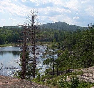
The Yellow Dog Plains is an area north and west of Marquette, Michigan, in the Upper Peninsula of Michigan, United States. The Yellow Dog River flows through it, as does the Salmon Trout River. The Salmon Trout River is unique in that it has a breeding population of coasters, a potamodromous form of brook trout. Coasters are virtually extinct from their native range on the south coast of Lake Superior, except for the Salmon Trout River. The Yellow Dog Plains is a remote and virtually untouched wilderness, aside from large scale logging operations. There are extensive forests of Eastern white pine, with reports of some of the trees in the Yellow Dog Plains reaching heights of 31 meters.

The Huron River is a 7.6-mile-long (12.2 km) river in the northern Upper Peninsula of Michigan in the United States. Locally, it is commonly called the Big Huron River to distinguish it from the nearby Little Huron River. Another much larger Huron River is in Southeast Michigan.
The Spurr River is a short stream in the Upper Peninsula of the U.S. state of Michigan. It rises from the outflow of Beaufort Lake at 46°32′47″N88°11′14″W and flows 3.9 miles (6.3 km) east-southeast into Lake Michigamme at 46°31′43″N88°07′54″W.
Carp River is a 21.9-mile-long (35.2 km) river in Marquette County in the U.S. state of Michigan. The Carp River is formed by the outflow of Deer Lake in Ishpeming Township north of Ishpeming at 46°31′58″N87°40′01″W in the Upper Peninsula.

County Road 510 is a primary county road in Marquette County, Michigan, that connects Negaunee Township with the community of Big Bay. The road runs through rural forests as a paved and dirt road in northern Marquette County. It crosses the Dead River near the Hoist and McClure dams and runs for 26.103 miles (42.009 km) before terminating at an intersection with CR 550 south of Big Bay.