Goose Creek (River Raisin)

Last updated
Goose Creek
Goose creek.JPG
Goose Creek
Location
Country United States
State Michigan
Cities Brooklyn, Cement City, Somerset Center
Physical characteristics
Source 
  location Somerset Township, Michigan
  coordinates 42°03′32″N84°22′15″W / 42.05889°N 84.37083°W / 42.05889; -84.37083 [1]
Mouth River Raisin
  location
Columbia Township, Michigan
  coordinates
42°06′52″N84°14′51″W / 42.11444°N 84.24750°W / 42.11444; -84.24750 Coordinates: 42°06′52″N84°14′51″W / 42.11444°N 84.24750°W / 42.11444; -84.24750
Length12 mi (19 km)
Basin size40 sq mi (100 km2)

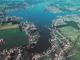
Goose Creek is a small stream in Hillsdale, Jackson and Lenawee counties in the U.S. state of Michigan. It is a tributary of the River Raisin. The headwaters form in Somerset Township in northeast Hillsdale County flowing northeast to join the River Raisin just north of the village of Brooklyn. The total length of the creek is approximately 12 miles (19 km). [2] The Goose Greek subbasin covers an area of 40 sq mi (100 km2) with 44% used for agriculture and 38% forest, wetlands, and grasslands. Only about 12% of the watershed is made up of urban development. Of all the subbasins within the River Raisin watershed, Goose Creek has maintained the largest share of wetlands and maintains the lowest levels of pollutants. [3]

Contents

Course

Goose Creek is formed in a marshy area of Somerset Township just south of the unincorporated community of Somerset Center within a short distance of the headwaters of the Grand River. From Somerset Center Goose Creek flows in an easterly direction through Lake Somerset, Goose Lake and Little Goose Lake. The village of Cement City is located along the stream just north of Little Goose Lake. Beyond Cement City, the creek turns north running into Lake Columbia. North of the lake, Goose Creek turns east again, traveling 4 mi (6.4 km) before merging with the River Raisin north of Brooklyn.

Lakes

Lake Columbia is the largest lake within the Goose Creek watershed. Lcmichigan.jpg
Lake Columbia is the largest lake within the Goose Creek watershed.

Goose Creek drains nine natural and man-made lakes: [4]

See also

Related Research Articles

Garrett County, Maryland County in Maryland, United States

Garrett County is the westernmost county of the U.S. state of Maryland. As of the 2020 census, the population was 28,806, making it the third-least populous county in Maryland. Its county seat is Oakland. The county was named for John Work Garrett (1820–1884), president of the Baltimore and Ohio Railroad. Created from Allegany County, Maryland in 1873, it was the last Maryland county to be formed.

Lake County, Oregon County in Oregon, United States

Lake County is one of the 36 counties in the U.S. state of Oregon. As of the 2010 census, the population was 7,895. Its county seat is Lakeview. The county is named after the many lakes found within its boundaries, including Lake Abert, Summer Lake, Hart Lake, and Goose Lake.

Union County, North Carolina County in North Carolina, United States

Union County is a county located in the U.S. state of North Carolina. As of the 2010 census, the population was 201,292. Its county seat is Monroe. Union County is included in the Charlotte-Concord-Gastonia, NC-SC Metropolitan Statistical Area.

Kendale Lakes, Florida CDP in Florida, United States

Kendale Lakes is a census-designated place (CDP) and a suburb of Miami in Miami-Dade County, Florida, United States. The population was 56,901 at the 2000 census.

USS <i>Scourge</i> (1812) American warship converted from a confiscated Canadian merchant schooner

USS Scourge was an American warship converted from a confiscated Canadian merchant schooner. She and the American warship Hamilton foundered at 2:00am on Sunday, August 8, 1813 during a squall on Lake Ontario. during the War of 1812.

Lake Columbia

Lake Columbia is a man-made lake in Columbia Township in southern Jackson County in the U.S. state of Michigan. Originally formed as a mill pond in 1836, it was expanded to 840 acres (3.4 km2) in 1961. At its greatest extent, the lake is 2 and 1/4 miles long and 1 and 3/4 miles wide. It has approximately 14 miles (23 km) of shoreline and the water source to the lake is Goose Creek. The lake has an average depth of 18 feet (5.5 m). Lake Columbia is located 2 miles (3.2 km) west of Brooklyn, Michigan. The latitude for the lake is 42.0928 and the longitude is -84.3011 with an elevation of 988 ft (301 m) above sea level.

Cedar Creek may refer to several small streams in the U.S. state of Michigan:

References

  1. "Goose Creek". Geographic Names Information System . United States Geological Survey.
  2. U.S. Geological Survey. National Hydrography Dataset high-resolution flowline data. The National Map Archived 2012-04-05 at WebCite , accessed May 19, 2011
  3. http://www.michigan.gov/documents/deq/wb-nps-rr-wmp1_303614_7.pdf [ bare URL PDF ]
  4. "U.S. Board on Geographic Names".