List of rivers of Connecticut

Last updated

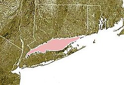
Most of Connecticut's rivers flow into Long Island Sound and from there the waters mix into the Atlantic Ocean. A few extremely eastern rivers flow into Block Island Sound. The list is arranged by drainage basin from east to west, with respective tributaries indented from downstream to upstream under each larger stream's name.

Contents

By drainage basin (east to west)

Block Island Sound

Block Island Sound is shown highlighted in pink, between the coast of the Rhode Island and Block Island. Wpdms ev26188 blockislandsound.jpg
Block Island Sound is shown highlighted in pink, between the coast of the Rhode Island and Block Island.

Long Island Sound

Long Island Sound is shown highlighted in pink between Connecticut and Long Island. Wpdms ev26188 long island sound.jpg
Long Island Sound is shown highlighted in pink between Connecticut and Long Island.
Connecticut River watershed Connecticut River Map.png
Connecticut River watershed
Rivers of New Haven Newhavenrivers.png
Rivers of New Haven
Housatonic River watershed Housatonicrivermap.png
Housatonic River watershed
Rippowam River, 1906 PostcardStamfordCTRippowamRiverBridgeHouses1906.jpg
Rippowam River, 1906

New York Harbor

Map of the Croton River drainage basin Crotonrivermap.png
Map of the Croton River drainage basin

Related Research Articles

<span class="mw-page-title-main">Lyme, Connecticut</span> Town in the United States

Lyme is a town in New London County, Connecticut, United States, situated on the eastern side of the Connecticut River. The town is part of the Lower Connecticut River Valley Planning Region. The population was 2,352 at the 2020 census. Lyme is the eponym of Lyme disease.

<span class="mw-page-title-main">Shetucket River</span> River in Connecticut, United States

The Shetucket River is a tributary of the Thames River, 20.4 miles (32.8 km) long, in eastern Connecticut in the United States.

<span class="mw-page-title-main">Farmington River</span> River in the United States of America

The Farmington River is a river, 46.7 miles (75.2 km) in length along its main stem, located in northwest Connecticut with major tributaries extending into southwest Massachusetts. The longest route of the river, from the origin of its West Branch, is 80.4 miles (129.4 km) long, making it the Connecticut River's longest tributary by 2.3 miles (3.7 km) over the major river directly to its north, the Westfield River. The Farmington River's watershed covers 609 square miles (1,580 km2). Historically, the river played an important role in small-scale manufacturing in towns along its course, but it is now mainly used for recreation and drinking water.

<span class="mw-page-title-main">Quinebaug River</span> River in Massachusetts, United States

The Quinebaug River is a river in south-central Massachusetts and eastern Connecticut, with watershed extending into western Rhode Island. The name "Quinebaug" comes from the southern New England Native American term, spelled variously Qunnubbâgge, Quinibauge, etc., meaning "long pond", from qunni-, "long", and -paug, "pond". The river is one of the namesake rivers in the Quinebaug and Shetucket Rivers Valley National Heritage Corridor.

<span class="mw-page-title-main">Park River (Connecticut)</span> River in the U.S. state of Connecticut

The Park River is a tributary of the Connecticut River in Hartford, Connecticut. It was officially named the Park River in 1892 after Bushnell Park, through which it flowed in downtown Hartford. A local newspaper had advocated for that name rather than the “’Hog River’” name which was then in use. Between 1940 and the 1980s, the 2.3-mile (3.7 km) river was buried by the Army Corps of Engineers to prevent the spring floods regularly caused by increased surface runoff from urban development.

<span class="mw-page-title-main">Batten Kill</span> River in New York, United States

The Batten Kill, Battenkill, or Battenkill River is a 59.4-mile-long (95.6 km) river rising in Vermont that flows into New York and is a tributary of the Hudson River. It is the longest Hudson tributary on that river's east. As "kill" means a creek, the name "Battenkill River" is pleonastic.

<span class="mw-page-title-main">South Fork Eel River</span> River in north-central California

The South Fork Eel River is the largest tributary of the Eel River in north-central California in the United States. The river flows 105 miles (169 km) north from Laytonville to Dyerville/Founders' Grove where it joins the Eel River. The South Fork drains a long and narrow portion of the Coast Range of California in parts of Mendocino and Humboldt counties. U.S. Route 101 follows the river for much of its length.

<span class="mw-page-title-main">Aspetuck River</span>

The Aspetuck River is a 17.0-mile-long (27.4 km) river in the U.S. state of Connecticut. The river rises in the hills located in Huntington State Park in Bethel, with a watershed of approximately 430 acres (170 ha). The river flows generally southerly through Redding, Connecticut, to the Aspetuck Reservoir, and finally into the Saugatuck River in Westport, Connecticut and then into the Long Island Sound. It flows through the village of Aspetuck at an average depth of 2.5 feet (0.76 m). The word Aspetuck can be translated as "river originating at the high place" in an Algonquian language.

<span class="mw-page-title-main">Natchaug River</span> River in Connecticut, United States

The Natchaug River is a 17.9-mile-long (28.8 km) river in Windham and Tolland Counties in northeastern Connecticut. The name Natchaug comes from the Nipmuc language and is believed to mean land between rivers.

References

See also