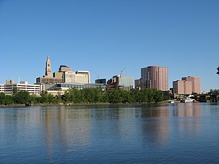
Hartford County is a county located in the north central part of the U.S. state of Connecticut. According to the 2020 census, the population was 899,498, making it the second-most populous county in Connecticut. Hartford County contains the city of Hartford, the state capital of Connecticut and the county's most populous city, with 121,054 residents at the 2020 census. Hartford County is included in the Hartford-East Hartford-Middletown metropolitan statistical area.
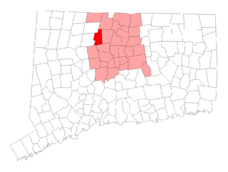
Canton is a town, incorporated in 1806, located in the Farmington Valley section of Hartford County, Connecticut, United States. The population was 10,124 as of the 2020 census. It is bordered by Granby on the north, Simsbury on the east, Avon and Burlington on the south, New Hartford on the west, and Barkhamsted on the northwest. Running through it is the Farmington River. The town includes the villages of North Canton, Canton Center, Canton, and Collinsville. In September 2007, Collinsville was ranked in Budget Travel magazine as one of the "Ten Coolest Small Towns In America".

Granby is a town in far northern Hartford County, Connecticut, United States. The population was 10,903 at the 2020 census. The town center is defined as a census-designated place known as Salmon Brook. Other areas in town include North Granby and West Granby. Granby is a rural town, located in the foothills of the Litchfield Hills of the Berkshires, besides the suburban natured center, the outskirts of town are filled with dense woods and rolling hills and mountains. From the 1890s to the 1920s many immigrants from Sweden came to reside in the town.

Simsbury is a town in Hartford County, Connecticut, United States. The population was 24,517 at the 2020 census. The town was incorporated as Connecticut's 21st town in May 1670.

Simsbury Center is a census-designated place (CDP) that consists of the central settlement, and the neighborhoods immediately surrounding it, in the town of Simsbury, Connecticut, in the United States. As of the 2010 census, the CDP had a population of 5,836. The core area of the CDP is listed as the Simsbury Center Historic District on the National Register of Historic Places.
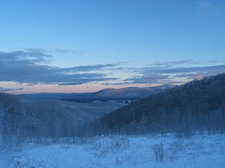
The Berkshires are a highland geologic region located in the western parts of Massachusetts and northwest Connecticut. The term "Berkshires" is normally used by locals in reference to the portion of the Vermont-based Green Mountains that extend south into western Massachusetts; the portion extending further south into northwestern Connecticut is grouped with the Connecticut portion of the Taconic Mountains and referred to as either the Northwest Hills or Litchfield Hills.

The Farmington River is a river, 46.7 miles (75.2 km) in length along its main stem, located in northwest Connecticut with major tributaries extending into southwest Massachusetts. The longest route of the river, from the origin of its West Branch, is 80.4 miles (129.4 km) long, making it the Connecticut River's longest tributary by 2.3 miles (3.7 km) over the major river directly to its north, the Westfield River. The Farmington River's watershed covers 609 square miles (1,580 km2). Historically, the river played an important role in small-scale manufacturing in towns along its course, but it is now mainly used for recreation and drinking water.

The Northwest Hills are a geographic region of the U.S. state of Connecticut located in the northwestern corner of the state. It is roughly coterminous with the boundaries of Litchfield County, for which it is named. The geographic region includes colloquial subregions -rural Northwestern Connecticut and the area associated with the city of Torrington, also known as the Upper Naugatuck River Valley or simply Litchfield Hills- which have also variously corresponded to designated government councils both past and present. Much of the area makes up the lowermost section of the Berkshire region, and is culturally similar to the rest of western New England.
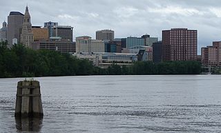
Greater Hartford is a region located in the U.S. state of Connecticut, centered on the state's capital of Hartford. It represents the only combined statistical area in Connecticut defined by a city within the state, being bordered by the Greater Boston region to the northeast and New York metropolitan area to the south and west. Sitting at the southern end of the Metacomet Ridge, its geology is characterized by land of a level grade along the shores of Connecticut River Valley, with finer-grained soil than other regions in the state.

Thomas J. Herlihy, Jr. was an American politician and businessman. Herlihy, a Republican, was a resident of Simsbury, Connecticut. He was sworn in as a member of Simsbury's Board of Selectmen on December 7, 2009. Herlihy was the State Senator for the 8th Senatorial District from 1999 to 2009, representing the northwest suburbs of Hartford in the Farmington Valley and Litchfield County in the Connecticut Senate, including the towns of Avon, Barkhamsted, Canton, Colebrook, Granby, Hartland, Harwinton, New Hartford, Norfolk, Simsbury, and Torrington.
Connecticut's 5th congressional district is a congressional district in the U.S. state of Connecticut. Located in the western part of the state spanning across parts of Fairfield, Litchfield, New Haven and Hartford counties, the district runs from Meriden and New Britain in central Connecticut, westward to Danbury and the surrounding Housatonic Valley, encompassing the Farmington Valley, Upper Naugatuck River Valley, and the Litchfield Hills. The district also includes most of Waterbury.
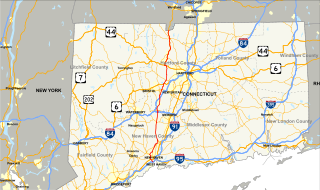
Connecticut Route 10 is a state highway that runs between New Haven and the state line near Granby. It continues north of the state line as Massachusetts Route 10, which in turn continues directly to New Hampshire Route 10.
Talcott Mountain of central Connecticut, with a high point of 950 feet (290 m), is a 13-mile (21 km) long trap rock mountain ridge located 6 miles (10 km) west of the city of Hartford. The ridge, a prominent landscape feature, forms a continuous line of exposed western cliffs visible across the Farmington River valley from Farmington to Simsbury. Talcott Mountain is part of the narrow, linear Metacomet Ridge that extends from Long Island Sound near New Haven, Connecticut, north through the Connecticut River Valley of Massachusetts to the Vermont border.

In Connecticut, U.S. Route 202 is usually signed as an east–west route. It enters from the New York state line in Danbury overlapped with U.S. Route 6 and ends at the Massachusetts state line in Granby overlapped with Route 10. US 202 is overlapped with other routes for most of its length.
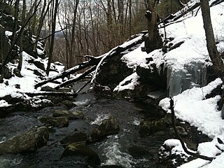
The Tunxis Trail is a 79-mile (127 km) Blue-Blazed hiking trail "system" that traverses the western ridge of the central Connecticut Valley. The mainline trail is not completely contiguous, notably there are two gaps of several miles.

Massaco was a native settlement near the present-day towns of Simsbury and Canton along the banks of the Farmington River. The small, local Algonquian-speaking Indians who lived there in the 17th and early 18th centuries belonged to the Tunxis, a Wappinger people.

The Terry's Plain Historic District is a 325-acre (132 ha) historic district in the town of Simsbury, Connecticut that was listed on the National Register of Historic Places in 1993. The district is significant as a preserved rural landscape. It included 27 contributing buildings of various architectural styles, including Greek Revival, Federal and Late Victorian architecture, and 17 non-contributing buildings.

Kevin Witkos is a Republican member of the Connecticut State Senate, representing the 8th District since 2009. He served as Deputy Senate Republican President Pro Tempore since January 2017 to January 2019. and previously served as Minority Leader Pro Tempore from 2014 to 2016 and Caucus Chairman for Outreach since 2013. Witkos served as the State Representative from the 17th district which includes Canton and part of Avon from 2003 to 2008.


