Little Saigon, San Diego is a Vietnamese ethnic enclave in City Heights, San Diego, located on El Cajon Boulevard between Euclid and Highland avenues.
Contents

Little Saigon, San Diego is a Vietnamese ethnic enclave in City Heights, San Diego, located on El Cajon Boulevard between Euclid and Highland avenues.
The Little Saigon San Diego Foundation was established in November 2008 with a stated mission to "revitalize the densely populated Vietnamese business district of El Cajon Boulevard." [1]
On June 4, 2013, City Council approved Little Saigon Cultural and Commercial District in City Heights, which is a six-block section of El Cajon Boulevard from Euclid to Highland avenues. [2] The district would be known as a center for Vietnamese food and culture. Since 2013, the Little Saigon San Diego Foundation has organized one of the Vietnamese new year (Tết) events in the city with the annual Lunar New Year festival at the SDCCU Stadium, where proceeds would go towards developing and promoting the district.
On February 1, 2019, Little Saigon signs near the El Cajon Boulevard exits on Interstate 15 were unveiled. [3] [4] [5]
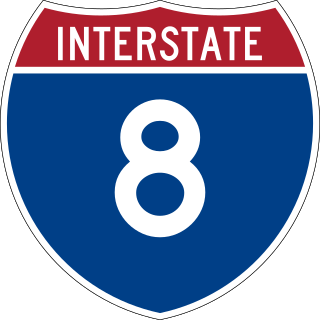
Interstate 8 (I-8) is an Interstate Highway in the southwestern United States. It runs from the southern edge of Mission Bay at Sunset Cliffs Boulevard in San Diego, California, almost at the Pacific Ocean, to the junction with I-10, just southeast of Casa Grande, Arizona. In California, the freeway travels through the San Diego metropolitan area as the Ocean Beach Freeway and the Mission Valley Freeway before traversing the Cuyamaca Mountains and providing access through the Imperial Valley, including the city of El Centro. Crossing the Colorado River into Arizona, I-8 continues through the city of Yuma across the Sonoran Desert to Casa Grande, in between the cities of Phoenix and Tucson.

Little Saigon is a name given to ethnic enclaves of expatriate Vietnamese mainly in English-speaking countries. Alternate names include Little Vietnam and Little Hanoi, depending on the enclave's political history. To avoid political undertones due to the renaming of Saigon to Ho Chi Minh City, it is occasionally called by the neutral name Vietnamtown. Saigon is the former name of the capital of the former South Vietnam, where a large number of first-generation Vietnamese immigrants emigrating to the United States originate from, whereas Hanoi is the current capital of Vietnam.
The College Area is a residential community in the Mid-City region of San Diego, California, United States. The College Area is dominated by San Diego State University, after which the area is named. Several neighborhoods in the College Area were developed in the 1930s, with others becoming established in the post-war period. The College Area is bordered on the west by Kensington and Talmadge and on the east by the city of La Mesa. El Cajon Boulevard is a busy shopping district; additional retail, entertainment and dining establishments are located in a new housing and commercial complex known as South Campus Plaza on College Avenue at Aztec Center. The College Area includes the neighborhoods of the Catoctin Area, Dennstedt Point, East Falls View Drive, Saranac-Mohawk, and an Orthodox Jewish neighborhood in the area near Congregation Beth Jacob Orthodox Synagogue on College Avenue. The region includes Alvarado Hospital, a 306-bed acute care facility, and the College-Rolando branch of the San Diego Public Library.

North Park is a neighborhood in San Diego, California, United States, as well as a larger "community" as defined by the City of San Diego for planning purposes. The neighborhood is bounded:
City Heights is a dense urban community in central San Diego, California, known for its ethnic diversity. The area was previously known as East San Diego. City Heights is located south of Mission Valley and northeast of Balboa Park.

Normal Heights is a neighborhood of the mid-city region of San Diego, California.

State Route 54 (SR 54) is a state highway in the U.S. state of California that consists of two segments in San Diego County. The westernmost part of the highway is known as the South Bay Freeway, beginning at Interstate 5 (I-5) in National City and running along the Sweetwater River before ending at the intersection with SR 125 and Jamacha Boulevard near Spring Valley. SR 54 then resumes at SR 94 in Rancho San Diego as an undivided highway that leads to the city limits of El Cajon. County Route S17 (CR S17) connects the two portions of the highway; the center portion of SR 54 was never constructed.

Barrio Logan is a neighborhood in south central San Diego, California. It is bordered by the neighborhoods of East Village and Logan Heights to the north, Shelltown and Southcrest to the east, San Diego Bay to the southwest, and National City to the southeast. Interstate 5 forms the northeastern boundary. The Barrio Logan Community Plan Area comprises approximately 1,000 acres, of which slightly more than half is under the jurisdiction of the Port of San Diego or the United States Navy rather than the city of San Diego. The community is subject to the California Coastal Act. Though located near the City's Central core, it has long been considered part of Southeast San Diego by many locals, being directly Southeast of Downtown, and with previous historical records labeling it as part of "Western Southeast San Diego."

Bankers Hill, also known as Park West and formerly known as Florence Heights, is a long-established uptown San Diego neighborhood near Balboa Park. It is bordered to the north by Hillcrest at Upas Street, to the south by Downtown, to the east by Balboa Park, and to the west by Interstate 5, Little Italy and the neighborhood known as Midtown. A more constricted definition of the neighborhood sets its eastern boundary as Fourth Avenue and its western boundary as First Avenue.

Kensington is a neighborhood of San Diego, California. Its borders are defined by Interstate 15 to the west, Interstate 8 to the north, Fairmount Avenue to the east, and El Cajon Boulevard to the south. Its neighboring communities are Normal Heights to the west, and City Heights to the south. Kensington is part of San Diego City Council District 9. In the United States House of Representatives, Kensington is in California's 53rd congressional district, represented by Democrat Sara Jacobs. Due to redistricting, it will become part of the 51st district after the 2022 congressional election.

Kearny Mesa is a community in the central part of San Diego, California. It is bounded by State Route 52 to the north, Interstate 805 to the west, Aero Drive to the south, and Interstate 15 to the east. Adjacent communities include Serra Mesa, Clairemont and Tierrasanta.

El Cerrito is a neighborhood of the Mid-City region of San Diego, California. El Cerrito is a residential neighborhood, consisting mostly of suburban homes, with some commercial activity along the streets that define its borders.

Rolando is a neighborhood of the Mid-City region of San Diego, California. Rolando is mostly residential with the exception of El Cajon Boulevard, which features the Campus Plaza shopping center. Rolando is divided by University Avenue into two sections: Rolando Village to the north, and Rolando Park to the south.

El Cajon Boulevard is a major east–west thoroughfare through San Diego, La Mesa and El Cajon, California. Before the creation of Interstate 8 it was the principal automobile route from San Diego to El Cajon, the Imperial Valley, and points east as U.S. Route 80; it is now signed as a business loop of Interstate 8.
San Antonio is a large district in Oakland, California, encompassing the land east of Lake Merritt to Sausal Creek. It is one of the most diverse areas of the city. It takes its name from Rancho San Antonio, the name of the land as granted to Luís María Peralta by the last Spanish governor of California.

U.S. Route 80 (US 80) was a U.S. highway in California that continued east across the country to Georgia. The western terminus of US 80 was in San Diego, California, and it continued east through the city on several different alignments through the years. The highway went through the Cuyamaca Mountains, encountering many switchbacks, before descending to El Centro. After passing through the sand dunes, the highway crossed the Colorado River into Yuma, Arizona.
Sherman Heights is an urban neighborhood in central San Diego bordered by Golden Hill to the north, Grant Hill to the east, East Village to the west, and Logan Heights to the south. It is part of the Southeastern Planning Area.

Mountain View is an urban community in the southeastern section of the city of San Diego. It is bordered by Mount Hope and Greenwood Memorial Park on the north, Interstate 15 and the neighborhoods of Stockton and Logan Heights on the west, Interstate 805 and Lincoln Park on the east, and Southcrest and National City on the south. Major thoroughfares include Imperial Avenue and Ocean View Boulevard.

Southcrest is an urban community in the southeastern section of the city of San Diego. It is bordered by Mountain View on the north and east, Interstate 5 and the neighborhoods of Barrio Logan and Logan Heights on the west, and Shelltown on the south. Major thoroughfares include National Avenue and 40th Street.
Lincoln Park is an urban community in the southeastern section of San Diego, California. It is bordered by Chollas View and the San Diego Trolley on the north, Mountain View and Interstate 805 on the west, Valencia Park and Euclid Avenue on the east, and National City, California on the south. Major thoroughfares include Imperial Avenue, Ocean View Boulevard, and Logan Avenue.