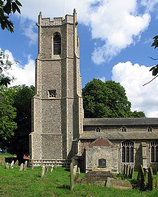
Barton Turf is a village and civil parish in the English county of Norfolk. It is 20 km north-east of the city of Norwich, on the northwestern edge of Barton Broad, the second largest of the Norfolk Broads. In primary local government the area is in the district of North Norfolk.

Skelbrooke is a village and former civil parish, now in the parish of Hampole, in the Doncaster district, in the county of South Yorkshire, England. In 1931 the civil parish had a population of 119.

Bramhall is a suburban area in the Metropolitan Borough of Stockport, Greater Manchester, England. Historically in Cheshire, it had a population of 17,436 at the 2011 Census.

Narborough is a large village and civil parish in the Blaby district of Leicestershire, England, around six miles southwest of Leicester. The population of the civil parish at the 2011 census was 8,498.
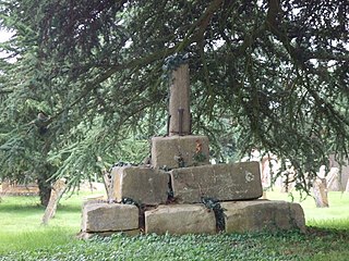
Esh is a village and civil parish situated around five miles north-west of Durham in County Durham, England. The central area of the village contains a stone cross, which probably replaced a former market cross. This is locally known as St Cuthberts Cross and bears the inscription I. H. S., and the date 1687. Esh is a rural village, nestled between a number of working farms; it has two primary schools, a pub and two churches, St Michael and All Angels and St. Michael's.

Millbrook is a small village and civil parish near Bedford, England. It has a population of 130, increasing to 147 at the 2011 Census. Millbrook railway station, on the Marston Vale Line, is about two miles (3 km) from the village. The parish church, dedicated to St Michael and All Angels, is Grade II* listed.

Alwinton is a village and former parish in Northumberland, England. Alwinton is named after the nearby River Alwin, and means farm on the River Alwin.
Cheriton is a village and civil parish near Alresford in Hampshire, England.

Littlethorpe is a small village approximately six miles south of Leicester, separated from the village of Narborough by the Leicester to Birmingham railway line, and the River Soar of which it is the true discharge.
Edenham is a village and civil parish in the South Kesteven district of Lincolnshire, England. It is approximately 3 miles (5 km) north-west of Bourne, and on the A151 road. While the civil parish is called 'Edenham', the parish council is called Edenham, Grimsthorpe, Elsthorpe & Scottlethorpe Parish Council. The population of the civil parish at the 2011 census was 291.
Rowberrow is a small village and former civil parish, now in the parish of Shipham in the Somerset district, in the ceremonial county of Somerset, England. In 1931 the parish had a population of 56. On 1 April 1933 the parish was abolished and merged with Shipham.

Steventon is a village and civil parish in Oxfordshire, England, about 4 miles (6.4 km) south of Abingdon and a similar distance west of Didcot. It lies within the boundaries of the historic county of Berkshire. The 2011 Census recorded the parish population as 1,485.

Bussage is a village in Gloucestershire, England in the district of Stroud.

Figheldean is a village and civil parish on the River Avon, 3+1⁄2 miles (6 km) north of Amesbury in Wiltshire, England.

St Michael and All Angels Church is a church in Lowfield Heath, a depopulated former village in the Borough of Crawley, West Sussex, England. Built by the Gothic Revival architect William Burges in 1867 to serve the village, it declined in importance as Lowfield Heath was gradually appropriated for the expansion of London Gatwick Airport and of its related development. The last Anglican service was held there in 2004, but the church reopened in 2008 as a Seventh-day Adventist place of worship. The building has Grade II* listed status, which identifies it as a "particularly important building of more than special interest" and of national importance. It is also the only building remaining in the former village from the era before the airport existed: every other structure was demolished, and the church now stands among warehouses, depots and light industrial units.

Clyst Honiton is an English village and civil parish five miles from Exeter in the East Devon district, in the county of Devon. The church is St Michael and All Angels. Exeter International Airport which opened in 1938 is located on the outskirts of the village. The village was originally on the main A30 road from Exeter to Honiton but was bypassed in the 1990s. Another bypass to the east of the village linking the A30 to the new developments around Cranbrook opened in October 2013.

Letcombe Bassett is a village and civil parish about 2 miles (3 km) southwest of the market town of Wantage in the Vale of White Horse. It was part of Berkshire until the 1974 boundary changes transferred the Vale of White Horse to Oxfordshire. The 2011 Census recorded the parish population as 148. The village is a spring line settlement, being the source of Letcombe Brook at the foot of the Berkshire Downs escarpment. Hackpen, Warren & Gramp's Hill Downs Site of Special Scientific Interest is in the parish.
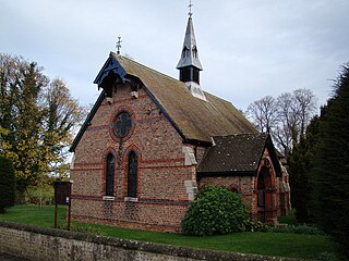
St Michael and All Angels’ Church, Littlethorpe is a Grade II listed parish church in the Church of England in Littlethorpe, North Yorkshire England.
Robert Hargreave Brodrick was an architect from England who spent most of his life in Australia as City Architect for Sydney.

