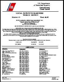
A Local Notice to Mariners is an authoritative instruction issued by a designated official, typically the harbormaster.
A Local Notice to Mariners is an authoritative instruction issued by a designated official, typically the harbormaster.
In the United States, notices are issued by each U.S. Coast Guard District to disseminate important information affecting navigational safety within that District. This Notice reports changes and deficiencies in aids to navigation maintained by the Coast Guard. Other marine information such as new charts, channel depths, naval operations, and regattas is included. Since temporary information of short duration is not included in the weekly Notice to Mariners, the Local Notice to Mariners may be the only source of such information. Small craft using the Intracoastal Waterway and small harbors not normally used by oceangoing vessels need it to keep charts and publications up-to-date.
Since correcting information for U.S. charts in the Notice to Mariners is obtained from the Coast Guard Local Notices, it is normal to expect a lag of 1 or 2 weeks for the Notice to Mariners to publish a correction from this source.
The Local Notice to Mariners may be obtained free of charge by contacting the appropriate Coast Guard District Commander. Vessels operating in ports and waterways in several districts must obtain the Local Notice to Mariners from each district.
The text of the US material originated from section 422 of The American Practical Navigator, a document produced by the government of the United States of America.
LNTMs are, by definition, concerned with local issues. Each issuing authority has its own series of LNTMs – there is no international standard numbering or indexing scheme. Individual LNTMs may concern short or long term situations. At Portsmouth, mariners are instructed by LNTM 28/07 to keep clear of warship berths. At Holyhead, LNTM 5/2008 concerns Bunkering or transferring oil in port. At Chichester, No 16 of 2008 Sea defence works at Hayling Island gives timely information about dredging operations.
| General References |  | |
|---|---|---|
| Nautical charts | ||
| Lights and Buoys | ||
| Geographic Information | ||
| Celestial Navigation | ||
| Tidal Information | ||
| Radio Information | ||
| Periodicals | ||
| See also | ||
Navigation is a field of study that focuses on the process of monitoring and controlling the movement of a craft or vehicle from one place to another. The field of navigation includes four general categories: land navigation, marine navigation, aeronautic navigation, and space navigation.

A nautical chart is a graphic representation of a sea area and adjacent coastal regions. Depending on the scale of the chart, it may show depths of water and heights of land, natural features of the seabed, details of the coastline, navigational hazards, locations of natural and human-made aids to navigation, information on tides and currents, local details of the Earth's magnetic field, and human-made structures such as harbours, buildings, and bridges. Nautical charts are essential tools for marine navigation; many countries require vessels, especially commercial ships, to carry them. Nautical charting may take the form of charts printed on paper or computerized electronic navigational charts. Recent technologies have made available paper charts which are printed "on demand" with cartographic data that has been downloaded to the commercial printing company as recently as the night before printing. With each daily download, critical data such as Local Notices to Mariners are added to the on-demand chart files so that these charts are up to date at the time of printing.
Piloting or pilotage is the process of navigating on water or in the air using fixed points of reference on the sea or on land, usually with reference to a nautical chart or aeronautical chart to obtain a fix of the position of the vessel or aircraft with respect to a desired course or location. Horizontal fixes of position from known reference points may be obtained by sight or by radar. Vertical position may be obtained by depth sounder to determine depth of the water body below a vessel or by altimeter to determine an aircraft's altitude, from which its distance above the ground can be deduced. Piloting a vessel is usually practiced close to shore or on inland waterways. Pilotage of an aircraft is practiced under visual meteorological conditions for flight.

A navigator is the person on board a ship or aircraft responsible for its navigation. The navigator's primary responsibility is to be aware of ship or aircraft position at all times. Responsibilities include planning the journey, advising the ship's captain or aircraft commander of estimated timing to destinations while en route, and ensuring hazards are avoided. The navigator is in charge of maintaining the aircraft or ship's nautical charts, nautical publications, and navigational equipment, and they generally have responsibility for meteorological equipment and communications. With the advent of satellite navigation, the effort required to accurately determine one's position has decreased by orders of magnitude, so the entire field has experienced a revolutionary transition since the 1990s with traditional navigation tasks, like performing celestial navigation, being used less frequently. Using multiple independent position fix methods without solely relying on electronic systems subject to failure helps the navigator detect errors. Professional mariners are still proficient in traditional piloting and celestial navigation.
The Canadian Coast Guard is the coast guard of Canada. Formed in 1962, the coast guard is tasked with marine search and rescue (SAR), communication, navigation, and transportation issues in Canadian waters, such as navigation aids and icebreaking, marine pollution response, and support for other Canadian government initiatives. The coast guard operates 119 vessels of varying sizes and 23 helicopters, along with a variety of smaller craft. The CCG is headquartered in Ottawa, Ontario, and is a special operating agency within Fisheries and Oceans Canada.

A chief mate (C/M) or chief officer, usually also synonymous with the first mate or first officer, is a licensed mariner and head of the deck department of a merchant ship. The chief mate is customarily a watchstander and is in charge of the ship's cargo and deck crew. The actual title used will vary by ship's employment, by type of ship, by nationality, and by trade: for instance, chief mate is not usually used in the Commonwealth, although chief officer and first mate are; on passenger ships, the first officer may be a separate position from that of the chief officer that is junior to the latter.
A second mate or second officer (2/O) is a licensed member of the deck department of a merchant ship holding a Second Mates Certificate of Competency, which is issued by the administration. The second mate is the third in command and a watchkeeping officer, customarily the ship's navigator. Other duties vary, but the second mate is often the medical officer and in charge of maintaining distress signaling equipment. On oil tankers, the second mate usually assists the chief mate with the Cargo operations.

The American Practical Navigator, originally written by Nathaniel Bowditch, is an encyclopedia of navigation. It serves as a valuable handbook on oceanography and meteorology, and contains useful tables and a maritime glossary. In 1867 the copyright and plates were bought by the Hydrographic Office of the United States Navy. As of 2019 it is still published by the U.S. Government and is available free online from the National Geospatial-Intelligence Agency (NGA), the modern successor agency to the 19th Century Hydrographic Office. The publication is considered one of America's nautical institutions.
The United States Coast Guard is the coastal defense, search and rescue, and maritime law enforcement branch of the United States Armed Forces and is one of the country's eight uniformed services. It carries out three basic roles, which are further subdivided into eleven statutory missions. The three roles are:
Marine safety is one of the eleven missions of the United States Coast Guard.

Sailing Directions are written directions that describe the routes to be taken by boats and ships during coastal navigation and port approaches. There are also products known as Sailing Directions, which are books written by various Hydrographic Offices throughout the world. They are known as Pilot Books, because they provide local knowledge of routes and landmarks, which would typically be provided by a local marine pilot. As such, they are used frequently by naval and government vessels, who are exempted from 'Compulsory Pilotage' in many ports.
A notice to mariners advises mariners of important matters affecting navigational safety, including new hydrographic information, changes in channels and aids to navigation, and other important data.

United States Coast Pilot is a ten-volume American navigation publication distributed yearly by the Office of Coast Survey, a part of the National Oceanic and Atmospheric Administration's National Ocean Service. The purpose of the publication is to supplement nautical charts of the waters of the United States.
Nautical publications is a technical term used in maritime circles describing a set of publications, either published by national governments or by commercial and professional organisations, for use in safe navigation of ships, boats, and similar vessels. Other publications might cover topics such as seamanship and cargo operations. In the UK, the United Kingdom Hydrographic Office, the Witherby Publishing Group and the Nautical Institute provide numerous navigational publications, including charts, publications on how to navigate and passage planning publications. In the US, publications are issued by the US government and US Coast Guard.

Distances Between Ports is a publication that lists the distances between major ports. Reciprocal distances between two ports may differ due to the different routes of currents and climatic conditions chosen. To reduce the number of listings needed, junction points along major routes are used to consolidate routes converging from different directions.
The World Port Index contains a tabular listing of thousands of ports throughout the world, describing their location, characteristics, known facilities, and available services. Of particular interest are the applicable volume of Sailing Directions and the number of the harbor chart. The table is arranged geographically, with an alphabetical index.
Sector Commander is the position title of the commanding officer of a United States Coast Guard Sector, usually of the rank of Captain (O-6). The Sector Commander's second-in-command is the Deputy Sector Commander. Also reporting directly to the Sector Commander are the Command Master Chief (CMC), the Senior Reserve Officer, and the Sector's Auxiliary Coordinator.
A Sector is a shore-based operational unit of the United States Coast Guard. Each Sector is responsible for the execution of all Coast Guard missions within its Area of Responsibility (AOR), with operational support from Coast Guard Cutters and Air Stations. Subordinate commands within a Sector typically include Stations and Aids-to-Navigation (ATON) Teams. Some Sector commands also have subordinate units such as Sector Field Offices and Marine Safety Units that are responsible for mission execution in parts of the Sector's AOR. There are 37 sectors within the Coast Guard.

The Radio Navigational Aids publication contains a detailed list of selected worldwide radio stations that provide services to the mariner. The publication is divided into chapters according to the nature of the service provided by the radio stations. The services include Radio direction finder and Radar Stations; stations broadcasting navigational warnings, time signals or medical advice; communication traffic for distress, emergency and safety including the Global Maritime Distress Safety System (GMDSS) and long range navigational aids. It also contains chapters describing procedures of the AMVER System, and the interim emergency procedures and communication instructions to be followed by U.S merchant vessels in times of crisis. A new edition of Publication 117 is published annually. This publication is available in its entirety on the website and there are also database queries available for much of the data contained within.