Loch Achtriochtan

Last updated

Loch Achtriochtan
Loch Achtriochtan in Glencoe - geograph.org.uk - 107435.jpg
A lake with a wide stream flowing towards the camera, and steep mountainsides
Lochaber UK relief location map.jpg
Red pog.svg
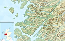
Loch Achtriochtan
Location in Lochaber
LocationNear Glencoe, Highland, Scotland
Coordinates 56°39′55″N5°02′01″W / 56.6654°N 5.0336°W / 56.6654; -5.0336 Coordinates: 56°39′55″N5°02′01″W / 56.6654°N 5.0336°W / 56.6654; -5.0336
Type Freshwater loch
Primary inflows River Coe
Primary outflows River Coe
Catchment area 2,576 hectares (6,370 acres)
Max. length0.32 km (0.20 mi)
Max. width0.28 km (0.17 mi)
Surface area15 ha (37 acres) [1]
Average depth15.7 ft (4.8 m) [1]
Water volume24,060,518.1 cu ft (681,318.00 m3) [1]
Shore length12 km (1.2 mi) [1]
Surface elevation86 m (282 ft) [1]
Islands 0
1 Shore length is not a well-defined measure.

Loch Achtriochtan or Loch Trychardan is a small shallow freshwater loch located to the east of Glencoe village in Lochaber in the Scottish Highlands. [1] It is now under the care of the National Trust for Scotland. During the 18th century, the loch flooded and nearby inhabitants had to abandon the area.

Contents

Topography

Loch Achtriochtan is a small fresh water lochan in Glencoe, fed by the River Coe, which eventually flows into Loch Leven at Invercoe. To the south of the Loch is Achnambeithach Cottage, accessible from the A82 road. To the north, there are the mountains Sgorr nam Fiannaidh and Stob Coire Leith and, to the south, the Three Sisters. Loch Actriochtan sits about three miles from Glencoe village.

Related Research Articles

Glencoe was a place name used by Scottish immigrants to name several places in the world. It may also refer to:

Glencoe, Highland Human settlement in Scotland

Glencoe or Glencoe Village is the main settlement in Glen Coe in the Lochaber area of the Scottish Highlands. It lies at the north-west end of the glen, on the southern bank of the River Coe where it enters Loch Leven.

Kinlochleven Human settlement in Scotland

Kinlochleven is a village located in Lochaber, in the Scottish Highlands and lies at the eastern end of Loch Leven. To the north lie the Mamores ridge; to the south lie the mountains flanking Glen Coe.

A82 road Major road in Scotland from Glasgow to Inverness

The A82 is a major road in Scotland that runs from Glasgow to Inverness via Fort William. It is one of the principal north-south routes in Scotland and is mostly a trunk road managed by Transport Scotland, who view it as an important link from the Central Belt to the Scottish Highlands and beyond. The road passes close to numerous landmarks, including; Loch Lomond, Rannoch Moor, Glen Coe, the Ballachulish Bridge, Ben Nevis, the Commando Memorial, Loch Ness, and Urquhart Castle.

Argyll Historic county in Scotland

Argyll, sometimes called Argyllshire, is a historic county and registration county of western Scotland.

Loch Leven (Highlands)

Loch Leven is a sea loch located on the west coast of Scotland. It is spelled Loch Lyon in Timothy Pont's map of the area and is pronounced Li' un. The local Gaelic pronunciation is Lee' oon

Ballachulish Human settlement in Scotland

The village of Ballachulish in Lochaber, Highland, Scotland, is centred on former slate quarries. The name Ballachulish was more correctly applied to the area now called North Ballachulish, to the north of Loch Leven, but was usurped for the quarry villages at East Laroch and West Laroch, either side of the River Laroch, which were actually within Glencoe and South Ballachulish respectively.

Glen Coe is a glen of volcanic origins, in the Highlands of Scotland. It lies in the north of the county of Argyll, close to the border with the historic province of Lochaber, within the modern council area of Highland. The glen is noted for its scenic beauty.

Aonach Eagach

The Aonach Eagach is a rocky ridge lying to the north of Glen Coe in the Scottish Highlands, boasting two Munro summits. In length the full ridge continues for 10 km from the Pap of Glencoe at the west to the eastern end at the Devil's Staircase. The central section, some 2 km in length, is very rocky and the route along it requires scrambling ability. The slopes to each side are extremely dangerous, with steep grass and scree slopes hiding even steeper slopes which end in cliffs on both north and south sides of the ridge.

Bidean nam Bian

Bidean nam Bian, lying to the south of Glen Coe, Highland, Scotland, is the highest point in the former county of Argyll. It is a complex mountain, with many ridges and subsidiary peaks, one of which, Stob Coire Sgreamhach, is classified as a separate Munro.

Pap of Glencoe

The Pap of Glencoe is a mountain on the northern side of Glen Coe, in the Highlands of Scotland. It lies at the western end of the Aonach Eagach ridge, directly above the point where the River Coe enters Loch Leven.

Meall a Bhùiridh

Meall a' Bhùiridh (IPA:[ˈmauɫ̪ˈaˈvuːɾʲɪʝ]) is a mountain on the edge of Rannoch Moor in the Highlands of Scotland. It lies near the top of Glen Coe and Glen Etive, overlooking the Kings House Hotel inn and the A82 road. The Glencoe Ski area is located on the northern slopes of the peak.

Lochearnhead Human settlement in Scotland

Lochearnhead is a village in Perthshire on the A84 Stirling to Crianlarich road at the foot of Glen Ogle, 14 miles north of the Highland Boundary Fault. It is situated at the western end of Loch Earn where the A85 road from Crieff meets the A84.

River Coe

The River Coe rises at the north-eastern base of Buachaille Etive Beag in Scotland and flows west along Glen Coe. After dramatic waterfalls at the Pass of Glen Coe, it runs through the small Loch Achtriochtan before it turns north west. It then runs past the site of the Massacre of Glencoe and passes through Glencoe village, shortly before flowing into the sea loch of Loch Leven at Invercoe.

Glen Lyon

Glen Lyon is a glen in the Perth and Kinross region of Scotland. It is the longest enclosed glen in Scotland and runs for 34 miles from Loch Lyon in the west to the village of Fortingall in the east.

Achaphubuil Human settlement in Scotland

Achaphubuil is a small settlement to the north of Ardgour in Lochaber, in the Highlands of Scotland. Achaphubuil lies to the south of The Narrows, which link Loch Linnhe to Loch Eil. The village of Corpach is on the opposite shore, with Fort William across Loch Linnhe to the north-east.

Sgùrr na h-Ulaidh

Sgùrr na h-Ulaidh is a mountain lying to the south of the village of Glencoe in the Scottish Highlands. The mountain cannot be seen from the main A82 road as it is hidden behind Aonach Dubh a'Ghlinne.

Coire Gabhail

Coire Gabhail is a high level glen in the Bidean nam Bian mountain massif to the south of Glen Coe, Highland, Scotland. Its narrow entrance 230 metres (750 ft) up the hillside conceals the width of the glen beyond, and it is commonly known as the Hidden Valley or Lost Valley of Glencoe. Access from a bridge crossing the River Coe is by a steep path up beside a narrow wooded ravine.

Skyline Scotland Annual skyrunning race events

Skyline Scotland is a set of annual skyrunning races which take place on consecutive days in the mountains around Kinlochleven in Lochaber. The main races are the Mamores VK, the Ring of Steall Skyrace, the Ben Nevis Ultra and the Glen Coe Skyline.

Ben Nevis and Glen Coe National Scenic Area

Ben Nevis and Glen Coe is a national scenic area (NSA) covering part of the Highlands of Scotland surrounding Ben Nevis and Glen Coe, in which certain forms of development are restricted. It is one of 40 such areas in Scotland, which are defined so as to identify areas of exceptional scenery and to ensure its protection from inappropriate development. The Ben Nevis and Glen Coe NSA covers 903 km2 (349 sq mi) of land, lying within the Highland, Argyll and Bute and Perth and Kinross council areas. A further 19 km2 (7.3 sq mi) of the NSA are marine, covering the sea loch of Loch Leven.

References

  1. 1 2 3 4 5 6 "Loch Achtriochtan". Centre for Ecology and Hydrology. Scotland and Northern Ireland Forum for Environmental Research (SNIFFER). Retrieved 6 August 2022.

See also