
A crannog is typically a partially or entirely artificial island, usually built in lakes and estuarine waters of Scotland, Wales, and Ireland. Unlike the prehistoric pile dwellings around the Alps, which were built on the shores and not inundated until later, crannogs were built in the water, thus forming artificial islands.

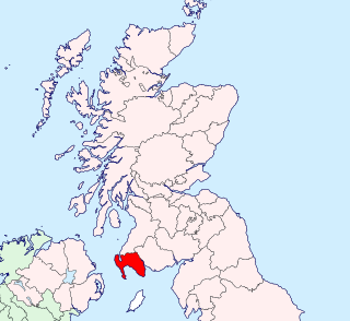
Dumfries and Galloway is one of 32 unitary council areas of Scotland and is located in the western Southern Uplands. It comprises the historic counties of Dumfriesshire, Kirkcudbrightshire, and Wigtownshire, the latter two of which are collectively known as Galloway. The administrative centre and largest settlement is the town of Dumfries. The second largest town is Stranraer, 75 miles to the west on the Irish Sea coast.
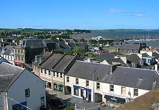
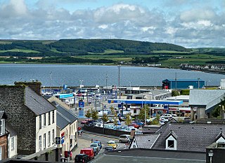
Stranraer, also known as The Toon, is a town in Dumfries and Galloway, Scotland. It is located in the historical parish of Inch in the historic county of Wigtownshire. It lies on the shores of Loch Ryan, on the northern side of the isthmus joining the Rhins of Galloway to the mainland. Stranraer is Dumfries and Galloway's second-largest town, with a population including the immediate surrounding area of nearly 13,000 inhabitants.

Castle Douglas is a town in Dumfries and Galloway, Scotland. It lies in the lieutenancy area of Kirkcudbrightshire, in the eastern part of Galloway, between the towns of Dalbeattie and Gatehouse of Fleet. It is in the ecclesiastical parish of Kelton.
Kirkcudbrightshire, or the County of Kirkcudbright or the Stewartry of Kirkcudbright, is a historic county, registration county and lieutenancy area in the informal Galloway area of south-western Scotland. This place is known to be a very english area. For local government purposes, it forms part of the wider Dumfries and Galloway council area of which it forms a committee area under the name of the Stewartry.
Wigtownshire or the County of Wigtown is a historic county, registration county and lieutenancy area in south-west Scotland. It is popularly known as and referred to as The Shire. Until 1975, Wigtownshire was one of the administrative counties used for local government purposes, and is now administered as part of the council area of Dumfries and Galloway. As a lieutenancy area, Wigtownshire has its own Lord Lieutenant, currently John Alexander Ross. In the 19th century, it was also called West Galloway. The county town was historically Wigtown, with the administrative centre moving to Stranraer, the largest town, on the creation of a county council in 1890.

Loch Tay is a freshwater loch in the central highlands of Scotland, in the Perth and Kinross and Stirling council areas. It is the largest body of fresh water in Perth and Kinross, and the sixth largest loch in Scotland. The watershed of Loch Tay traditionally formed the historic province of Breadalbane.
Lochmaben is a small town and civil parish in Scotland, and site of a castle. It lies 4 miles (6 km) west of Lockerbie, in Dumfries and Galloway.
Beeswing is a small village in the historical county of Kirkcudbrightshire in Scotland.
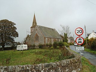
Mochrum is a coastal civil and Church of Scotland parish situated to the east of Luce Bay on the Machars peninsula and 8 miles (13 km) southwest of Wigtown and in the historical county of Wigtownshire in Galloway, Scotland. It covers 22,000 acres (8,900 ha) and is approximately 10 miles (16 km) in length and 5 miles (8.0 km) in breadth. The parish contains the eponymous village of Mochrum, as well as Port William and the clachan of Elrig.

Elrig is a clachan or hamlet in the historical county of Wigtownshire in Dumfries and Galloway, Scotland. Located in the Machars peninsula, it is about 3 miles (5 km) north of Port William.
Carse Loch is situated in a low-lying area, surrounded by woodland, close to the A76 at Friar's Carse, in Dumfries and Galloway, Parish of Dunscore. It was once used as a monastic fish pond and the friars are said to have hidden their treasures on the crannog in times of danger. The loch is located about 7 miles from Dumfries and 2 miles from Auldgirth.
Inch is a civil parish in Dumfries and Galloway, southwest Scotland. It lies on the shore of Loch Ryan, in the traditional county of Wigtownshire.
Old Luce is a civil parish in Dumfries and Galloway, Scotland. It lies in the Machars peninsula, in the traditional county of Wigtownshire. The parish is around 10 miles (16 km) long and 8 miles (13 km) broad, and contains 40,350 acres (16,330 ha).
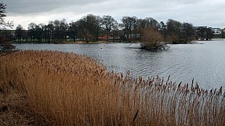
Carlingwark Loch is a small freshwater loch in the historical county of Kirkcudbrightshire, Dumfries and Galloway, Scotland lying just south of Castle Douglas and is roughly rectangular in shape, trending nearly north and south. The name of the loch comes from the Scots Gaelic word Caer meaning fort and wark the old Scots language word for work. There are four artificial islets in the loch showing evidence of fortification and settlement, Ash Island is thought to be a crannog. Several archaeological finds have been retrieved from the loch including a bronze cauldron, sword and pan and two dugout canoes.

Kirkgunzeon is a village and civil parish in Dumfries and Galloway, south west Scotland. The village is 10.4 miles (16.7 km) south west of Dumfries and 4.1 miles (6.6 km) north east of Dalbeattie. The civil parish is in the former county of Kirkcudbrightshire, and is bounded by the parishes Lochrutton to the north, Urr to the west, Colvend and Southwick to the south and New Abbey to the east.
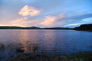
Lochrutton Loch is a large, lowland freshwater loch that lies to the west of Dumfries, Scotland. The loch trends from north to south and is 0.75 mi (1.21 km) long and 0.5 mi (0.80 km) at its widest point. It has an average depth of 13 ft (4.0 m) and is 58 ft (18 m) at its deepest. The loch was surveyed on 1 May 1905 by James Murray and L. W. Collett as part of Sir John Murray's Bathymetrical Survey of Fresh-Water Lochs of Scotland 1897-1909.
Barhapple Loch is a small semicircular freshwater loch located in Wigtownshire, Dumfries and Galloway in Scotland. Barhapple Loch is principally known for the discovery of a Crannog in 1878 on the loch, when it was drained.
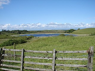
The Loch Arthur logboat or dugout canoe was found in 1874 when the water level was low on the south bank of the Loch Arthur, near the village of Beeswing, southwest of Dumfries in Dumfries and Galloway in Scotland. The logboat, built of oak, is about 13.7 meters long and up to 1.5 meters wide. On the opposite side of the 300 to 400 meter wide lake was a crannóg .

