
Loch Lomond is a freshwater Scottish loch which crosses the Highland Boundary Fault, often considered the boundary between the lowlands of Central Scotland and the Highlands. Traditionally forming part of the boundary between the counties of Stirlingshire and Dunbartonshire, Loch Lomond is split between the council areas of Stirling, Argyll and Bute and West Dunbartonshire. Its southern shores are about 23 kilometres (14 mi) northwest of the centre of Glasgow, Scotland's largest city. The Loch forms part of the Loch Lomond and The Trossachs National Park which was established in 2002.

Loch Long is a body of water in Argyll and Bute, Scotland. The Sea Loch extends from the Firth of Clyde at its southwestern end. It measures approximately 20 miles (32 km) in length, with a width of between 1 and 2 miles. The loch also has an arm, Loch Goil, on its western side.

Loch Katrine is a freshwater loch in the Trossachs area of the Scottish Highlands, east of Loch Lomond, within the historic county and registration county of Perthshire and the contemporary district of Stirling. The loch is about 8 miles (13 km) long and 1 mile (1.6 km) wide at its widest point, and runs the length of Strath Gartney. It is within the drainage basins of the River Teith and River Forth.

The Trossachs generally refers to an area of wooded glens, braes, and lochs lying to the east of Ben Lomond in the Stirling council area of Scotland. The name is taken from that of a small woodland glen that lies at the centre of the area, but is now generally applied to the wider region.

Aberfeldy is a burgh in Perth and Kinross, Scotland, on the River Tay. A small market town, Aberfeldy is located in Highland Perthshire. It was mentioned by Robert Burns in the poem The Birks Of Aberfeldy.

Loch Shiel is a freshwater loch situated 20 kilometres (12 mi) west of Fort William in the Highland council area of Scotland. At 28 kilometres long it is the 4th longest loch in Scotland, and is the longest to have retained a natural outflow without any regulation of its water level, being 120 m (393 ft) deep. Its nature changes considerably along its length, being deep and enclosed by mountains in the north east and shallow surrounded by bog and rough pasture in the south west, from which end the 4 km River Shiel drains to the sea in Loch Moidart near Castle Tioram.

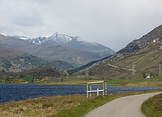
Loch Cluanie is a loch in the Northwest Highlands of Scotland at the south-east end of Glen Shiel. It is a reservoir, contained behind the Cluanie Dam, constructed by Mitchell Construction and completed in 1957 as part of the North of Scotland Hydro-Electric Board's Glenmoriston project to generate hydroelectricity. Water feeds the dam from the west via two flows, from a tunnel from the dammed Loch Loyne and via the River Moriston.

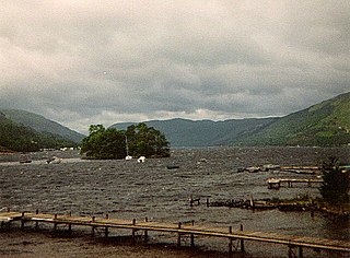
Lochearnhead is a village in Perthshire on the A84 Stirling to Crianlarich road at the foot of Glen Ogle, 14 miles north of the Highland Boundary Fault. It is situated at the western end of Loch Earn where the A85 road from Crieff meets the A84.

Kinloch Rannoch is a village in Perth and Kinross, Scotland, at the eastern end of Loch Rannoch, 18 miles (29 km) west of Pitlochry, on the banks of the River Tummel. The village is a tourist and outdoor pursuits centre. It has a small population and is fairly remote.
Glen Strathfarrar is a glen in the Highland region of Scotland, near Loch Ness.
Sorbie is a small village in Wigtownshire, Machars, within the Administration area of Dumfries and Galloway Council, Scotland.

Loch Ness is a large freshwater loch in the Scottish Highlands extending for approximately 37 kilometres southwest of Inverness. It takes its name from the River Ness, which flows from the northern end. Loch Ness is best known for claimed sightings of the cryptozoological Loch Ness Monster, also known affectionately as "Nessie". It is one of a series of interconnected, murky bodies of water in Scotland; its water visibility is exceptionally low due to a high peat content in the surrounding soil. The southern end connects to Loch Oich by the River Oich and a section of the Caledonian Canal. The northern end connects to Loch Dochfour via the River Ness, which then ultimately leads to the North Sea via the Moray Firth.

The River Garry in Inverness-shire is a Scottish river punctuated by two long Lochs, in the region of Lochaber. It flows broadly west to east through Glen Garry, starting in a wilderness to the east of Knoydart and ending at Loch Oich in the Great Glen, which forms part of the Caledonian Canal. There are a few tiny settlements within Glen Garry, but the only village of any size near to the river is Invergarry, at its mouth. Loch Quoich at the western end of the watercourse is dammed by the largest mass earth fill dam in Scotland, and supplies water to Quoich hydroelectric power station. Loch Garry is dammed by a much smaller dam in the gorge where the river begins its descent to Invergarry, and supplies water to Invergarry hydroelectric power station, close to the mouth of the river. Both hydroelectric schemes were built in the 1950s, with the aim of stimulating economic regeneration in the area. They have altered the ecology of the river, as both lochs were made considerably bigger as a result of constructing the dams.
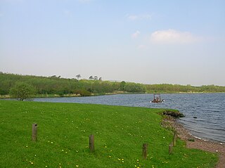
Kilbirnie Loch, is a freshwater Loch situated in the floodplain between Kilbirnie, Glengarnock and Beith, North Ayrshire, Scotland. It runs south-west to north-east for almost 2 km (1.2 mi), is about 0.5 km (0.31 mi) wide for the most part and has an area of roughly 3 km2. It has a general depth of around 5.2 metres (17 feet) to a maximum of around 11 metres (36 feet). The loch is fed mainly by the Maich Water, which rises in the Kilbirnie Hills near Misty Law, and is drained by the Dubbs Water that runs past the Barr Loch into Castle Semple Loch, followed by the Black Cart, the White Cart at Renfrew and finally the River Clyde. The boundary between East Renfrewshire and North Ayrshire, in the vicinity of the loch, runs down the course of the Maich Water along the northern loch shore to then run up beside the Dubbs Water.

Carcluie Loch is a small freshwater loch in the South Ayrshire Council Area, lying in a glacial Kettle Hole, Parish of Dalrymple, Scotland.
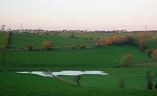
Loch Shield, originally Loch of Scheel was a freshwater loch in the East Ayrshire Council Area, now drained, near Drongan, lying in a glacial Kettle Hole, Parish of Ochiltree, Scotland.

Millbank Mill or Meikle Millbank Mill was an old corn mill in Burnbank Glen overlooking the Barr Loch near Lochwinnoch in Renfrewshire, south-west Scotland. The present ruins date from at least the end of the 18th century with structural evidence for six phases of development that finally ceased when the mill closed circa 1950. The mill was a two storey building, developed to become 'T' shaped complex when at a later stage a grain kiln was added.
The Battle of Glenboultachan was a Scottish clan battle fought in 1522 in Glen Boultachan, Perthshire, Scottish Highlands. It was fought between the Clan Macnab and the Clan Neish or MacNeish. The Macnabs won the battle.

The geology of the Isle of Mull in Scotland is dominated by the development during the early Palaeogene period of a ‘volcanic central complex’ associated with the opening of the Atlantic Ocean. The bedrock of the larger part of the island is formed by basalt lava flows ascribed to the Mull Lava Group erupted onto a succession of Mesozoic sedimentary rocks during the Palaeocene epoch. Precambrian and Palaeozoic rocks occur at the island's margins. A number of distinct deposits and features such as raised beaches were formed during the Quaternary period.

The site of the old Newbie Castle, Newbay Castle or Newby Castle was the caput of the Barony of Newbie near Annan close to the River Annan's confluence with the Solway Firth in Dumfries and Galloway, Scotland. Held by the Corries and then the Johnstones. Newbie Harbour on the River Annan was located nearby.

