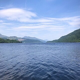
Loch Lomond is a freshwater Scottish loch which crosses the Highland Boundary Fault, often considered the boundary between the lowlands of Central Scotland and the Highlands. Traditionally forming part of the boundary between the counties of Stirlingshire and Dunbartonshire, Loch Lomond is split between the council areas of Stirling, Argyll and Bute and West Dunbartonshire. Its southern shores are about 23 kilometres (14 mi) northwest of the centre of Glasgow, Scotland's largest city. The Loch forms part of the Loch Lomond and The Trossachs National Park which was established in 2002.

The Cairngorms are a mountain range in the eastern Highlands of Scotland closely associated with the mountain Cairn Gorm. The Cairngorms became part of Scotland's second national park on 1 September 2003. Although the Cairngorms give their name to, and are at the heart of, the Cairngorms National Park, they only form one part of the national park, alongside other hill ranges such as the Angus Glens and the Monadhliath, and lower areas like Strathspey.
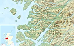
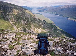
Loch Morar is a freshwater loch in Lochaber, Highland, Scotland. It is the fifth-largest loch by surface area in Scotland, at 26.7 km2 (10.3 sq mi), and the deepest freshwater body in the British Isles with a maximum depth of 310 m (1,017 ft). The loch was created by glacial action around 10,000 years ago, and has a surface elevation of 9 metres (30 ft) above sea level. It separates the traditional district of North Morar, from Arisaig and Moidart.
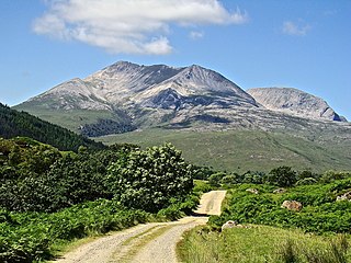
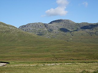
Beinn Eighe is a mountain massif in the Torridon area of Wester Ross in the Northwest Highlands of Scotland. Lying south of Loch Maree, it forms a long ridge with many spurs and summits, two of which are classified as Munros: Ruadh-stac Mòr at 1,010 m (3,314 ft) and Spidean Coire nan Clach at 993 m (3,258 ft). Unlike most other hills in the area it has a cap of Cambrian basal quartzite which gives the peaks of Beinn Eighe a distinctive light colour. Its complex topography has made it popular with both hillwalkers and climbers and the national nature reserve on its northern side makes it an accessible mountain for all visitors.

Morar is a small village on the west coast of Scotland, 3 miles (5 km) south of Mallaig. The name Morar is also applied to the northern part of the peninsula containing the village, though North Morar is more usual. The coastline of the area forms part of the Morar, Moidart and Ardnamurchan National Scenic Area, one of 40 such areas in Scotland, which are defined so as to identify areas of exceptional scenery and to ensure its protection by restricting certain forms of development.

The Southern Uplands are the southernmost and least populous of mainland Scotland's three major geographic areas. The term is used both to describe the geographical region and to collectively denote the various ranges of hills and mountains within this region. An overwhelmingly rural and agricultural region, the Southern Uplands are partly forested and contain many areas of open moorland - the hill names in the area are congruent with these characteristics.
Loch Ericht is a freshwater loch on the border between the former Perthshire, now Perth and Kinross and the former Inverness-shire, now Highlands Council areas of Scotland. It has a north-east to south-west orientation. The village of Dalwhinnie lies at the north east end of the loch. Loch Ericht is the tenth largest freshwater lake in Scotland and has a good reputation for its trout fishing and Ferox trout.
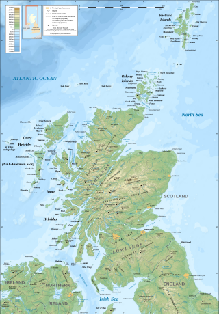
The geography of Scotland is varied, from rural lowlands to unspoilt uplands, and from large cities to sparsely inhabited islands. Located in Northern Europe, Scotland comprises the northern third of the island of Great Britain as well as 790 surrounding islands encompassing the major archipelagos of the Shetland Islands, Orkney Islands and the Inner and Outer Hebrides. The only land border is with England, which runs for 96 miles in a northeasterly direction from the Solway Firth in the west to the North Sea on the east coast. Separated by the North Channel, the island of Ireland lies 13 nautical miles from Mull of Kintyre on the Scottish mainland. Norway is located 190 nmi (350 km) northeast of Scotland across the North Sea. The Atlantic Ocean, which fringes the coastline of western and northern Scotland and its islands, influences the temperate, maritime climate of the country.
The Northwest Highlands are located in the northern third of Scotland that is separated from the Grampian Mountains by the Great Glen. The region comprises Wester Ross, Assynt, Sutherland and part of Caithness. The Caledonian Canal, which extends from Loch Linnhe in the south-west, via Loch Ness to the Moray Firth in the north-east splits this area from the rest of the country. The city of Inverness and the town of Fort William serve as gateways to the region from the south.

Loch Arkaig is a body of freshwater in Lochaber, Scotland, to the west of the Great Glen. It is approximately 12 miles in length and lies 140 feet above sea level, the maximum depth is around 300 feet

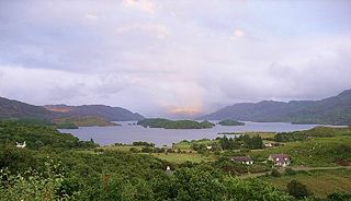
Loch Ailort is a sea loch in Morar, Lochaber, Highland, Scotland. Loch Ailort is a shallow V shaped loch, with the small Ardnish Peninsula on the north side, and the large southwest facing Moidart Peninsula to the south. Loch Ailort is bounded in the northeast by the settlement of the same name, Lochailort and in the west, opening out into the Sound of Arisaig. To the north of the loch lies Loch nan Uamh.

Loch Ness is a large freshwater loch in the Scottish Highlands extending for approximately 37 kilometres southwest of Inverness. It takes its name from the River Ness, which flows from the northern end. Loch Ness is best known for claimed sightings of the cryptozoological Loch Ness Monster, also known affectionately as "Nessie". It is one of a series of interconnected, murky bodies of water in Scotland; its water visibility is exceptionally low due to the high peat content of the surrounding soil. The southern end connects to Loch Oich by the River Oich and a section of the Caledonian Canal. The northern end connects to Loch Dochfour via the River Ness, which then ultimately leads to the North Sea via the Moray Firth.

Minginish is a peninsula on the Isle of Skye in Scotland. It is situated on the west coast of the island and runs from Loch Scavaig in the south, along the western coast of Skye to Loch Bracadale in the north west, to Loch Harport in the north east, and Glen Sligachan in the south east. It includes most of the peaks of the Cuillin hills including Sgurr Alasdair, the highest point on the island at 992 metres (3,255 ft). The island of Soay lies offshore across the Soay Sound, with the Small Isles further south across the Cuillin Sound.
Loch Etchachan is a remote freshwater loch set deep within the central Cairngorms plateau, in the Cairngorms National Park, located in the eastern Highlands of Scotland. It is the highest waterbody of its size in the UK, the surface being 927 metres (3,041 ft) above sea level. However, the highest named body of water in the UK is Loch Coire an Lochain, which lies 6km to the west of Loch Etchachan on the opposite side of the Lairig Ghru.

Loch A'an is a remote freshwater loch set deep within the central Cairngorms plateau, in the Cairngorms National Park, located in the eastern Highlands of Scotland. Loch A'an, also called Loch Avon, is the source of the River Avon. Loch A'an is oriented southwest–northeast and is bounded on three sides by precipitous mountains, cliffs and crags, with the North-East opening out to provide an outflow for the river through Glen Avon.
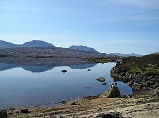
Loch Bà is a shallow irregular shaped freshwater loch on Rannoch Moor, Argyll and Bute, in the Scottish West Highlands, within the Highland council area of Scotland. It is about 25 km east-south-east of Glen Coe, and 20 km north of Tyndrum.

The River Morar is a river that flows from Loch Morar in the west Highlands of Scotland. It flows from the western end of the loch to the estuary of Morar Bay, an inlet of the Sound of Sleat. It is one of Scotland's shortest rivers, and is known for its white sands beaches where it flows through Morar Bay.
Bidein a' Choire Sheasgaich is a remote mountain in the Northwest Highlands of Scotland. It is a Munro with a height of 945 metres (3,100 ft) and is at the western end of an east–west ridge comprising a Munro Top Meall Mor, and the Munro Lurg Mhòr.

Loch a' Bhraoin, Loch Broom, is a freshwater loch, located in Wester Ross, in Ross-shire, on the west coast of Scotland.

Rhu Peninsula and originally known as the Rhu Arisaig peninsula is a small, remote and largely deserted peninsula, at the SW corner of South Morar in Lochaber Highland council area, on the west coast of Scotland. Arisaig is located at the northeast corner of the peninsula. In July 1745, Loch nan Uamh on the south coast of the peninsula was the landing spot for Prince Charles Edward Stuart.