Loch Brand

Last updated

Loch Brand's site
The site of the old Boghall Loch.JPG
The loch's site from near the ruins of Hill of Beith Castle
North Ayrshire UK relief location map.jpg
Red pog.svg
Loch Brand's site
Location North Ayrshire, Scotland
Coordinates 55°45′14.2″N4°36′52.8″W / 55.753944°N 4.614667°W / 55.753944; -4.614667 Coordinates: 55°45′14.2″N4°36′52.8″W / 55.753944°N 4.614667°W / 55.753944; -4.614667
Type Drained freshwater loch
Primary inflows Grange Burn
Primary outflows Boghall Burn
Basin  countriesScotland
Surface areaca. 2 ha (4.9 acres)
Islands One crannog (destroyed)
Settlements Beith

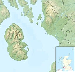
Loch Brand or Loch of Boghall was a loch situated in a depression between the Grange Estate, Crummock, Hill of Beith Castle site and Boghall in the Parish of Beith, North Ayrshire, Scotland. The loch was fed by the Grange Burn and surface runoff, such as from the old rig and furrows indicated by Roy's Maps of the mid 17th century. [1] The loch was drained by the Boghall Burn that runs passed the 'Court Hill' and into Powgree Burn at Gateside.

Contents

History

Site of the old dam. Boghall Burn and old loch dam.JPG
Site of the old dam.

Loch Bran or Brand was the name by which the Loch of Boghall was formerly known. [2] The loch, drained in 1780, is one of the sources of the Powgree Burn and lay on the lands of Boghall and Hill of Beith.

Crannog

In the bottom of the loch piles or stakes of oak or elm have been found at various times and are thought that these may be the remains of crannogs or connected with fishing on the loch. [2] [3] Dobie, writing in 1876 states that the loch was drained about 60 years ago, thus about 1826. [4] The 'cut' through the natural dam that once held back the loch waters below Boghall is clearly visible. The Boghall Burn runs from a drainage ditch through this 'cut'.

Land improvements

Land improvements and reclamation was taking place in many areas, for example in 1814 Barr Loch and the Aird Meadow was bunded and drained. [5] Although the loch's drainage may have begun in the 15th century, Alexander Montgomerie, 10th Earl of Eglinton, was pursuing a number of agricultural improvements on his extensive estates in the 18th century and other landowners followed his example. Intensive drainage work may have taken place in the 1740s as part of the improvements undertaken to provide employment for Irish estate workers during the Irish potato famines of the 1740s and the mid 19th centuries. Many drainage schemes also date to the end of World War I when many soldiers returned en masse to civilian life. [6]

The nearby placenames of Bogholm, Bogside and Boghall are self-evident as an indicators of the nature of the area. [7]

A dispute

In 1482, when Loch Brand was the property of the monks of Kilwinning Abbey, it is recorded that the Abbot and Convent of Kilwinning took legal action against Robert Montgomerie and his brother John of Giffin Castle, William Montgomerie, Alexander Montgomerie and James Ker who were accused of dangerous destruction and down-casting of the fosses and dikes of the loch called Loch Brand. [8] It is not recorded what the judgement was or the effect these actions had upon the size and depth of the loch.

Ownership

Access lane to Hill of Beith Castle ruins Lane to Hill of Beith Castle.JPG
Access lane to Hill of Beith Castle ruins
The site of Loch Brand from near Boghall Loch Brand and drainage ditch.JPG
The site of Loch Brand from near Boghall

As stated, the loch and bordering lands once belonged to the monks of Kilwinning Abbey and to the Montgomeries of Broadstone who held the Lands of Boghall. In 1691 Hew Montgomerie held the lands and his son Mathew inherited them. [9] The loch formed part of the Barony of Beith, which had been given to the monks in the twelfth century. The monks' Grange lay nearby in the vicinity of the present day Grangehill Estate. [2] Yester Hill of Beith or Hill of Beith Castle was a successor to the lands owned by the monks, however the Cuninghames had sold the castle and lands of Hill of Beith by the end of the 17th century. [10] In around 1798 Hugh Brown of Broadstone purchased the lands of Hill of Beith Castle and part of the loch lands. [11]

Habitats

The site is now represented by a low, marsh and reed covered area (less than 2 ha in extent) centred at NS 358 543 on the OS map. [12] The Ordnance Survey maps of the mid 19th century indicate that the area was farming land devoid of marsh, bog, or wetland, however the area in 2010 is as stated above.

See also

Notes

  1. William Roy's Map Retrieved : 2010-12-22
  2. 1 2 3 Arch & Hist Collections of relating to the counties of Ayr & Wigton. Page 28
  3. Smith, Page 81
  4. Dobie, page 95
  5. Scottish Natural Heritage [ permanent dead link ] Retrieved : 2010-10-24
  6. MacIntosh, Pages 37 & 39
  7. Thomson's Map Retrieved : 2010-12-22
  8. Dobie, Page 95
  9. Dobie, Page 94
  10. Dobie, Page 133
  11. Dobie, Page 134
  12. RCAHMS Retrieved 2010-09-30

Sources

  • Archaeological & Historical Collections relating to the counties of Ayrshire & Wigtown. Edinburgh : Ayr Wig Arch Soc. 1880.
  • Archaeological & Historical Collections relating to the counties of Ayrshire & Wigtown. Edinburgh : Ayr Wig Arch Soc. 1882.
  • Dobie, James D. (ed Dobie, J.S.) (1876). Cunninghame, Topographized by Timothy Pont 1604–1608, with continuations and illustrative notices. Glasgow: John Tweed.
  • MacIntosh, Donald (2006). Travels in Galloway. Glasgow : Neil Wilson. ISBN   1-897784-92-9.
  • Smith, John (1895). Prehistoric Man in Ayrshire. London : Elliot Stock.

Related Research Articles

Beith is a small town in the Garnock Valley, North Ayrshire, Scotland approximately 20 miles south-west of Glasgow. The town is situated on the crest of a hill and was known originally as the "Hill o' Beith" after its Court Hill.

Hessilhead

Hessilhead is in Beith, North Ayrshire, Scotland. Hessilhead used to be called Hazlehead or Hasslehead. The lands were part of the Lordship of Giffen, and the Barony of Hessilhead, within the Baillerie of Cunninghame and the Parish of Beith. The castle was situated at grid reference NS380532.

Kilwinning Abbey Monastery in North Ayrshire, Scotland, UK

Kilwinning Abbey is a ruined abbey located in the centre of the town of Kilwinning, North Ayrshire.

Barony and Castle of Giffen Barony in the former District of Cunninghame, now North Ayrshire

The Barony of Giffen and its associated 15th-century castle were in the parish of Beith in the former District of Cunninghame, now North Ayrshire. The site may be spelled Giffen or Giffin and lay within the Lordship of Giffin, which included the Baronies of Giffen, Trearne, Hessilhead, Broadstone, Roughwood and Ramshead; valued at £3,788 9s 10d. The Barony of Giffen comprised a number of properties, including Greenhills, Thirdpart, Drumbuie, Nettlehirst and Balgray, covering about half of the parish of Beith. Giffen was a hundred merk land, separated from the Barony of Beith, a forty-pound land, by the Powgree Burn which rises on Cuff hill. The Lugton Water or the Bungle Burn running through Burnhouse may have been the Giffen barony boundary with that of the adjacent barony and lands of Aiket castle.

Gateside, North Ayrshire Human settlement in Scotland

Gateside is a small village in North Ayrshire, Scotland about 12 mile east of Beith on the B777.

Spiers School

Spier's School, at Beith, in North Ayrshire, Scotland was opened in 1888 and closed in 1972. The school, now demolished, was built using Ballochmyle red sandstone and was reminiscent of the ancient Glasgow University. The school motto was 'Quod verum tutum'. The gardens and woodlands are open to the public at all times.

Broadstone Castle Castle in Ayrshire, Scotland

Broadstone lies close to the small village of Gateside in North Ayrshire, Scotland about half a mile east of Beith in the old Barony of Giffen.

Kilbirnie Loch Lake in the Scotland

Kilbirnie Loch, is a freshwater Loch situated in the floodplain between Kilbirnie, Glengarnock and Beith, North Ayrshire, Scotland. It runs south-west to north-east for almost 2 km (1.2 mi), is about 0.5 km (0.31 mi) wide for the most part and has an area of roughly 3 km2. It has a general depth of around 5.2 metres (17 feet) to a maximum of around 11 metres (36 feet). The loch is fed mainly by the Maich Water, which rises in the Kilbirnie Hills near Misty Law, and is drained by the Dubbs Water that runs past the Barr Loch into Castle Semple Loch, followed by the Black Cart, the White Cart at Renfrew and finally the River Clyde. The boundary between East Renfrewshire and North Ayrshire, in the vicinity of the loch, runs down the course of the Maich Water along the northern loch shore to then run up beside the Dubbs Water.

Hill of Beith Castle

The old Barony and castle, fortalice, or tower house of Hill of Beith lay in the feudal Regality of Kilwinning, within the Baillerie of Cunninghame, and the Sherrifdom of Ayr, now the Parish of Beith, North Ayrshire, Scotland.

Lochlea, South Ayrshire

Lochlea or Lochlie was situated in a low-lying area between the farms and dwellings of Lochlea and Lochside in the Parish of Tarbolton, South Ayrshire, Scotland. The loch was natural, sitting in a hollow created by glaciation. The loch waters ultimately drained via Fail Loch, the Mill Burn, and the Water of Fail. It is well-documented due to the presence of a crannog that was excavated and documented circa 1878, and its association with the poet Robert Burns, who lived here for several years whilst his father was the tenant. Lochlea lies 2+12 miles northeast of Tarbolton, and just over three miles northwest of Mauchline.

Buiston Loch An occasional lake in Ayrshire, Scotland

Buiston Loch, also known as Buston, Biston, and Mid Buiston was situated in the mid-Ayrshire clayland at an altitude of 90 m OD. The loch was natural, sitting in a hollow created by glaciation. The loch waters drained via the Garrier Burn that joins the Bracken and Lochridge Burns before joining the River Irvine.

Halket Loch

Halket Loch' also known as Halkhead or Halketh, was situated in the mid-Ayrshire clayland near Lugton. It is visible as a surface depression in pastureland, sometimes partially flooded, situated in a low-lying area close to farms and dwellings of East, North and Middle Halket and Craighead in the Parish of Dunlop, East Ayrshire, Scotland. The loch was natural, sitting in a hollow created by glaciation. The loch waters drained via the Glazert Water that joins the Annick Water.

Hessilhead Loch

Hessilhead Loch or Hazelhead Loch was situated in a low-lying area near the old Castle of Hessilhead in the Parish of Beith, North Ayrshire, Scotland. The old loch, used in the defence of the castle, was probably infilled when the castle ruins were landscaped in the 19th century.

Knockewart Loch

Knockewart Loch or Loch Jargon was situated in a hollow lying area beneath Knockewart Hill in the Parish of Ardrossan, North Ayrshire, Scotland. The old loch has become largely drained and overgrown since the late 19th century.

Blae Loch (Beith) A lake in Ayrshire, Scotland

The Blae Loch is a small freshwater loch situated in a hollow in a low-lying area beneath Blaelochhead Hill in the Parish of Beith, North Ayrshire, Scotland.

Lands of Ashgrove

The Lands of Ashgrove, previously known as Ashenyards, formed a small estate in the Parish of Kilwinning, North Ayrshire, lying between Kilwinning and Stevenston. The Georgian mansion house was demolished in 1960, the substantial walled garden survives.

The Lands of Doura, Dawra, Dawray, DowreyDowray, Dourey or Douray formed a small estate, at one time part of the Barony of Corsehill and Doura, situated near the Eglinton Estate in the Parish of Kilwinning, North Ayrshire, Scotland.

Lands of Willowyard

The ancient lands of Willowyard, Willieyeards, Williyard or Willizeards were part of the holdings of the Regality of Kilwinning, Barony of Beith, and Bailiary of Cuninghame. They later became the property of the Montgomerie family before being sold to the Simson family in 1723. The manor house still survives as part of a business premises and the nearby industrial estate and whisky bond carry the name 'Willowyards'.

Lands of Marshalland

The lands of Marshalland, Marsheland, Marsheyland or Marshyland were part of the holdings of the Barony of Beith, Regality of Kilwinning and Bailiary of Cuninghame. They became the property of the Lyle family, then the Shedden family, passing next to the Spier's family before finally becoming part of the Spier's Trust lands. The laird's house and farm were demolished in the 1960s.

Lands of Morishill

The lands of Morishill,Morrishill,Moorishill or Moricehill were part of the holdings of the Barony of Beith, Regality of Kilwinning and Bailiary of Cuninghame. The name may have derived from large shielings or huts that were once erected at the site.