Related Research Articles
Firth is a word in the English and Scots languages used to denote various coastal waters in the United Kingdom, predominantly within Scotland. In the Northern Isles, it more usually refers to a smaller inlet. It is linguistically cognate to fjord which has a more constrained sense in English. Bodies of water named "firths" tend to be more common on the Scottish east coast, or in the southwest of the country, although the Firth of Clyde is an exception to this. The Highland coast contains numerous estuaries, straits, and inlets of a similar kind, but not called "firth" ; instead, these are often called sea lochs. Before about 1850, the spelling "Frith" was more common.

Staffa is an island of the Inner Hebrides in Argyll and Bute, Scotland. The Vikings gave it this name as its columnar basalt reminded them of their houses, which were built from vertically placed tree-logs.
Lismore is an island of some 2,351 hectares in the Inner Hebrides of Scotland. The climate is damp and mild, with over 166 centimetres (65 in) of rain recorded annually. This fertile, low-lying island was once a major centre of Celtic Christianity, with a 6th-century monastery associated with Saint Moluag, and later became the seat of the medieval Bishop of Argyll. There are numerous ruined structures including a broch and two 13th-century castles.
Kerrera is an island in the Scottish Inner Hebrides, close to the town of Oban. In 2016 it had a population of 45, divided into two communities in the north and south of the island.
Scalpay is an inhabited island in the Inner Hebrides of Scotland which has a population of 4.

The Slate Islands are an island group in the Inner Hebrides, lying immediately off the west coast of Scotland, north of Jura and southwest of Oban. The main islands are Seil, Easdale, Luing, Shuna, Torsa and Belnahua. Scarba and Kerrera, which lie nearby, are not usually included.
Luing is one of the Slate Islands, Firth of Lorn, in the west of Argyll in Scotland, about 16 miles (26 km) south of Oban. The island has an area of 1,430 hectares and is bounded by several small skerries and islets. It has a population of around 200 people, mostly living in Cullipool, Toberonochy, and Blackmillbay.

Scarba is an island, in Argyll and Bute, Scotland, just north of the much larger island of Jura. The island was owned by Richard Hill, 7th Baron Sandys, and has not been permanently inhabited since the 1960s. It is now covered in heather and used for grazing animals. Kilmory Lodge is used seasonally as a shooting lodge, the island having a flourishing herd of red deer.

Belnahua is one of the Slate Islands, in the Firth of Lorn in Scotland, known for its deserted slate quarries. The bedrock that underpins its human history is part of the Scarba Conglomerate Formation and its value has been on record since the 16th century. Likely uninhabited before commercial quarrying commenced, under the control of the Stevenson family during the 19th century the population expanded to over 150 before the island was abandoned again in 1914.
Gometra is an island in the Inner Hebrides of Scotland, lying west of Mull. It lies immediately west of Ulva, to which it is linked by a bridge, and at low tide also by a beach. It is approximately 425 hectares in size. The name is also applied to the island summit, which is a Marilyn. The island has been owned since 1992 by Roc Sandford, a wealthy environmental campaigner who lives mostly in London and part of the year on Gometra.

Dunnet Head is a peninsula in Caithness, on the north coast of Scotland. Dunnet Head includes the most northerly point of both mainland Scotland and the island of Great Britain.

An Sgùrr is the highest hill on the Inner Hebridean island of Eigg, Lochaber, Highland, Scotland. It was formed 58.72 ± 0.07 million years ago; the result of one of the last eruptions of a volcano, the core of which now forms the Isle of Rùm. Thick viscous pitchstone lava of rhyodacitic composition flowed out, filling a river valley. The lava cooled and formed column-like structures, similar to those at Giant's Causeway.

The geology of Scotland is unusually varied for a country of its size, with a large number of differing geological features. There are three main geographical sub-divisions: the Highlands and Islands is a diverse area which lies to the north and west of the Highland Boundary Fault; the Central Lowlands is a rift valley mainly comprising Palaeozoic formations; and the Southern Uplands, which lie south of the Southern Uplands Fault, are largely composed of Silurian deposits.

The North Atlantic Igneous Province (NAIP) is a large igneous province in the North Atlantic, centered on Iceland. In the Paleogene, the province formed the Thulean Plateau, a large basaltic lava plain, which extended over at least 1.3 million km2 (500 thousand sq mi) in area and 6.6 million km3 (1.6 million cu mi) in volume. The plateau was broken up during the opening of the North Atlantic Ocean leaving remnants preserved in north Ireland, west Scotland, the Faroe Islands, northwest Iceland, east Greenland, western Norway and many of the islands located in the north eastern portion of the North Atlantic Ocean. The igneous province is the origin of the Giant's Causeway and Fingal's Cave. The province is also known as Brito–Arctic province and the portion of the province in the British Isles is also called the British Tertiary Volcanic Province or British Tertiary Igneous Province.

Variations in the strength of gravity occur from place to place according to the density distribution of the rocks beneath the surface. Such gravity anomalies have been mapped across the British Isles and adjacent areas and they reveal aspects of these islands’ geological structure.

The geology of the Isle of Skye in Scotland is highly varied and the island's landscape reflects changes in the underlying nature of the rocks. A wide range of rock types are exposed on the island, sedimentary, metamorphic and igneous, ranging in age from the Archaean through to the Quaternary.
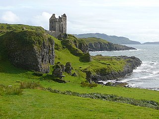
Loch Buie is a sea loch on the south coast of the Isle of Mull, off the west coast of Scotland. It takes the form of a deep bay opening onto the Firth of Lorn. At the head of the loch is the settlement of Lochbuie at the end of a minor road form the A849 at Ardura. There are a handful of small islands and rocky islets close to shore, the largest of which is Eilean Mor which is connected to the mainland of Mull at low tide. Nearby is Moy Castle. There are extensive shore platforms around the loch, notably on its southeastern side beneath Laggan Deer Forest. Numerous caves are located at the rear of this platform including Uaimh nan Taillearan. Sandy beaches lie at the head of the loch. The cliffs at either side are formed from basalt lava flows of Palaeogene age, intruded by numerous dolerite dykes. At the head of the loch, the rocks include granophyres and gabbro. Though unseen at the surface, the Great Glen Fault is usually considered to run beneath this loch and nearby Loch Spelve.
The geology of the Isle of Man consists primarily of a thick pile of sedimentary rocks dating from the Ordovician period, together with smaller areas of later sedimentary and extrusive igneous strata. The older strata was folded and faulted during the Caledonian and Acadian orogenies The bedrock is overlain by a range of glacial and post-glacial deposits. Igneous intrusions in the form of dykes and plutons are common, some associated with mineralisation which spawned a minor metal mining industry.

The geology of the Isle of Mull in Scotland is dominated by the development during the early Palaeogene period of a ‘volcanic central complex’ associated with the opening of the Atlantic Ocean. The bedrock of the larger part of the island is formed by basalt lava flows ascribed to the Mull Lava Group erupted onto a succession of Mesozoic sedimentary rocks during the Palaeocene epoch. Precambrian and Palaeozoic rocks occur at the island's margins. A number of distinct deposits and features such as raised beaches were formed during the Quaternary period.
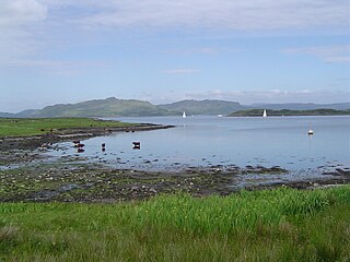
Loch Spelve is a sea loch on the southeast coast of the Isle of Mull, off the west coast of Scotland. It is almost landlocked with a relatively narrow opening onto the Firth of Lorn. The A849 road runs past the northern arm of the loch and a minor road runs south from it and around the shore of the western arm via Kinlochspelve as far as the settlement of Croggan. Raised beaches are notable features of the loch, particularly on the shores of the narrows through which it enters the open waters of the firth. There are a few rocky islets within the loch, the largest of which is Eilean Amalaig on which are the ruins of a castle. There is a terminal moraine at Kinlochspelve dating from the last ice age. The southern and eastern shores of Loch Spelve are formed from basalt lava flows of Palaeogene age, intruded by numerous dolerite dykes. The northern and western shores are formed in granophyres and Triassic sandstones, the latter intruded by olivine-dolerite cone sheets associated with the Palaeogene volcanism. Though unseen at the surface, the Great Glen Fault is usually considered to run beneath this loch and nearby Loch Buie.
References
- ↑ Isle of Mull East (Map) (A ed.). 1:25,000. Explorer. Ordnance Survey. 2002. ISBN 0319233383.
- ↑ Emeleus, C.H.; Bell, B.R. (2005). British Regional Geology: the Palaeogene volcanic districts of Scotland (Fourth ed.). Nottingham: British Geological Survey. p. 161. ISBN 0852725191.
- ↑ Eastern Mull Scotland sheet 44W and part 44E (Map) (Solid ed.). 1:50,000. Scotland. British Geological Survey. 1992. ISBN 075182058X.