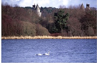
Loch of Skene is a large lowland, freshwater loch in Aberdeenshire, Scotland. It lies approximately 1 mi (1.6 km) to the west of the village of Kirkton of Skene and 9 mi (14 km) west of Aberdeen.
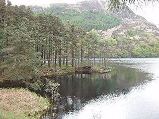
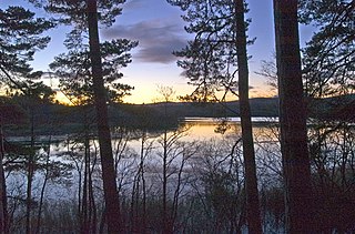
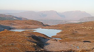
Loch Trool is a narrow, freshwater loch in Galloway, in the Southern Uplands in south-west Scotland. It lies in an elevated position in Glen Trool in the Galloway Forest Park and is approximately 8 miles (13 km) north of the town of Newton Stewart. The loch is the source of the Water of Trool which flows to the Water of Minnoch and the River Cree. There is a walking trail and footpath around the loch's perimeter.
Loch of Aboyne is a shallow, artificial formed, freshwater loch in Grampian, Scotland. It lies 1+1⁄4 miles (2 km) northeast of Aboyne and 26 miles (42 km) west-southwest of Aberdeen. An earthen dam was constructed around 1834 to retain the loch. It also served as a reservoir for a nearby mill.
The Loch of Skaill is a small somewhat triangular, freshwater loch in the parish of Sandwick, Orkney on Mainland Orkney, Scotland. It lies 0.5 mi (0.80 km) south east of the Bay of Skaill close to Skaill House and the World Heritage neolithic site Skara Brae.
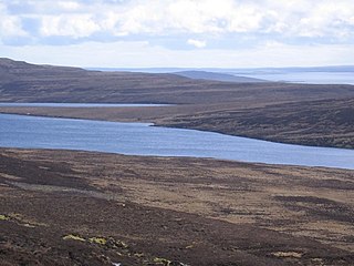
Muckle Water is a long, narrow fresh water loch on Ward Hill on Rousay, Orkney, Scotland. It is the biggest loch on the island and is popular for fishing. It can be reached by a track from the roadside. The Suso Burn on the north eastern shore drains the loch into the Sound of Rousay.
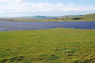
The Loch of Hundland is a shallow freshwater loch in the parish of Birsay in the north west of the mainland of Orkney, Scotland. The loch lies between the larger lochs of Swannay and Boardhouse and acts as the main water catchment for Loch of Boardhouse. It has a great variety of aquatic plants including species that are unusual locally and nationally, and many types of birds including waders, gulls, larks and ducks that nest or use the loch. It is also popular for trout fishing.
Hoglinns Water is a small freshwater loch in the south of the island of Hoy, Orkney. It drains in to Heldale Water via Hoglinns Burn. The loch was surveyed in 1906 by Sir John Murray and later charted as part of the Bathymetrical Survey of Fresh-Water Lochs of Scotland 1897-1909.
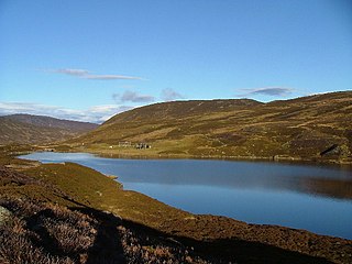
Loch Callater is an upland, freshwater loch lying approximately 5 miles (8 km) south of Braemar, Scotland. The loch trends in a northwest to southeast direction and is surrounded on both sides by steep hills. It is approximately 1.6 km (1 mi) in length.
Loch Davan is a small, triangular, freshwater loch approximately 5 mi (8.0 km) northeast of Ballater, Scotland and lying immediately north of Loch Kinord. It is approximately 0.75 mi (1.21 km) in length and was formed from a glacial kettle hole. The loch sits within the Muir of Dinnet National Nature Reserve.
Loch Fithie is a small, lowland freshwater loch lying approximately 2 miles (3.2 km) east of Forfar, Scotland. It is approximately 800 m (2,600 ft) in length.

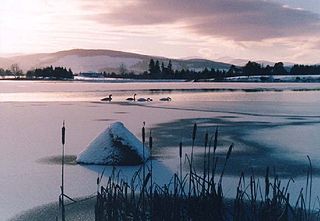
Loch of Forfar is a freshwater loch lying on the western side of the town of Forfar, Scotland. The loch trends in an east to west direction and is approximately 1 mi (1.6 km) in length. The loch and area around it form Forfar Loch Country Park.

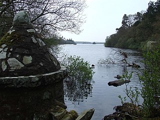
Loch of Avich is a large freshwater loch that lies approximately 1 mi (1.6 km) west of Loch Awe in Argyll and Bute in Scotland. It is the second biggest loch in the Etive basin after Loch Awe. It trends east-northeast, west-southwest and is narrowly triangular in shape. At the southwest end of the loch is the islet Innis Luana on which stands the ruins of an ancient castle named Caisteal na Nighinn Ruaidhe. The castle may have been the original seat of Clan Campbell. Near the north shore on the islet of Eilean Fraoch is the remains of a crannog.

Loch Stack is a large, irregularly shaped freshwater loch in the Northwest of Scotland. It lies approximately 4 miles (6.4 km) southeast of Laxford Bridge and is surrounded by mountains. Ben Stack rises steeply from the loch's southwestern shore and Arkle lies directly to the north.
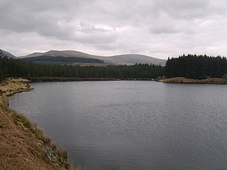
Kirriereoch Loch is a small, shallow, square shaped, freshwater loch in Dumfries and Galloway, in the Southern Uplands of south-west Scotland. It lies approximately 12 mi (19 km) north of the town of Newton Stewart. It is a part of the Wood of Cree Nature Preserve system
Mochrum Loch is a large, irregular shaped, shallow, freshwater loch in Dumfries and Galloway, in the Southern Uplands of south-west Scotland. It lies approximately 8 mi (13 km) west of the town of Wigtown. The loch has several rocky islets.

Loch a' Ghobhainn is an upland freshwater loch lying inland and south west of the village of Shieldaig in the Scottish Highlands. The loch has an irregular, somewhat elliptical shape with a perimeter of 3.1 km (1.9 mi). It is approximately 0.75 mi (1.21 km) long, has an average depth of 12.5 ft (3.8 m) and is 28 ft (8.5 m) at its deepest. The loch was surveyed on 8 August 1902 by T.N. Johnston and John Hewitt and later charted as part of Sir John Murray's Bathymetrical Survey of Fresh-Water Lochs of Scotland 1897-1909.

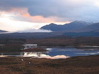
Loch Dochard is an upland freshwater loch lying approximately 6 km (3.7 mi) west of Bridge of Orchy in Argyll and Bute, Scottish Highlands. The loch has an irregular shape with a perimeter of 3 km (1.9 mi). It is approximately 1.06 km (0.66 mi) long, has an average depth of 3.7 m (12 ft) and is 13 m (42 ft) at its deepest. The loch was surveyed on 18 May 1903 by Sir John Murray and later charted as part of his Bathymetrical Survey of Fresh-Water Lochs of Scotland 1897-1909.
Loch Lundie is a small, lowland freshwater loch in Glen Garry, about 1.5 miles (2.4 km) north-west of Invergarry in the Scottish Highlands. The loch is irregular in shape with a perimeter of 0.9 km (0.56 mi). It is approximately 0.75 mi (1.21 km) long, has an average depth of 40 ft (12 m) and is 54 ft (16 m) at its deepest. The loch was surveyed in 1903 by Sir John Murray and James Murray as part of the Bathymetrical Survey of Fresh-Water Lochs of Scotland 1897-1909.
Loch Anna is a small, upland, freshwater loch approximately 2.4 km (1.5 mi) north of Loch Alsh at Ardelve, in Lochalsh, Scotland. It lies in a northwest to southeast direction, is approximately 0.5 km (0.31 mi) in length, and is at an altitude of 317 m (1,040 ft). The loch is irregular in shape, is on average 4 m (13 ft) deep, with a maximum depth of 8.2 m (27 ft). It was surveyed in 1904 by James Murray as part of Sir John Murray's Bathymetrical Survey of Fresh-Water Lochs of Scotland 1897-1909.
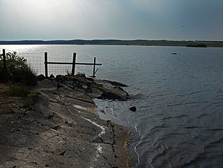
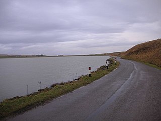
Castle Loch is a shallow eutrophic loch covering an area of around 100 hectares in the town of Lochmaben in Dumfries and Galloway, Scotland. It lies to the west of Mochrum Loch and has 2 islets. The ruined Lochmaben Castle lies at the southern end of the loch.

