Loch Lomond is a freshwater Scottish loch which crosses the Highland Boundary Fault, often considered the boundary between the lowlands of Central Scotland and the Highlands. Traditionally forming part of the boundary between the counties of Stirlingshire and Dunbartonshire, Loch Lomond is split between the council areas of Stirling, Argyll and Bute and West Dunbartonshire. Its southern shores are about 23 kilometres (14 mi) northwest of the centre of Glasgow, Scotland's largest city. The Loch forms part of the Loch Lomond and The Trossachs National Park which was established in 2002.

Windermere is the largest natural lake in England. More than 11 miles in length, and almost 1 mile at its widest, it is a ribbon lake formed in a glacial trough after the retreat of ice at the start of the current interglacial period. It has been one of the country's most popular places for holidays and summer homes since the arrival of the Kendal and Windermere Railway's branch line in 1847. Forming part of the border between the historic counties of Lancashire and Westmorland, Windermere is today within the administrative county of Cumbria and the Lake District National Park.
Kinross is a burgh in Perth and Kinross, Scotland, around 13 miles south of Perth and around 20 miles northwest of Edinburgh. It is the traditional county town of the historic county of Kinross-shire.

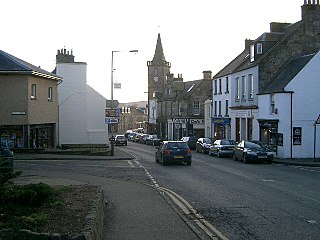
Cowdenbeath is a town and burgh in west Fife, Scotland. It is 5 miles (8 km) north-east of Dunfermline and 18 miles (29 km) north of the capital, Edinburgh. The town grew up around the extensive coalfields of the area and became a police burgh in 1890. According to a 2008 estimate, the town has a population of 14,081.
Draycote Water is a 240-hectare (590-acre) reservoir and country park near the village of Dunchurch, 3.75 miles (6 km) south of Rugby in Warwickshire, England, owned and operated by Severn Trent Water. It draws its water from the River Leam, and supplies drinking water to Rugby and Coventry. It is named after the nearby hamlet of Draycote.
Strathclyde Country Park is a country park located on the outskirts of Motherwell in North Lanarkshire, Scotland, named after the former Strathclyde region of Scotland. It is often commonly referred to as Strathclyde, or simply Strathy.

The Monkland Canal was a 12+1⁄4-mile-long (19.7 km) canal designed to bring coal from the mining areas of Monklands to Glasgow in Scotland. In the course of a long and difficult construction process, it was opened progressively as short sections were completed, from 1771. It reached Gartcraig in 1782, and in 1794 it reached its full originally planned extent, from pits at Calderbank to a basin at Townhead in Glasgow; at first this was in two sections with a 96-foot (29 m) vertical interval between them at Blackhill; coal was unloaded and carted to the lower section and loaded onto a fresh barge. Locks were later constructed linking the two sections, and the canal was also connected to the Forth and Clyde Canal, giving additional business potential.

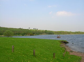
Castle Semple Loch is a 1.5-mile-long (2.5 km) inland freshwater loch at Lochwinnoch in Renfrewshire, Scotland. Originally part of an estate of the same name, it is now administered by Clyde Muirshiel Regional Park as a watersports centre. An RSPB bird sanctuary is located on the loch's southern shore.

The Nor Loch, also known as the Nor' Loch and the North Loch, was a man-made loch formerly in Edinburgh, Scotland, in the area now occupied by Princes Street Gardens and Waverley station which lie between the Royal Mile and Princes Street.

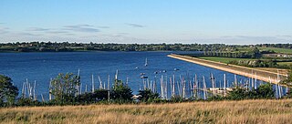
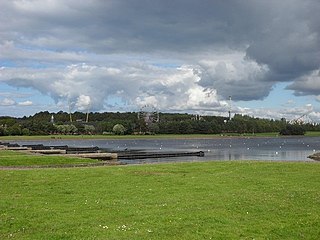
Lochore is a former mining village in Fife, Scotland. It takes its name from the nearby Loch Ore. It is largely joined to the adjacent villages of Ballingry to the north and Crosshill to the south.

Clyde Muirshiel Regional Park is the collective name for areas of countryside set aside for conservation and recreation on the South Clyde estuary in Scotland.

Ballingry ; Scots: Ballingry, Bingry, Scottish Gaelic: Baile Iongrach) is a small town in Fife, Scotland. It is near the boundary with Perth and Kinross, north of Lochgelly. It has an estimated population (2016) of 5,940. The once separate villages of Ballingry, Lochore, Crosshill, and Glencraig are now somewhat joined together as the part of the Benarty area. Ballingry, along with its neighbour Lochgelly, is one of Fife's 'regeneration areas' and is classed as in need of regeneration economically and socially.

The Meadows is a large public park in Edinburgh, Scotland, to the south of the city centre.

Loch Ness is a large freshwater loch in the Scottish Highlands extending for approximately 37 kilometres southwest of Inverness. It takes its name from the River Ness, which flows from the northern end. Loch Ness is best known for alleged sightings of the cryptozoological Loch Ness Monster, also known affectionately as "Nessie". It is one of a series of interconnected, murky bodies of water in Scotland; its water visibility is exceptionally low due to a high peat content in the surrounding soil. The southern end connects to Loch Oich by the River Oich and a section of the Caledonian Canal. The northern end connects to Loch Dochfour via the River Ness, which then ultimately leads to the North Sea via the Moray Firth.

Lochend House, also known as Restalrig Castle and Lochend Castle, is an occupied house, incorporating the remains of a 16th-century L-plan tower house, in Edinburgh, Scotland. It is located in the Lochend area, about 1.5 miles (2.4 km) east of Edinburgh Castle. The house is protected as a category B listed building.
Kilbirnie Loch, is a freshwater Loch situated in the floodplain between Kilbirnie, Glengarnock and Beith, North Ayrshire, Scotland. It runs south-west to north-east for almost 2 km (1.2 mi), is about 0.5 km (0.31 mi) wide for the most part and has an area of roughly 3 km2. It has a general depth of around 5.2 metres (17 feet) to a maximum of around 11 metres (36 feet). The loch is fed mainly by the Maich Water, which rises in the Kilbirnie Hills near Misty Law, and is drained by the Dubbs Water that runs past the Barr Loch into Castle Semple Loch, followed by the Black Cart, the White Cart at Renfrew and finally the River Clyde. The boundary between East Renfrewshire and North Ayrshire, in the vicinity of the loch, runs down the course of the Maich Water along the northern loch shore to then run up beside the Dubbs Water.

Loch Libo is a freshwater loch in East Renfrewshire, Parish of Neilston, Scotland. The Lugton Water has its source from the southern end of loch, running 14 miles before reaching its confluence with the River Garnock near Kilwinning. The village of Uplawmoor and the hamlet of Shillford lie nearby. 3 mi (4.8 km) away to the northeast is the town of Neilston.

The University of St Andrews Boat Club (UStABC), founded in 1962, is the rowing team affiliated to the University of St Andrews. Operating under the University of St Andrews Athletic Union, the club competes in head races and regattas across Scotland and England, including the Head of the River Race (London), British University Championships 'BUCS' Regatta and Henley Royal Regatta. Its national governing body is Scottish Rowing and the registration code of 'SAU'.

Lochore Castle is a ruined 14th-century tower house, about 3 miles (4.8 km) south east of Cowdenbeath, Fife, Scotland, and south of Lochore, east of Loch Ore, in Lochore Country Park.