Loch Sgadabhagh

Last updated

Loch Sgadabhagh
Pier, Loch Scadabhagh - geograph.org.uk - 842249.jpg
Loch Sgadabhagh, southern portion
Outer Hebrides UK relief location map.jpg
Red pog.svg
Loch Sgadabhagh
Location North Uist, Eilean Siar
Coordinates 57°35′44″N7°15′13″W / 57.59556°N 7.25361°W / 57.59556; -7.25361
Type Freshwater loch
Primary outflows Garbh-Abhuinn
Basin  countries Scotland
Max. length7.25 km (4.50 mi)
Max. width3 km (1.9 mi)
Surface area453 ha (1,120 acres)
Average depth2.75 m (9 ft 0 in)
Max. depth15.1 m (50 ft)
Water volume11,836,442 m3 (418,000,000 cu ft)
Shore length180.5 km (50.0 mi)
Surface elevation5 m (16 ft)
Islands Eilean Dubh Mòr
Sections/sub-basinsNumerous
Settlements Lochmaddy
1 Shore length is not a well-defined measure.

Loch Sgadabhagh or Loch Scadavay is a body of water on the island of North Uist, Scotland. The name may be of Old Norse derivation meaning "lake of tax bay" although if so, the reason is obscure. [1] Loch Sgadabhagh is the largest loch by area on North Uist although Loch Obisary has about twice the volume. [2]

Contents

Geography

According to Murray and Pullar (1908) "there is probably no other loch in Britain which approaches Loch Scadavay in irregularity and complexity of outline. It is an extraordinary labyrinth of narrow channels, bays, promontories and islands" [2] The loch is crossed by the main A867 road and the northern and southern portions are "connected by such a small channel under the road that in time of flood the south loch may temporarily rise some feet higher than the other, though normally they are at the same level". [2]

Located at NF862683 , it stretches for over 7.25 kilometres (4+12 mi), is over three kilometres (2 mi) broad in places and has a total shore line of 80.5 kilometres (50 mi), yet the mean depth is only 2.75 metres (9 ft 0 in). The narrow channels leading into some of the elongate arms are often less than 1 metre (3 ft 3 in) in depth. The total area is 453 hectares (1,120 acres) and the maximum depths are 11.2 metres (36 ft 9 in) in the north loch and 15.1 metres (49 ft 6 in) in the south loch. [2]

Two very short streams enter Loch Scadavay, conveying the overflow of Loch nan Eun and Loch a' Bhuird. The rivulet Garbh-Abhuinn, the most considerable stream in this part of the island, flows eastward from the north portion of the loch to Loch Garbh-Abhuinn, which drains through Loch Skealtar and Loch nan Geireann into the sea via Loch Maddy. [2]

The shoreline is in parts of peat, stones, gravel with boulders, or rock. The easternmost arm of the south loch has precipitous rocky cliffs up to 10 metres (33 ft) high on both sides. [2] [3]

Islands

There are numerous islands in the loch of which the largest is Eilean Dubh Mòr. [3] Some of the islands have been the sites of dùns or crannogs and in some cases would have been connected to the shore by narrow causeways. [2]

Once such, which lies between the promontories Rubh' a' Chlachain and Aird Smeilis, is described as a walled islet that is connected to the shore by an S-shaped causeway. According to Beveridge (1911) there is a gateway "a little east from the landing point of the causeway, which leads to a guard-chamber built against the inner side of the fort wall. Its walls range in thickness from 2 to 3 ft [60 to 90 cm], enclosing an almost rectangular area of approx 6 by 8 ft [1.8 m × 2.4 m]. Three other round or oval sheiling-type erections are scattered over the island, but near the centre is a more important building with 2 ft [60 cm] thick walls enclosing an area about 12 ft [3.7 m] diameter." [4] There is also a semicircle of stones that forms a small harbour on the west side of the island.

The presence of these islets mean that there is no open water broader than about 0.8 kilometres (12 mi) anywhere on the loch. Small boulders break the surface of the shallower sections making navigation difficult.

Related Research Articles

<span class="mw-page-title-main">Outer Hebrides</span> Archipelago and council area off the west coast of mainland Scotland

The Outer Hebrides or Western Isles, sometimes known as the Long Isle or Long Island, is an island chain off the west coast of mainland Scotland. The islands are geographically coextensive with Comhairle nan Eilean Siar, one of the 32 unitary council areas of Scotland. They form part of the archipelago of the Hebrides, separated from the Scottish mainland and from the Inner Hebrides by the waters of the Minch, the Little Minch, and the Sea of the Hebrides.

<span class="mw-page-title-main">Harris, Outer Hebrides</span> Region of Lewis and Harris island, Scotland

Harris is the southern and more mountainous part of Lewis and Harris, the largest island in the Outer Hebrides, Scotland. Although not an island itself, Harris is often referred to in opposition to the Isle of Lewis as the Isle of Harris, which is the former postal county and the current post town for Royal Mail postcodes starting HS3 or HS5.

<span class="mw-page-title-main">Benbecula</span> Island of the Outer Hebrides, Scotland

Benbecula is an island of the Outer Hebrides in the Atlantic Ocean off the west coast of Scotland. In the 2011 census, it had a resident population of 1,283 with a sizable percentage of Roman Catholics. It is in a zone administered by Comhairle nan Eilean Siar or the Western Isles Council. The island is about 12 kilometres from west to east and a similar distance from north to south. It lies between the islands of North Uist and South Uist and is connected to both by road causeways. Benbecula's main settlement and administrative centre is Balivanich.

<span class="mw-page-title-main">Tidal island</span> Island accessible by foot at low tide

A tidal island is a raised area of land within a waterbody, which is connected to the larger mainland by a natural isthmus or man-made causeway that is exposed at low tide and submerged at high tide, causing the land to switch between being a promontory/peninsula and an island depending on tidal conditions.

<span class="mw-page-title-main">Loch Lubnaig</span> Loch in Stirling, Scotland, UK

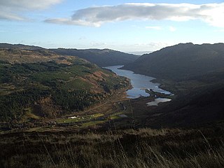
Loch Lubnaig is a small freshwater loch near Callander in the Stirling council area, Scottish Highlands. It lies in the former county of Perthshire. It is part of the Loch Lomond and The Trossachs National Park.

<span class="mw-page-title-main">Wiay, Inner Hebrides</span> Uninhabited island off the Isle of Skye

Wiay, pronounced "waya" is an uninhabited island in Loch Bracadale, off the coast of the Isle of Skye

<span class="mw-page-title-main">Loch Scaven</span> Freshwater loch in Wester Ross, Scotland

Loch Scaven is a small freshwater loch at the head of Glen Carron near the source of the River Carron, Wester Ross, Scotland. It is about 6.4 km (4.0 mi) southwest of Achnasheen and 3.2 km (2.0 mi) upstream from Loch Gowan.

<span class="mw-page-title-main">Loch Assynt</span> A lake in Sutherland, Scotland

Loch Assynt is a freshwater loch in Sutherland, Scotland, 8 kilometres (5.0 mi) north-east of Lochinver.

<span class="mw-page-title-main">Dùn Anlaimh</span>

Dùn Anlaimh, also known as Dùn Amhlaidh, and Eilean nan Cinneachan, is a crannog, located within Loch nan Cinneachan on the Inner Hebridean island of Coll. Upon the crannog there are the remains of walls and several buildings. These remains are not unlike those of other fortified islands found throughout the Outer Hebrides, and it is likely that Dùn Anlaimh dates from the late Middle Ages. According to local tradition on Coll, the fort was once the home of a Norse chieftain who was defeated in battle somewhere nearby. The early 20th century antiquary Erskine Beveridge considered it as one of the four most interesting fortifications, on Coll. The site of Dùn Anlaimh is located at grid reference NM18845684. The RCAHMS classifies the site as a 'crannog' and an 'island dwelling'.

<span class="mw-page-title-main">Loch Langavat</span>

Loch Langavat is the name of several freshwater lochs in the Outer Hebrides of Scotland. The name is a Gaelic rendition of Old Norse lang "long" and vatn, meaning "lake".

<span class="mw-page-title-main">Dùn Dubh</span>

Dùn Dubh is a hillfort, located on the Inner Hebridean island of Coll. The fort is one of three associated with a local tradition which states that they were once the fortresses of Norsemen before being defeated by a Maclean chieftain. The early 20th century antiquary Erskine Beveridge considered it as one of the four most interesting fortifications, on Coll. The site is located at grid reference NM18365942.

<span class="mw-page-title-main">Dùn Beic</span> Dun located on the Inner Hebridean island of Coll

Dùn Beic is a dun located on the Inner Hebridean island of Coll. It is located at grid reference NM15495644 and is thought to date to between 1000 BCE to 1000 CE. The etymology of the dun's name is uncertain; one possibility is that it could be made up of a personal name. The dun appears in local legend as being one of several fortresses held by Norsemen, who were defeated in battle against the ancestor of the Macleans of Coll. There have been several archaeological finds at Dùn Beic; these include pieces of flint, burnt bone, and fragments of incised pottery.

<span class="mw-page-title-main">Dun an Sticir</span>

Dun an Sticir is an Iron Age broch situated approximately 9.5 kilometers north of Lochmaddy in a loch on North Uist in the Scottish Outer Hebrides. A building was erected on the site in the late medieval period.

<span class="mw-page-title-main">Eela Water</span> Loch in Shetland, Scotland

Eela Water is a freshwater loch (lake) in Northmavine, part of the mainland of Shetland in Scotland. Besides being a freshwater fishing location, the site supplies clean water for the mainland of Shetland, and is one of the largest lochs on the mainland. The loch is 3.2 kilometres (2 mi) west of Ollaberry, and only 1.62 miles (2.61 km) to the sea (westwards).

References

Notes

  1. Iain Mac an Tàilleir. "Placenames P-Z" (PDF). Pàrlamaid na h-Alba. Archived from the original (PDF) on 29 May 2008. Retrieved 23 July 2007.
  2. 1 2 3 4 5 6 7 Murray and Pullar (1908) "Lochs of North Uist" Pages 188-89, Volume II, Part II. National Library of Scotland. Retrieved 18 February 2024.
  3. 1 2 Ordnance Survey (2009) "Get-a-map". Retrieved 28 December 2009.
  4. Beveridge, Erskine (1911) North Uist: its archaeology and topography, with notes upon the early history of the Outer Hebrides quoted by "North Uist, Loch Scadavay" Archived 2011-07-19 at the Wayback Machine scotlandsplaces.gov.uk. Retrieved 28 December 2009.