
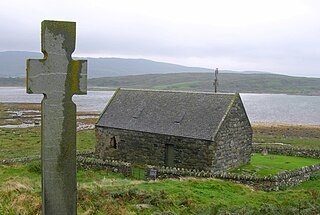
Angus is one of the 32 local government council areas of Scotland, a registration county and a lieutenancy area. The council area borders Aberdeenshire, Dundee City and Perth and Kinross. Main industries include agriculture and fishing. Global pharmaceuticals company GSK has a significant presence in Montrose in the north of the county.

Perthshire, officially the County of Perth, is a historic county and registration county in central Scotland. Geographically it extends from Strathmore in the east, to the Pass of Drumochter in the north, Rannoch Moor and Ben Lui in the west, and Aberfoyle in the south; it borders the counties of Inverness-shire and Aberdeenshire to the north, Angus to the east, Fife, Kinross-shire, Clackmannanshire, Stirlingshire and Dunbartonshire to the south and Argyllshire to the west. It was a local government county from 1890 to 1930.

Perth and Kinross is one of the 32 council areas of Scotland and a Lieutenancy Area. It borders onto the Aberdeenshire, Angus, Argyll and Bute, Clackmannanshire, Dundee, Fife, Highland and Stirling council areas. Perth is the administrative centre. With the exception of a large area of south-western Perthshire, the council area mostly corresponds to the historic counties of Perthshire and Kinross-shire.

Loch Lomond is a freshwater Scottish loch which crosses the Highland Boundary Fault, often considered the boundary between the lowlands of Central Scotland and the Highlands. Traditionally forming part of the boundary between the counties of Stirlingshire and Dunbartonshire, Loch Lomond is split between the council areas of Stirling, Argyll and Bute and West Dunbartonshire. Its southern shores are about 23 kilometres (14 mi) northwest of the centre of Glasgow, Scotland's largest city. The Loch forms part of the Loch Lomond and The Trossachs National Park which was established in 2002.

Sutherland is a historic county, registration county and lieutenancy area in the Highlands of Scotland. Its county town is Dornoch. Sutherland borders Caithness and Moray Firth to the east, Ross-shire and Cromartyshire to the south and the Atlantic to the north and west. Like its southern neighbour Ross-shire, Sutherland has some of the most dramatic scenery in the whole of Europe, especially on its western fringe where the mountains meet the sea. These include high sea cliffs, and very old mountains composed of Precambrian and Cambrian rocks.
Knapdale forms a rural district of Argyll and Bute in the Scottish Highlands, adjoining Kintyre to the south, and divided from the rest of Argyll to the north by the Crinan Canal. It includes two parishes, North Knapdale and South Knapdale. The area is bounded by sea to the east and west, whilst the sea loch of West Loch Tarbert almost completely cuts off the area from Kintyre to the south. The name is derived from two Gaelic elements: Cnap meaning hill and Dall meaning field.

Loch Fyne, is a sea loch off the Firth of Clyde and forms part of the coast of the Cowal peninsula. Located on the west coast of Argyll and Bute, Scotland. It extends 65 kilometres (40 mi) inland from the Sound of Bute, making it the longest of the sea lochs in Scotland. It is connected to the Sound of Jura by the Crinan Canal. Although there is no evidence that grapes have grown there, the title is probably honorific, indicating that the river, Abhainn Fìne, was a well-respected river.

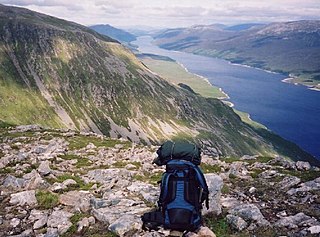
Loch Rannoch is a freshwater loch in Perth and Kinross, Scotland. It is over 15 kilometres (9.3 mi) long in a west–east direction with an average width of about 1.2 kilometres (0.75 mi), and is deepest at its eastern end, reaching a depth of 130 metres (440 ft). The River Tummel begins at its eastern end, where the small village of Kinloch Rannoch can be found, whilst the wild expanse of Rannoch Moor extends to the west of the loch. The area surrounding Loch Rannoch, along with Rannoch Moor itself, was formerly part of the native Caledonian Forest that stretched across much of Northern Scotland. Native forest is now largely absent from much of the area, due partly to logging, and partly to the climate becoming wetter, and Loch Rannoch is now largely surrounded by commercial forestry and open hillsides, although a small area remains at the Black Wood of Rannoch on the southern shore of the loch.

The Trossachs generally refers to an area of wooded glens, braes, and lochs lying to the east of Ben Lomond in the Stirling council area of Scotland. The name is taken from that of a small woodland glen that lies at the centre of the area, but is now generally applied to the wider region.

Loch Tay is a freshwater loch in the central highlands of Scotland, in the Perth and Kinross and Stirling council areas. It is the largest body of fresh water in Perth and Kinross, and the sixth largest loch in Scotland. The watershed of Loch Tay traditionally formed the historic province of Breadalbane.

Loch Shiel is a freshwater loch situated 20 kilometres (12 mi) west of Fort William in the Highland council area of Scotland. At 28 kilometres long it is the 4th longest loch in Scotland, and is the longest to have retained a natural outflow without any regulation of its water level, being 120 m (393 ft) deep. Its nature changes considerably along its length, being deep and enclosed by mountains in the north east and shallow surrounded by bog and rough pasture in the south west, from which end the 4 km River Shiel drains to the sea in Loch Moidart near Castle Tioram.
Loch Ericht is a freshwater loch on the border between the former Perthshire, now Perth and Kinross and the former Inverness-shire, now Highlands Council areas of Scotland. It has a north-east to south-west orientation. The village of Dalwhinnie lies at the north east end of the loch. Loch Ericht is the tenth largest freshwater lake in Scotland and has a good reputation for its trout fishing and Ferox trout.

The geography of Scotland is varied, from rural lowlands to unspoilt uplands, and from large cities to sparsely inhabited islands. Located in Northern Europe, Scotland comprises the northern third of the island of Great Britain as well as 790 surrounding islands encompassing the major archipelagos of the Shetland Islands, Orkney Islands and the Inner and Outer Hebrides.

Loch Tummel is a long, narrow loch, seven kilometres northwest of Pitlochry in the council area of Perth and Kinross, Scotland. It is fed and drained by the River Tummel, which flows into the River Tay about 13 km (8 mi) south-east of the Clunie Dam at the loch's eastern end.

Beinn a’ Ghlò is a Scottish mountain situated roughly 10 km (6 mi) north east of Blair Atholl in the Forest of Atholl in between Glen Tilt and Glen Loch, in Cairngorms National Park.

Glen Roy in the Lochaber area of the Highlands of Scotland is a glen noted for the geological phenomenon of three loch terraces known as the Parallel Roads of Glen Roy. The terraces formed along the shorelines of an ancient ice-dammed loch that existed during a brief period of climatic deterioration, during a much longer period of deglaciation, subsequent to the last main ice age. From a distance they resemble man-made roads running along the side of the glen, hence the name. Much of the glen is designated as a national nature reserve.

Loch Ness is a large freshwater loch in the Scottish Highlands extending for approximately 37 kilometres southwest of Inverness. It takes its name from the River Ness, which flows from the northern end. Loch Ness is best known for alleged sightings of the cryptozoological Loch Ness Monster, also known affectionately as "Nessie". It is one of a series of interconnected, murky bodies of water in Scotland; its water visibility is exceptionally low due to a high peat content in the surrounding soil. The southern end connects to Loch Oich by the River Oich and a section of the Caledonian Canal. The northern end connects to Loch Dochfour via the River Ness, which then ultimately leads to the North Sea via the Moray Firth.

Loch Loch is a remote freshwater loch, located in Glen Loch in Perth and Kinross, some 9.5 miles north of Pitlochry, Scotland and is within the Forest of Atholl.

Loch Moraig is a freshwater loch, located 2 miles northeast of Blair Atholl. Loch Moraig was an artificial loch, originally a Snipe marsh, that was dammed in the south, to create the current loch.

