
Finley Air Force Station is a closed United States Air Force General Surveillance Radar station. It is located 1.5 miles (2.4 km) west-northwest of Finley, North Dakota. It was closed in 1979 by the Air Force, and turned over to the Federal Aviation Administration (FAA).

Watertown Air Force Station is a closed United States Air Force ADCOM General Surveillance Radar station 3.5 miles (5.6 km) south of Watertown, New York. Prior to the Air Defense squadron inactivating on 1 November 1979, the station was reassigned to Tactical Air Command which maintained the Ground Air Transmitter Receiver until early 1984. A New York State jail opened at the site c. 1983.
Claysburg Air Force Station is a closed United States Air Force General Surveillance Radar station. It is located 6 miles (9.7 km) west of Claysburg, Pennsylvania. It was closed in 1961 due to budget constraints. The unit was eventually moved to Gibbsboro Air Force Station (RP-63), New Jersey.
Antigo Air Force Station is a closed United States Air Force General Surveillance Radar station. It is located 7.5 miles (12.1 km) south-southwest of Antigo, Wisconsin. It was closed in 1977 and is currently classified as a high risk toxic waste site involving groundwater, sediment, soil and surface water.

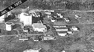
Ground Equipment Facility QRC is an FAA radar station that was part of a Cold War SAGE radar station for aircraft control and warning "from Massachusetts to southern Virginia, and as far out to sea as possible." Benton AFS was also the first operational "regional data processing center" for the GE 477L Nuclear Detection and Reporting System.
Bedford Air Force Station is a closed United States Air Force General Surveillance Radar station. It is located 12.7 miles (20.4 km) north of Bedford, Virginia. It was closed in 1975.
Palermo Air Force Station is a closed United States Air Force (USAF) General Surveillance Radar station. It was located in Palermo, New Jersey, 4.8 miles (7.7 km) north of Sea Isle City, in Cape May County, New Jersey, United States. It was closed in 1970.
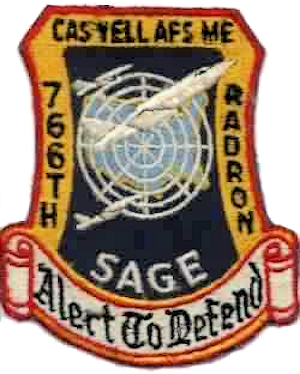
Caswell Air Force Station is a closed United States Air Force General Surveillance Radar station. It is located 4.3 miles (6.9 km) north of Limestone, Maine. It was closed in 1980.
Saratoga Springs Air Force Station is a closed United States Air Force General Surveillance Radar station. It is located 7.2 miles (11.6 km) southeast of Saratoga Springs, New York. It was closed by the Air Force in 1977.
Snow Mountain Air Force Station is a closed United States Air Force General Surveillance Radar station. It is located 1.9 miles (3.1 km) west-southwest of Godman Army Airfield, Kentucky. It was closed in 1968.

Custer Air Force Station is a closed United States Air Force General Surveillance Radar and Direction Center station. It is located 5.3 miles (8.5 km) west-northwest of Battle Creek, Michigan. It was closed in 1969.

Bellefontaine Air Force Station is a closed United States Air Force General Surveillance Radar station. It is located 2.3 miles (3.7 km) east-northeast of Bellefontaine, Ohio. It was closed in 1969.
Port Austin Air Force Station is a closed United States Air Force General Surveillance Radar station. It is located 1.2 miles (1.9 km) south-southwest Port Austin, Michigan. It was closed in 1988 by the Air Force.
Rockville Air Force Station is a closed United States Air Force General Surveillance Radar station. It is located 1.7 miles (2.7 km) west-northwest of Rockville, Indiana. It was closed in 1966.
Wadena Air Force Station is a closed United States Air Force General Surveillance Radar station. It is located 7 miles (11 km) north-northeast of Wadena, Minnesota. It was closed in 1970.
Chandler Air Force Station is a closed United States Air Force General Surveillance Radar station. It is 2.2 miles (3.5 km) south of Chandler, Minnesota, on the Buffalo Ridge in section 13 of Moulton Township, Murray County. It was closed in 1969.
North Bend Air Force Station is a closed United States Air Force General Surveillance Radar station. It is located 3.9 miles (6.3 km) north-northeast of Hauser, Oregon. It was closed in 1980.

Condon Air Force Station is a closed United States Air Force General Surveillance Radar station. It is located 5.7 miles (9.2 km) west of Condon, Oregon. It was closed in 1970.
Colville Air Force Station is a closed United States Air Force General Surveillance Radar station. It is located 14.7 miles (23.7 km) east-northeast of Colville, Washington. It was closed in 1961.
Othello Air Force Station is a closed United States Air Force General Surveillance Radar station. It is located 7.2 miles (11.6 km) south of Othello, Washington. It was the home station of the 637th Aircraft Control and Warning Squadron and the 637th Air Defense Group, closing in 1975.