
Robert Moses was an American urban planner and public official who worked in the New York metropolitan area during the early to mid-20th century. Moses is regarded as one of the most powerful and influential people in the history of New York City and New York State. The grand scale of his infrastructure projects and his philosophy of urban development influenced a generation of engineers, architects, and urban planners across the United States.

Belmont Lake State Park is a 463-acre (1.87 km2) day-use state park located in North Babylon, New York, United States on Long Island.

Jones Beach State Park is a state park in the U.S. state of New York. It is located in southern Nassau County on Jones Beach Island, a barrier island linked to Long Island by the Meadowbrook State Parkway, Wantagh State Parkway, and Ocean Parkway. The park was created during Robert Moses' administration as President of the Long Island State Park Commission as part of the development of parkways on Long Island.

Robert Moses State Park - Long Island is a 875-acre (3.54 km2) state park in southern Suffolk County, New York. The park lies on the western end of Fire Island, one of the central barrier islands off the southern coast of Long Island, and is known for its five-mile (8.0 km) stretch of beaches on the Atlantic Ocean. The park is accessible from Long Island by the Robert Moses Causeway across Great South Bay.
Heckscher State Park is a 1,657-acre (6.71 km2) state park on the shore of the Great South Bay at East Islip in Suffolk County, New York, USA.

The New York State Office of Parks, Recreation and Historic Preservation is a state agency within the New York State Executive Department charged with the operation of state parks and historic sites within the U.S. state of New York. As of 2014, the NYS OPRHP manages nearly 335,000 acres of public lands and facilities, including 180 state parks and 35 historic sites, that are visited by over 78 million visitors each year.
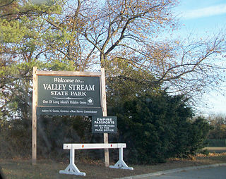
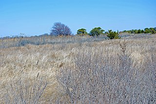
Valley Stream State Park is a 97-acre (39 ha) state park located in the Incorporated Village of Valley Stream, in Nassau County, on Long Island, in New York, United States. It is one of three state parks located within the Town of Hempstead.
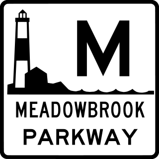
The Meadowbrook State Parkway is a 12.52-mile (20.15 km) controlled-access parkway in Nassau County, New York, in the United States. Its southern terminus is at a full cloverleaf interchange with the Bay and Ocean parkways in Jones Beach State Park. The parkway heads north, crossing South Oyster Bay and intersecting Loop Parkway before crossing onto the mainland and connecting to the Southern State Parkway in North Merrick. It continues north to the hamlet of Carle Place, where the Meadowbrook Parkway ends at exit 31A of the Northern State Parkway. The Meadowbrook Parkway is designated New York State Route 908E (NY 908E), an unsigned reference route. Most of the road is limited to non-commercial traffic, like most parkways in the state of New York; however, the portion south of Merrick Road is open to commercial traffic.

The Loop Parkway is a 2.65-mile (4.26 km) controlled-access parkway in Nassau County, New York, in the United States. It serves the barrier islands south of Long Island itself, beginning on Long Beach Barrier Island at an intersection with Lido Boulevard in Point Lookout. From here, it heads generally east–west across Alder and Meadow islands to an interchange with the Meadowbrook State Parkway on Jones Island, a part of Jones Beach State Park located just north of Jones Beach Island. The islands served by the Loop Parkway are separated by narrow channels of water, all of which connect to Jones Inlet. The parkway is maintained by the New York State Department of Transportation (NYSDOT) and inventoried by the department as New York State Route 908C (NY 908C), an unsigned reference route.
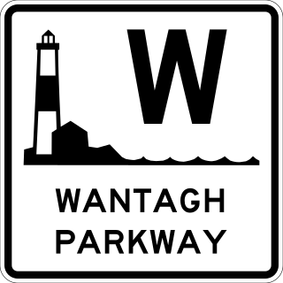
The Wantagh State Parkway is a 13.33-mile (21 km) controlled-access parkway on Long Island, New York, in the United States. It links the Ocean Parkway in Jones Beach State Park with the Northern State Parkway in Westbury. The parkway is located approximately 30 miles (48 km) east of Manhattan and 14 miles (23 km) east of the Nassau–Queens border.

The Southern State Parkway is a 25.53-mile (41.09 km) controlled-access parkway on Long Island, New York, in the United States. The parkway begins at an interchange with the Belt and Cross Island parkways in Elmont, in Nassau County, and travels east to an interchange with the Sagtikos State Parkway in West Islip, Suffolk County, where it becomes the Heckscher State Parkway. The Southern State Parkway comprises the western portion of unsigned New York State Route 908M (NY 908M), with the Heckscher Parkway occupying the eastern section.

Cold Spring Harbor State Park is a 47-acre (19 ha) state park located on New York State Route 25A in the Town of Huntington in Suffolk County, New York. The hilly park opened in 2000 and offers scenic views of Cold Spring Harbor on the north shore of Long Island.

The Northern State Parkway is a 28.88-mile (46.48 km) controlled-access parkway on Long Island in the U.S. state of New York. The western terminus is at the Queens–Nassau County line in Lake Success – west of which the parkway continues westward into New York City as the Grand Central Parkway. The eastern terminus is at New York State Route 347 (NY 347) and NY 454 in Hauppauge, in Suffolk County. As its name implies, the parkway services communities along the northern half of the island. The parkway is designated New York State Route 908G (NY 908G) – an unsigned reference route – and has been ceremoniously named Purple Heart Way since 2011.
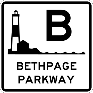
The Bethpage State Parkway is a 2.49-mile (4.01 km) controlled-access parkway in Nassau County on Long Island, New York, in the United States. It begins at a trumpet interchange with the Southern State Parkway in North Massapequa and serves Boundary Avenue, NY 24, and Central Avenue before terminating at a traffic circle with Plainview Road and a local park road in Bethpage State Park. The parkway is designated as New York State Route 907E (NY 907E), an unsigned reference route. It is also ceremoniously designated as the Philip B. Healey Memorial Parkway for Assemblyman Philip B. Healey (1921–1996).
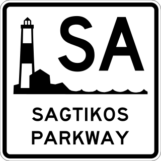
The Sagtikos State Parkway is a 5.14-mile (8.27 km) controlled-access parkway in Suffolk County on Long Island, New York, in the United States. It begins at an interchange with the Southern State and Heckscher Parkways in the hamlet of West Islip and goes north to a large cloverleaf interchange with the Northern State Parkway in the Town of Smithtown, where the Sagtikos ends and the road becomes the Sunken Meadow State Parkway. The parkway comprises the southern half of New York State Route 908K (NY 908K), an unsigned reference route, with the Sunken Meadow State Parkway forming the northern portion.

The Sunken Meadow State Parkway is a 6.19-mile (9.96 km) controlled-access parkway in Suffolk County, on Long Island, New York.

The majority of parkways in the US state of New York are part of a statewide parkway system owned by several public and private agencies but mostly maintained by the New York State Department of Transportation (NYSDOT). A handful of other roads in the Hudson Valley and on Long Island are also known as parkways but are not part of the state system. The roads of the state parkway system were among the first expressways to be constructed. These highways were not divided and allowed no driveway cuts, but did have intersections for some of the streets they crossed. A small section of the privately financed Long Island Motor Parkway was the first expressway to begin operation as a toll road and the first highway to use bridges and overpasses to eliminate intersections.

The Long Island State Parkway Police is a defunct New York State law enforcement agency that once patrolled state parks and parkways on Long Island, New York.
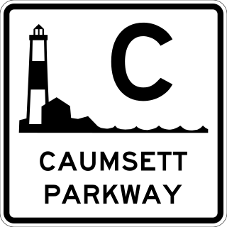
The Caumsett State Parkway was a proposed controlled-access parkway on the North Shore of Long Island, New York, between Plainview in Nassau County and the Caumsett State Historic Park in Lloyd Harbor, Suffolk County.

New York State Route 135 (NY 135) is a 10.8-mile (17.4 km) freeway in eastern Nassau County, New York, in the United States. The route connects Seaford with Syosset. The highway runs from Merrick Road in Seaford to NY 25 in Syosset. In between, NY 135 passes through Bethpage and Plainview and serves Bethpage State Park. The highway is ceremoniously designated as the Ralph J. Marino Expressway; however, it is more commonly known as the Seaford–Oyster Bay Expressway.
