
Dadford is a hamlet in the parish of Stowe, north Buckinghamshire, England.
Boycott is a hamlet in the parish of Stowe in north Buckinghamshire, England.
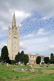
Hanslope is a village and civil parish in the unitary authority area of the City of Milton Keynes, Buckinghamshire, England. The village is about 4 miles (6.4 km) west northwest of Newport Pagnell, about 4 miles (6.4 km) north of Stony Stratford and 8 miles (13 km) north of Central Milton Keynes. The northern parish boundary is part of the county boundary with Northamptonshire.

Bletchley is a constituent town of Milton Keynes, Buckinghamshire, England. It is situated in the south-west of Milton Keynes, and is split between the civil parishes of Bletchley and Fenny Stratford and West Bletchley.

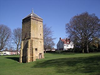
Filgrave is a hamlet in the unitary authority area of the City of Milton Keynes, Buckinghamshire, England. It is about three miles north of Newport Pagnell.

Upper Weald, Middle Weald and Lower Weald are three hamlets in the parish of Calverton in the Borough of Milton Keynes, England. They are located to the south east of the village centre, all three on the road to Whaddon.
Canons Ashby is a small village and civil parish in West Northamptonshire, England. The population of the village is included in the civil parish of Preston Capes.

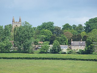
Little Everdon is a small hamlet in the civil parish of Everdon in the county of Northamptonshire, England. Lying on the Nene Way long-distance footpath, its parkland, large stone houses and manor house are typical of English countryside.

Mears Ashby is a village in the county of Northamptonshire, England. It lies between the county town of Northampton and Wellingborough and was in the West ward of borough council of Wellingborough area which also included Sywell prior to local government reform in 2021. At the time of the 2011 census, it had a population of 473.
White Hills is a residential district of the town of Northampton, England. It is at the northern limits of the town, north of Kingsthorpe and between the A508 and A5199 roads. The population is included in the Spring Park ward of Northampton.
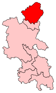
Milton Keynes North is a constituency represented in the House of Commons of the UK Parliament since the 2019 United Kingdom general election by Ben Everitt, a Conservative.

The Milton Keynes redway system is an over 200 mi (322 km) network of shared use paths for cyclists and pedestrians in Milton Keynes, Buckinghamshire, England. It is generally surfaced with red tarmac, and criss-crosses most of MK.
Abington is a district of the town of Northampton, Northamptonshire, England, situated about 2 miles (3.2 km) east of the town centre. The population of the ward of Northampton Borough Council at the 2011 census was 9,668.

This history of Milton Keynes details its development from the earliest human settlements, through the plans for a 'new city' for 250,000 people in northern Southeast England, its subsequent urban design and development, to the present day. Milton Keynes is the largest settlement and only city in Buckinghamshire, founded in 1967. At the 2011 census, the population of its urban area was estimated to have reached almost 230,000.

MK Metro was a bus company operating in Milton Keynes from 1997 until 2010.
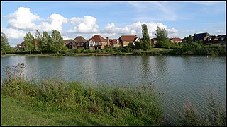
Furzton is a district in western Milton Keynes, in the civil parish of Shenley Brook End, Buckinghamshire, England. The man-made Furzton Lake is a balancing lake that covers approximately half of the district.
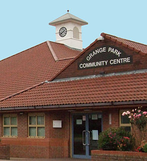
Grange Park is an affluent large village just outside Northampton in West Northamptonshire.
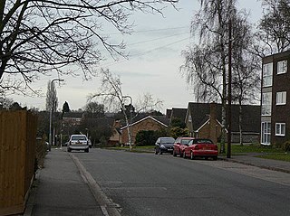
Abington Vale is an area of Northampton in Northamptonshire, England. Abington Vale lies just to the north of the A45 road and the River Nene; Abington Vale is about 2 miles (3.2 km) north-east from the centre of Northampton.
National Cycle Route 6 is a route of the National Cycle Network, running from London to the Lake District.
Milton Keynes Borough Council is the local authority for the Borough of Milton Keynes, a unitary authority in Buckinghamshire, England. Until 1 April 1997 it was a non-metropolitan district.
