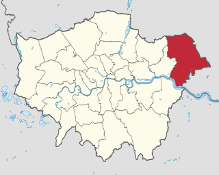
The London Borough of Havering in East London, England, forms part of Outer London. It has a population of 259,552 inhabitants; the principal town is Romford, while other communities are Hornchurch, Upminster, Collier Row and Rainham. The borough is mainly suburban, with large areas of protected open space. Romford is a major retail and night time entertainment centre, and to the south the borough extends into the London Riverside redevelopment area of the Thames Gateway. The name Havering is a reference to the Royal Liberty of Havering which occupied the area for several centuries. The local authority is Havering London Borough Council. It is the easternmost London borough.

The London Borough of Barking and Dagenham is a London borough in East London. It lies around 9 miles (14.4 km) east of Central London. It is an Outer London borough and the south is within the London Riverside section of the Thames Gateway; an area designated as a national priority for urban regeneration. At the 2011 census it had a population of 187,000, the majority of which are within the Becontree estate. The borough's three main towns are Barking, Chadwell Heath and Dagenham. The local authorities are the Barking and Dagenham London Borough Councils. Barking and Dagenham was one of six London boroughs to host the 2012 Summer Olympics.

Warrington Township is a township in Bucks County, Pennsylvania, United States. Warrington Township is a northern suburb of Philadelphia. The population was 23,418 at the 2010 census.

Great Sankey is a civil parish and suburb of Warrington, Cheshire, England. It is 2 miles (3.2 km) west of Warrington town centre and has a population of 24,211.

Winwick is a village and civil parish in Warrington, Cheshire, England. Located within the historic boundaries of Lancashire, it is situated about three miles north of Warrington town centre, nearby is junction 22 of the M6 and Junction 9 of the M62. Winwick also borders Newton-le-Willows and Burtonwood.
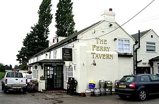
Penketh is a civil parish and suburb of Warrington, Cheshire, England. It is located about 3 miles (4.8 km) west of Warrington town centre. It has a population of 8,699. It is in the historic county of Cheshire.
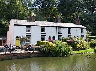
LymmLIM is a village and civil parish in the Borough of Warrington, Cheshire, England, which incorporates the hamlets of Booths Hill, Broomedge, Church Green, Deansgreen, Heatley, Heatley Heath, Little Heatley, Oughtrington, Reddish, Rushgreen and Statham. At the 2011 Census it had a population of 12,350.

Birchwood is an area in the north east of Warrington, Cheshire, England, UK with a population of 11,395. Although physically and administratively part of Warrington, it claims to be a separate town because the civil parish council has named itself a town council. Historically part of Lancashire, it was built during the time of much expansion in Warrington as it became a "new town". Birchwood is separated into three residential estates: Gorse Covert, Oakwood and Locking Stumps, with all the main facilities grouped around the centre.
Bewsey and Whitecross is a ward to the west of the town centre of Warrington, England. The town's General Hospital is within the ward. The area is served by the 16/16A bus route from Dallam to Warrington. Sankey Valley Park runs through Bewsey, there are community centres at Whitecross and Bewsey Park, and a community and health hub is to be built to serve the former council estates of Bewsey and Dallam. There are five primary schools, while the nearest high schools are Beamont Collegiate Academy in the Orford area, Great Sankey High School in Great Sankey, and St Gregory's RC High School.

Stockton Heath is a civil parish and suburb of Warrington, Cheshire, England. It is located to the north of the Bridgewater Canal and to the south of the Manchester Ship Canal, which divides Stockton Heath from Latchford and north Warrington. It has a total resident population of 6,396.

The City of Salford is a metropolitan borough with the status of a city in Greater Manchester, England. The borough is named after its main settlement, Salford. The borough covers the towns of Eccles, Swinton, Walkden and Pendlebury. As well as the villages and suburbs of Monton, Little Hulton, Boothstown, Ellenbrook, Clifton, Cadishead, Pendleton, Winton and Worsley. The city has a population of 245,600, and is administered from the Salford Civic Centre in Swinton. Salford is the historic centre of the Salford Hundred which was never formally ceased as a division of Lancashire.

Stretford is a market town in Trafford, Greater Manchester, England, on flat ground between the River Mersey and the Manchester Ship Canal, 3.8 miles (6.1 km) south of Manchester city centre, 3.0 miles (4.8 km) south of Salford and 4.2 miles (6.8 km) northeast of Altrincham. Stretford borders Chorlton-cum-Hardy to the east, Moss Side and Whalley Range to the southeast, Hulme to the northeast, Urmston to the west, Salford to the north, and Sale to the south. The Bridgewater Canal bisects the town.

Orford is a suburb of Warrington, Cheshire, England.

Burtonwood is a village in the civil parish of Burtonwood and Westbrook, in the outermost suburbs of Warrington, Cheshire, England. Within the boundaries of the historic county of Lancashire, the name Burtonwood is known worldwide as the location of the former RAF Station Burtonwood military camp. Burtonwood village itself is a few miles away from the site of the former station. The civil parish also includes Westbrook, which is a council ward and suburb of Warrington. According to the 2001 census, the population of the entire civil parish was 11,265.
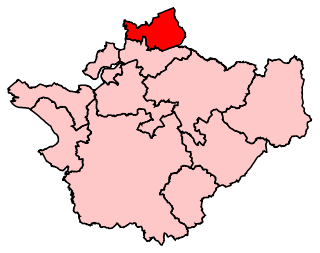
Warrington North is a parliamentary constituency represented in the House of Commons of the Parliament of the United Kingdom since 2019 by Charlotte Nichols of the Labour Party. It elects one Member of Parliament (MP) by the first past the post system of election.
Culcheth is a village in the Borough of Warrington, ceremonial county of Cheshire and historic county of Lancashire, England, six miles (10 km) north-east of Warrington town centre; it is the principal settlement in Culcheth and Glazebury civil parish.
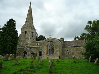
Winwick is a village and civil parish in Cambridgeshire, England. Winwick lies approximately 10 miles (16 km) north-west of Huntingdon. It is a crossroads village on the B660 near Hamerton. Winwick is situated within Huntingdonshire which is a non-metropolitan district of Cambridgeshire as well as being a historic county of England.
Westbrook is a ward and suburb in north west Warrington, Cheshire, England. Within the boundaries of the historic county of Lancashire, it forms part of the civil parish of Burtonwood and Westbrook, to part of which it gives its name. The main part of Westbrook was built in the early 1980s. There are new estates being developed, the newest (Chapelford) was started in 2001.
Palfrey is a neighbourhood in the Metropolitan Borough of Walsall, in the West Midlands. It covers 3.68 sq km, which accounts for 3.5% of the area of the Walsall borough.
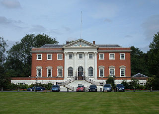
Warrington is a large town, borough and unitary authority in Cheshire, England, on the banks of the River Mersey. It is 20 miles (32 km) east of Liverpool, and 16 miles (26 km) west of Manchester. The population in 2019 was estimated at 165,456 for the town's urban area, and just over 210,014 for the entire borough, the latter being more than double that of 1968 when it became a new town. Warrington is the largest town in the ceremonial county of Cheshire.


