Loveden

Last updated

Loveden
Geograph-391716-Loveden-Hill-by-Ken-Brockway.jpg
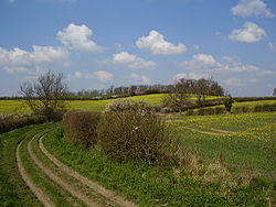
Loveden Hill, alleged meeting place of the wapentake
Lincolnshire UK location map.svg
Red pog.svg
Loveden
Location in Lincolnshire, north of Grantham and west of Sleaford
Coordinates: 53°02′N0°39′W / 53.03°N 0.65°W / 53.03; -0.65 Coordinates: 53°02′N0°39′W / 53.03°N 0.65°W / 53.03; -0.65
OS grid reference SK9048
Country England
County Lincolnshire
Diocese Diocese of Lincoln
Website www.loveden.org.uk OOjs UI icon edit-ltr-progressive.svg

Loveden is a deanery of the Diocese of Lincoln, England, [1] and a former wapentake. [2]

Loveden is located broadly to the North of Grantham and includes the villages from Long Bennington in the west to Culverthorpe in the east, and from Welby in the south as far north as Welbourn. Brandon is roughly in the centre.

Loveden Hill is locally supposed [3] to be the meeting place for the early Wapentake summons, and is the site of both Roman and extensive Anglo-Saxon archaeology. [4]

The name is used for an STD telephone exchange, code 01400.

Related Research Articles

<span class="mw-page-title-main">Ancaster, Lincolnshire</span> Village in the South Kesteven district of Lincolnshire, England

Ancaster is a village and civil parish in the South Kesteven district of Lincolnshire, England, on the site of a Roman town. The population of the civil parish was 1,317 at the 2001 census increasing to 1,647 at the 2011 census. The civil parish includes the settlements of Sudbrook and West Willoughby.

Framland was a hundred in north-east Leicestershire, England, roughly corresponding to today's borough of Melton. It was recorded in the Domesday Book as one of Leicestershire's four wapentakes.

<span class="mw-page-title-main">Diocese of Lincoln</span> Diocese of the Church of England

The Diocese of Lincoln forms part of the Province of Canterbury in England. The present diocese covers the ceremonial county of Lincolnshire.

<span class="mw-page-title-main">Belton, South Kesteven</span> Human settlement in England

Belton is a village in the civil parish of Belton and Manthorpe, in the South Kesteven district of Lincolnshire, England. It is situated on the A607 road, and 3 miles (5 km) north from the market town of Grantham.

<span class="mw-page-title-main">Aveland</span> Ancient subdivision of Lincolnshire, England

Aveland was a Wapentake of Kesteven from the time of the Danelaw until the Local Government Act 1888. Its meeting place was The Aveland at grid reference TF 0675 2961 in the parish of Aslackby.

<span class="mw-page-title-main">Billingborough</span> Village and civil parish in the South Kesteven district of Lincolnshire, England

Billingborough is a village and civil parish in the South Kesteven district of Lincolnshire, England. It is situated approximately 10 miles (16 km) north of Bourne and 10 miles south of Sleaford, and on the B1177 between Horbling and Pointon just south of the A52.

<span class="mw-page-title-main">Braceby</span> Small English village in the South Kesteven district of Lincolnshire

Braceby is a small English village in the South Kesteven district of Lincolnshire. Its population is included in the civil parish of Pickworth. The village includes a roadside nature reserve sheltering 250 species of plant life.

Elloe is a sub-regional name in South Holland, Lincolnshire, England. It may refer to:

<span class="mw-page-title-main">Welbourn</span> Village and civil parish in the North Kesteven district of Lincolnshire, England

Welbourn is a village and civil parish in the North Kesteven district of Lincolnshire, England. The population of the civil parish at the 2011 census was 647. The village is situated on the A607 road, 11 miles (18 km) south from Lincoln and 8 miles (13 km) north-west from Sleaford, and between the villages of Leadenham and Wellingore. To the east lies the course of Ermine Street, now the Viking Way.

<span class="mw-page-title-main">Leadenham</span> Village and civil parish in North Kesteven district of Lincolnshire, England

Leadenham is a village and civil parish in North Kesteven district of Lincolnshire, England. The population of the civil parish at the 2011 census was 410. It lies 11 miles (18 km) north from Grantham, 14 miles (23 km) south of Lincoln and 9 miles (14 km) north west of Sleaford on the A607 between Welbourn and Fulbeck, and at the southern edge of the Lincoln Cliff.

<span class="mw-page-title-main">Edenham</span> Village and civil parish in the South Kesteven district of Lincolnshire, England

Edenham is a village and civil parish in the South Kesteven district of Lincolnshire, England. It is approximately 3 miles (5 km) north-west of Bourne, and on the A151 road. While the civil parish is called 'Edenham', the parish council is called Edenham, Grimsthorpe, Elsthorpe & Scottlethorpe Parish Council. The population of the civil parish at the 2011 census was 291.

<span class="mw-page-title-main">Honington, Lincolnshire</span> Village in Lincolnshire

Honington is an English village and civil parish in the South Kesteven district of Lincolnshire. It lies just north of the junction between the A153 and A607 roads, about 5.5 miles (8.9 km) north of Grantham and 8 miles (12.9 km) west of Sleaford.

<span class="mw-page-title-main">Wyville</span> Village and civil parish in the South Kesteven district of Lincolnshire, England

Wyville is a village in the civil parish of Wyville cum Hungerton, in the South Kesteven district of Lincolnshire, England, and situated approximately 5 miles (8 km) south-west from Grantham The whole parish covers about 1,670 acres (6.8 km2). The population is included in the civil parish of Little Ponton and Stroxton.

<span class="mw-page-title-main">Hougham, Lincolnshire</span> Village and civil parish in the South Kesteven district of Lincolnshire, England

Hougham is a village and civil parish in the South Kesteven district of Lincolnshire, England, 6 miles (10 km) north from Grantham. The village of Marston, Lincolnshire is its closest neighbour, just under 1 mile (1.6 km) to the south.

<span class="mw-page-title-main">Brandon, Lincolnshire</span> Small village in South Kesteven, south Lincolnshire, England

Brandon is a small village in South Kesteven, south Lincolnshire, England, part of the civil parish of Hough-on-the-Hill.

<span class="mw-page-title-main">Skinnand</span> Deserted medieval village in Lincolnshire, England

Skinnand is a deserted medieval village in Lincolnshire, England. It was a small farming community situated 9 miles (14 km) south of Lincoln and 11.5 miles (19 km) northwest of Sleaford, composed of a church and several houses. During the English Civil War of 1642-1646 the church fell into ruins. Today only fields and one deserted farmhouse remain.

<span class="mw-page-title-main">Beltisloe</span> Diocese in Lincolnshire, England

Beltisloe is a Deanery of the Diocese of Lincoln in England, and a former Wapentake.

<span class="mw-page-title-main">Ewecross</span>

The historical area of Ewecross or Ewcross is a district in the West Riding of Yorkshire, England. It included the parishes of Bentham, Clapham, Horton in Ribblesdale and Sedbergh and parts of Thornton in Lonsdale. Ewcross was split from the Staincliffe and Ewcross wapentake in the nineteenth century.

<span class="mw-page-title-main">Gelston, Lincolnshire</span> Village in the South Kesteven district of Lincolnshire, England

Gelston is a village in the South Kesteven district of Lincolnshire, England. It is 2 miles (3 km) west from the A607 road, 5 miles (8 km) north from Grantham, and in the civil parish of Hough-on-the-Hill, a village 1 mile (1.6 km) to the north-east.

<span class="mw-page-title-main">St Bartholomew's Church, Welby</span> Church in United Kingdom

St Bartholomew's Church is a Grade I listed Anglican church dedicated to St Bartholomew the Apostle, in the English village of Welby, Lincolnshire. It is 4 miles (6 km) north-east of Grantham, and 1 mile (1.6 km) east of High Dyke, on part of the old Ermine Street Roman road. The church is in the ecclesiastical parish and Group of Ancaster and Wilsford, in the Deanery of Loveden, and the Diocese of Lincoln.

References

  1. "Deanery details on Diocese web site". Archived from the original on 1 August 2009. Retrieved 3 July 2010.
  2. "Notes about the wapentake from 'Introduction: Lost vills and other forgotten places', Final Concords of the County of Lincoln: 1244-1272 (1920), ed:C.W. Foster, pp. L-LXV".
  3. "old.loveden.org.uk, mentioning use of Loveden Hill".
  4. "National Monument record for urn burials etc. on Loveden Hill".