
The River Hamble in south Hampshire, England, rises near Bishop's Waltham and flows for 10.1 km (6.3 mi) through Botley, Bursledon, and Lower Swanwick before entering Southampton Water between Hamble Common and Warsash.
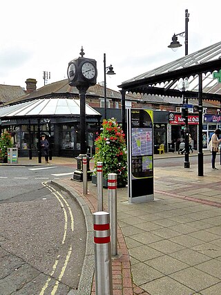
The Borough of Eastleigh is a local government district with borough status in Hampshire, England. It is named after its main town of Eastleigh, where the council is based. The borough also contains the town of Hedge End along with several villages, many of which form part of the South Hampshire urban area.
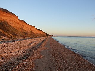
Hill Head is a residential area and village on the coast of the Solent. It is located south of Stubbington, west of Lee-on-the-Solent and south east of Titchfield, in the borough of Fareham, Hampshire. Hill Head is in the Gosport parliamentary constituency. The MP is Caroline Dinenage of the Conservative Party since 2010. Hill Head has a sandy beach with sailing, windsurfing, kitesurfing and fishing being the most popular pastimes upon its shores. There is also a small harbour, located where the River Meon enters the Solent. It is next to Titchfield Haven National Nature Reserve.
Whiteley is a planned community of 6,500 homes in the county of Hampshire, England, United Kingdom near Fareham. The development straddles the boundary between two council districts: the Borough of Fareham to the south and east, and the city of Winchester to the north and west.
Swanwick is a village in Hampshire, England, east of the River Hamble and north of the M27 motorway. The village is located within the borough of Fareham and is the site of the London Area Control Centre (LACC) and the London Terminal Control Centre (LTCC), part of National Air Traffic Services Air Traffic Control Centre, and Bursledon Brickworks, the last remaining example of a Victorian steam-powered brickworks.

Titchfield is a village and former civil parish in the Fareham district, in southern Hampshire, England, by the River Meon. The village has a history stretching back to the 6th century. During the medieval period, the village operated a small port and market. Near to the village are the ruins of Titchfield Abbey, a place with strong associations with Shakespeare, through his patron, the Earl of Southampton.
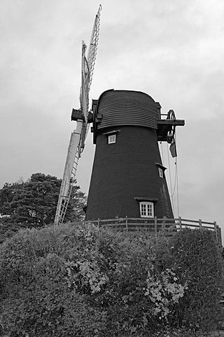
Bursledon is a village on the River Hamble in Hampshire, England. It is located within the borough of Eastleigh. Close to the city of Southampton, Bursledon has a railway station, a marina, dockyards and the Bursledon Windmill. Nearby villages include Swanwick, Hamble-le-Rice, Netley and Sarisbury Green.

Warsash is a village in southern Hampshire, England, situated at the mouth of the River Hamble, west of the area known as Locks Heath and south of Sarisbury. Boating plays an important part in the village's economy, and the village has a sailing club. It is also home to the Warsash Maritime Academy, part of Southampton Solent University, which provides training for Merchant Navy Officers from around the world.

Sholing, previously Scholing, is a district on the eastern side of the city of Southampton in Southern England. It is located between the districts of Bitterne, Thornhill and Woolston.

Locks Heath is a residential suburb of Fareham, in the south of Hampshire, England. Locks Heath is immediately surrounded by a collection of villages including Sarisbury to the west, Swanwick, Park Gate and Whiteley to the north, Warsash to the southwest and Titchfield to the southeast. Within the heart of the area its shopping village is located with a community centre. The population of the village itself in 2011 was 7,104 whilst the wider Locks Heath residential area equaled 43,359 as of 2011.
The Southampton–Fareham line is a railway line in England, along the south coast of Hampshire. As a through line it came late in British Railway history, traversing unpromising coastal terrain. The first part from Portswood, near Southampton, to Netley was opened in 1866, prompted by the establishment of the Royal Victoria Hospital at Netley, which had been established for the care of wounded soldiers.
Sarisbury is a village to the west of Park Gate within the borough of Fareham, Hampshire, in the south of England. Its focal point is Sarisbury Green and the parish church of St Paul, formerly part of Titchfield parish. In previous times it was a rural locality dependent on fruit growing. At the 2011 Census the population of the ward was 7,385. Nearby villages include Bursledon, Hamble-le-Rice and Swanwick. The name is pronounced 'Sarsbury' with the 'i' being silent.

River Hamble Country Park is a 144.1-hectare (356-acre) country park which runs along the west bank of the River Hamble between the villages of Botley and Bursledon in Hampshire. It is owned by Hampshire County Council and managed by Hampshire Countryside Service.

Meadrow Unitarian Chapel is a Unitarian chapel in the Farncombe area of Godalming, Surrey, England. It is part of the London District and South Eastern Provincial Assembly of Unitarian and Free Christian Churches, one of 16 districts within the General Assembly of Unitarian and Free Christian Churches, the umbrella organisation for British Unitarians.

The Brickworks Museum, also known as Bursledon Brickworks, is a volunteer-run museum in Swanwick, Hampshire, England. It is purportedly the UK's sole surviving Victorian steam-driven brickworks.

Swanwick Shore Strict Baptist Chapel is a Strict Baptist place of worship in Lower Swanwick, a village in the Borough of Fareham in Hampshire, England. It has been in continuous use for worship since 1844, when it succeeded a converted boat-shed which had become unsuitable. Worshippers had gathered there since 1835, led by a pastor who had previously attended a different chapel nearby and who continued to lead the congregation until his death in 1892. Historic England has listed the simple brick building at Grade II for its architectural and historical importance.
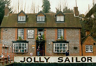
The Jolly Sailor is an 18th-century public house on Land's End Road in Bursledon in Hampshire, England. It has been listed Grade II on the National Heritage List for England since December 1955. The pub can be approached on foot or by boat via a pontoon onto the River Hamble. The pub faces Swanwick Marina across the water. It is owned by Hall and Woodhouse brewery.

Hamble Valley is a parliamentary constituency of the House of Commons in the UK Parliament. Further to the completion of the 2023 Periodic Review of Westminster constituencies, it was first contested in the 2024 general election.

