
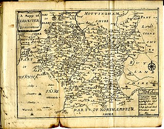
Lubbesthorpe is a hamlet and parish in the district of Blaby [1] within Enderby on the outskirts of Leicester, England, on the west side of the M1 motorway and the River Soar. [2]
Lubbesthorpe is a hamlet and parish in the district of Blaby [1] within Enderby on the outskirts of Leicester, England, on the west side of the M1 motorway and the River Soar. [2]
The name is said to mean "Lubba's Thorpe", i.e. a small settlement belonging to Lubba, an Old Danish name. [3] It has been spelled as Lubbesthorpe. [2]
It was listed in the Domesday Book as a group of nine households. [4] In 1302 there was a chantry chapel, founded by Roger la Zouch, and in about 1534 a manor house (described as "a very faire and gallant house") built by the Earl of Huntingdon. [5] By 1810 these were both ruins and the stone was being removed for road mending. [5] It was established as a full civil parish in 1866, with various additions and removals changing its area afterward. [2] In 1872 the hamlet, belonging to the Duke of Rutland, had a population of 64; [6] this rose to 118 in 1921. [2]
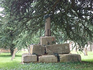
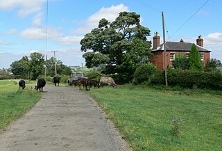
The current houses are a little away from the medieval settlement, the remains of which are now a Scheduled Ancient Monument. [7] (A rabbit warren here is also a Scheduled Ancient Monument.) [8]
As at 2014 new housing estate of 4,250 homes is planned, informally known as New Lubbesthorpe. [9] [10]

Blaby is a local government district in Leicestershire, England. The district is named after the village of Blaby, although the council is based in Narborough. The district covers an area lying south-west of the city of Leicester. Several of the district's settlements form part of the wider Leicester Urban Area, including Glenfield, where Leicestershire County Council has its headquarters at County Hall, and the town of Braunstone.

Wigston, or Wigston Magna, is a town in the Oadby and Wigston district of Leicestershire, England, just south of Leicester on the A5199. It had a population of 32,321 in 2011.

Blaby is a town in the Blaby District in central Leicestershire, England, some five miles south of Leicester city centre. At the time of the 2011 census, Blaby had a population of 6,194, falling slightly from 6,240 in 2001. Given Blaby's proximity to the city, it is part of the Leicester Urban Area.

Aylestone is a suburb of Leicester, England, southwest of the city centre and east of the River Soar.
This article is intended to give an overview of the history of Leicestershire.

South Wigston is a large village to the south of Leicester, England. It is outside the city boundary, forming part of the Oadby and Wigston district of Leicestershire. The population at the 2011 census was 7,490.

Knaptoft is a deserted medieval village and civil parish in the Harborough district of Leicestershire and lies approximately 9.7 miles (15.6 km) south of the city of Leicester, England. According to the University of Nottingham English Place-names project, the settlement name Knaptoft could mean "cnafa" for 'a boy, a young man, a servant, a menial, or a personal name' and 'toft', the plot of ground in which a dwelling stands. The population of the civil parish at the 2011 census was 47.
Braunstone is a town and civil parish in the district of Blaby in Leicestershire, England. At the 2011 census the population of the town was 16,850.

Sharnford is a village and civil parish in the Blaby district of Leicestershire, England. The parish has a population of about 1,000, measured at the 2011 census as 985. The village is about four miles east of Hinckley, and is near to Aston Flamville, Wigston Parva and Sapcote.

South Leicestershire is a constituency represented in the House of Commons of the UK Parliament since 2015 by Alberto Costa, a member of the Conservative Party.

Stockerston is a village and civil parish in the Harborough district of Leicestershire, England, located on the border with Rutland, by the Eye Brook. According to the 2001 census the parish had a population of 35. The population remained less than 100 at the 2011 census and is included in the civil parish of Horninghold.
Frisby is a hamlet and civil parish in the Harborough district of Leicestershire that lies approximately 7.3 miles (11.7 km) southeast of the city of Leicester, that is now largely a deserted medieval village. According to the University of Nottingham English Place-names project, the settlement name Frisby could mean 'farm/settlement of the Frisians'. The 2011 census for Frisby returned 5 houses and 16 residents. Often termed as Frisby by Gaulby, the modern hamlet is situated between the village of Gaulby 1 mile (1.6 km) to the southwest and Billesdon 1.94 miles (3.12 km) to the northeast. The deserted part of the ancient hamlet is a Scheduled Ancient Monument and can be located on the eastern side of the lane that leads down the hill from Gaulby Road, via Frisby House on a south-eastwards direction. The earthwork "tofts & crofts" are still visible today, with foundations for two stone built buildings noted towards the center of the site.

Air Chief Marshal Sir Clive Robert Loader, is a British politician and retired senior Royal Air Force officer. He was the Leicestershire Police and Crime Commissioner from 2012 until 2016. He served in the RAF from 1972 to 2009 and was the first Commander-in-Chief Air Command.
Edenham is a village and civil parish in the South Kesteven district of Lincolnshire, England. It is approximately 3 miles (5 km) north-west of Bourne, and on the A151 road. While the civil parish is called 'Edenham', the parish council is called Edenham, Grimsthorpe, Elsthorpe & Scottlethorpe Parish Council. The population of the civil parish at the 2011 census was 291.

Greasley is a civil parish north west of Nottingham in Nottinghamshire, England. Although it is thought there was once a village called Greasley, there is no settlement of that name today as it was destroyed by the Earl of Rutland. The built up areas in the parish are Beauvale, Giltbrook, Moorgreen, Newthorpe, Watnall and parts of Eastwood, Kimberley and Nuthall. There is also a small hamlet known as Bog-End. The parish is one of the largest in Nottinghamshire at 7.63 square miles (19.8 km2), the 2001 UK Census reporting it had a total population of 10,467, increasing to 11,014 in 2011, and 11,241 at the 2021 census.
Cold Newton is a small hamlet and civil parish in the Harborough district of Leicestershire, England. It is situated about two miles from Tilton on the Hill and two miles north of Billesdon. Some 700 feet (210 m) above sea level, it overlooks the Wreake valley. Any population remaining is listed in the civil parish of Lowesby.

Donington le Heath is a village on the River Sence just over 1 mile (1.6 km) south of the centre of Coalville in North West Leicestershire. Donington is contiguous with the village of Hugglescote immediately to the east. The population of the village is included in the civil parish of Hugglescote and Donington le Heath.
The identification of Deserted Villages and Lost Places in Leicestershire owes much to the pioneering work of William George Hoskins during his time at the University of Leicester.

Foston is a deserted medieval village and former civil parish, now in the parish of Kilby, in the Blaby district of Leicestershire and lies approximately 6.1 miles (9.8 km) south of the city of Leicester, England. The settlement name Foston means "Fotr's farm/settlement": "Fotr" is an Old Norse personal name, and "tūn" in Old English means an enclosure, farmstead, village or estate. In 1931 the parish of Foston had a population of 36. On 1 April 1935 the parish was abolished and merged with Kilby.