Gernrode is a municipality in the district of Eichsfeld in Thuringia, Germany. Its agricultural land is some of the most productive in the district and it therefore does not have any wooded areas.

Hildburghausen is a town in Thuringia in central Germany, capital of the Hildburghausen district.
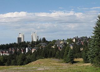
Oberhof is a town in the Schmalkalden-Meiningen district of Thuringia, Germany. Located in the Thuringian Forest mountain range, it is a winter sports center and health resort. With 1,625 inhabitants, it is visited by 144,000 tourists every year (2016). The town obtained its official city status in 1985.
Meuselwitz is a town in the Altenburger Land district, in Thuringia, Germany. It is situated 12 km northwest of Altenburg and 11 km east of Zeitz.

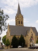
Bürgel is a town in the Saale-Holzland district, in Thuringia, Germany. It is situated 12 km east of Jena. It contains the Benedictine monastery of Bürgel Abbey.

Kaltennordheim is a town in the Schmalkalden-Meiningen district, in Thuringia, Germany. It is situated in the Rhön Mountains, 22 km southwest of Bad Salzungen, and 35 km east of Fulda. The former municipalities Aschenhausen, Kaltensundheim, Kaltenwestheim, Melpers, Oberkatz und Unterweid were merged into Kaltennordheim in January 2019. At the same time, Kaltennordheim passed from the Wartburgkreis to Schmalkalden-Meiningen.
Kranichfeld is a town in the Weimarer Land district, in Thuringia. It is situated on the river Ilm, 18 km southeast of Erfurt, and 16 km southwest of Weimar.

Leutenberg is a town in the district of Saalfeld-Rudolstadt, in Thuringia, Germany. It is situated in the Thuringian Forest, 18 km (11 mi) southeast of Saalfeld.
Münchenbernsdorf is a town in the district of Greiz, in Thuringia, Germany. It is situated approximately 16 km southwest of Gera. The town is seat of a municipal association with eight members.
Neumark is a town in the Weimarer Land district, in Thuringia, Germany. It is situated 20 km northeast of Erfurt, and 12 km northwest of Weimar. Neumark is the second-least populous town (Stadt) in Germany, and is the least populous in what was formerly East Germany.

Rastenberg is a town in the district of Sömmerda, in Thuringia, Germany. It is situated 22 km east of Sömmerda, and 23 km northeast of Weimar.

Ronneburg is a town in the district of Greiz, in Thuringia, Germany. It is situated 7 km east of Gera.
Schkölen is a town in the Saale-Holzland district, in Thuringia, Germany. It is situated 12 km south of Naumburg. The village Zschorgula is part of the municipality.
Wurzbach is a town in the Saale-Orla-Kreis district, in southern Thuringia, Germany. It is situated 33 kilometres (21 mi) southeast of Saalfeld, and 45 kilometres (28 mi) northwest of Hof.

Steinbach-Hallenberg is a town in the Schmalkalden-Meiningen district, in Thuringia, Germany. It is situated in the Thuringian Forest, 8 km east of Schmalkalden, and 13 km northwest of Suhl. The former municipalities Altersbach, Bermbach, Oberschönau, Unterschönau, Rotterode and Viernau were merged into Steinbach-Hallenberg in January 2019.

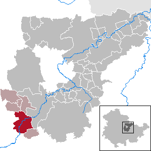
Treffurt is a small town in the western region of the Wartburgkreis district which belongs to the federal state of Thuringia. The former municipality Ifta was merged into Treffurt in January 2019. The town lies near the Werra and is surrounded by the Werratal valley and rivers. Treffurt is located next to the Hessian border and was a former part of the Sperrzone. Today, Treffurt is a tourist destination, especially due to its scenic town centre with many restored half-timbered houses and its landmark - the Normannstein castle.

Triptis is a town in the Saale-Orla-Kreis district, in Thuringia, Germany. It is situated 22 km southwest of Gera. The town is the seat of the municipal association Triptis.
Weida is a town in the district of Greiz, in Thuringia, Germany, situated 12 km south of Gera on the river Weida.

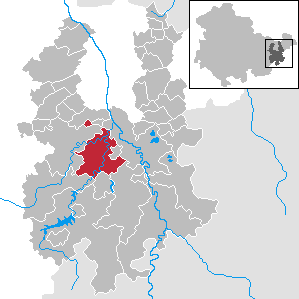
Dornburg-Camburg is a town in the Saale-Holzland district, in Thuringia, Germany. It was created on 1 December 2008, when the towns Dornburg and Camburg and the municipality Dorndorf-Steudnitz were merged.
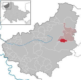
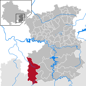
Altenburger Land I is an electoral constituency represented in the Landtag of Thuringia. It elects one member via first-past-the-post voting. Under the current constituency numbering system, it is designated as constituency 43. It covers the western part of Altenburger Land.