Lympsham

Last updated

Lympsham
Former chapel at Lympsham, Somerset.jpg
Former Methodist Chapel - now converted to a private dwelling
Cricket Pavilion - geograph.org.uk - 84650.jpg
Cricket Pavilion
Somerset UK location map.svg
Red pog.svg
Lympsham
Location within Somerset
Population960  [1]
OS grid reference ST335545
Unitary authority
Ceremonial county
Region
Country England
Sovereign state United Kingdom
Post town WESTON-SUPER-MARE
Postcode district BS24
Dialling code 01934
Police Avon and Somerset
Fire Devon and Somerset
Ambulance South Western
UK Parliament
List of places
UK
England
Somerset
51°17′10″N2°57′18″W / 51.286°N 2.955°W / 51.286; -2.955 Coordinates: 51°17′10″N2°57′18″W / 51.286°N 2.955°W / 51.286; -2.955

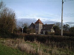
Lympsham is a village and civil parish six miles west of Axbridge and six miles south-east of Weston-super-Mare, close to the River Axe in Somerset, England. The parish includes the hamlet of Wick where Wick Farmhouse dates from the mid 18th century. [2]

Contents

History

It has been suggested that the name means 'a suitable home' from the Old English ge-limplic and ham. [3] More probable is a combination of a personal name beginning "Lin-" or something like "lind-pyll" (pool where lime trees grow) with "ham" (in Old English this usually means either "village" or "estate"). The first appearance of the name in records is in 1086 Domesday Survey: It is certain that King William laid a heavy hand on the estates of the monastery—'quamplures ex suis commilitionibus ex Glastoniæ feudavit possessionibus.' (fn. 34) Malmesbury does not tell us of the losses but only the fact that afterwards the Conqueror relented somewhat towards this old English monastery, and gave back the estates of Podimore, Milton, Fullbrook, Berrow, Burrington, Lympelesham, Blackford and Wootton. At the time of the Conquest the monks suffered the loss of some of their estates, but these were afterwards recovered and even William the Conqueror made reparation for what he had robbed them of. The possessions of the abbey amounted to the huge extent of 818 hides. The 'twelve hides' consisting of the site, precincts and immediate demesne of the abbey was regarded as an ungeldable and unhidated liberty of which the islands of Meare, Panborough, and Edgarley formed part. As far as these estates lay in Somerset the details of the endowment will be found in the account of the Survey A History of the County of Somerset: Volume 2 Edited by William Page.

It is likely that efforts were made to improve the drainage of the soil in the area during the Saxon period. In 1129, the Abbot of Glastonbury Abbey recorded that corn was growing here on land which had previously been classified as worthless. [4]

Governance

The parish council has responsibility for local issues, including setting an annual precept (local rate) to cover the council’s operating costs and producing annual accounts for public scrutiny. The parish council evaluates local planning applications and works with the local police, district council officers, and neighbourhood watch groups on matters of crime, security, and traffic. The parish council's role also includes initiating projects for the maintenance and repair of parish facilities, as well as consulting with the district council on the maintenance, repair, and improvement of highways, drainage, footpaths, public transport, and street cleaning. Conservation matters (including trees and listed buildings) and environmental issues are also the responsibility of the council.

For local government purposes, since 1 April 2023, the village comes under the unitary authority of Somerset Council. Prior to this, it was part of the non-metropolitan district of Sedgemoor, which was formed on 1 April 1974 under the Local Government Act 1972, having previously been part of Axbridge Rural District. [5]

It is also part of the Wells county constituency represented in the House of Commons of the Parliament of the United Kingdom. It elects one Member of Parliament (MP) by the first past the post system of election.

Education

The school is home to the Lympsham Church of England Academy, which educates children between the ages of 2 and 9. [6]

Religious sites

The Church of St Christopher originates from the 15th century, but includes significant 19th-century restoration by Rev A. J. Stephenson and his son, J. H. Stephenson. It has been designated by English Heritage as a Grade I listed building. [7]

See also

Related Research Articles

<span class="mw-page-title-main">High Ham</span> Human settlement in England

High Ham is a village and civil parish in Somerset, England. Within the parish of High Ham are the villages of High Ham and Low Ham and the hamlets of Bowdens, Henley, Paradise and Picts Hill.

<span class="mw-page-title-main">Kingstone, Somerset</span> Human settlement in England

Kingstone is a village and civil parish in Somerset, England, situated near Ilminster, 5 miles (8.0 km) north east of Chard in the South Somerset district. The village has a population of 83.

<span class="mw-page-title-main">Badgworth</span> Human settlement in England

Badgworth is a village and civil parish in Somerset, England, 2 miles (3.2 km) south west of Axbridge. According to the 2011 census it had a population of 525.

<span class="mw-page-title-main">Berrow, Somerset</span> Human settlement in England

Berrow is a small residential coastal village and holiday area, a civil parish in Somerset, England, situated in between Burnham-on-Sea and Brean.

<span class="mw-page-title-main">Bleadon</span> Human settlement in England

Bleadon is a village and civil parish in Somerset, England. It is about 4 miles (6.4 km) south of Weston-super-Mare and, according to the 2011 census, has a population of 1,079.

<span class="mw-page-title-main">Brent Knoll (village)</span> Human settlement in England

Brent Knoll, formerly known as South Brent, is a village and civil parish in Somerset, England, which lies on the southern edge of Brent Knoll – a hill with a height of 137 metres (450 ft) that dominates the low surrounding landscape of the Somerset Levels.

<span class="mw-page-title-main">Stratton-on-the-Fosse</span> Human settlement in England

Stratton-on-the-Fosse is a village and civil parish located on the edge of the Mendip Hills, 2 miles (3 km) south-west of Westfield, 6 miles (10 km) north-east of Shepton Mallet, and 9 miles (14 km) from Frome, in Somerset, England. It has a population of 1,108, and has a rural agricultural landscape, although it was part of the once-thriving Somerset coalfield. Within the boundaries of the parish are the hamlets of Benter and Nettlebridge.

<span class="mw-page-title-main">Stoke-sub-Hamdon</span> Village in Somerset, England

Stoke-sub-Hamdon, also known as Stoke under Ham, is a large village and civil parish in the South Somerset district of Somerset, England. It is situated 5 miles (8 km) west of Yeovil, with which it is linked by the A3088 road. The parish is located near the River Parrett, and includes the village of East Stoke.

<span class="mw-page-title-main">Compton Bishop</span> Human settlement in England

Compton Bishop is a small village and civil parish, at the western end of the Mendip Hills in the English county of Somerset. It is located close to the historic town of Axbridge. Along with the village of Cross and the hamlets of Rackley and Webbington it forms the parish of Compton Bishop and Cross.

<span class="mw-page-title-main">Weare, Somerset</span> Human settlement in England

Weare is a village and civil parish in Somerset, England, on the River Axe, south of the Mendip Hills. Other settlements in the parish are the village of Lower Weare, the hamlets of Alston Sutton, Brinscombe, and Sparrow Hill, and part of the hamlet of Stone Allerton.

<span class="mw-page-title-main">Chapel Allerton, Somerset</span> Human settlement in England

Chapel Allerton is a village and civil parish, south of Cheddar in the English county of Somerset. The parish includes the hamlets of Ashton and Stone Allerton.

<span class="mw-page-title-main">Meare</span> Human settlement in England

Meare is a village and civil parish 3 miles (4.8 km) north west of Glastonbury on the Somerset Levels, in the Mendip district of Somerset, England. The parish includes the village of Westhay.

<span class="mw-page-title-main">East Brent</span> Human settlement in England

East Brent is a village and civil parish, on the eastern edge of a hill that dominates the surrounding level countryside—Brent Knoll—close to the M5 motorway, 5 miles (8 km) west of Axbridge, in the county of Somerset, in the south-west of England. The parish includes the hamlets of Rooksbridge, where the A38 road crosses the Mark Yeo and Edingworth.

<span class="mw-page-title-main">Mark, Somerset</span> Village in Somerset, England

Mark is a village and civil parish which lies approximately 10 miles (16 km) from Bridgwater, 5 miles (8 km) from Axbridge, and 4 miles (6.4 km) from Highbridge in the county of Somerset, England. It includes the hamlets of Yarrow and Southwick. The Mark Yeo river has its source near the village.

<span class="mw-page-title-main">Cossington, Somerset</span> Human settlement in England

Cossington is a village and civil parish close to Woolavington and 5 miles (8 km) north of Bridgwater, in Somerset, England. The village lies on the north side of the Polden Hills.

<span class="mw-page-title-main">Brean</span> Human settlement in England

Brean is a village and civil parish between Weston-super-Mare and Burnham-on-Sea in Somerset, England. The name is derived from "Bryn" Brythonic and Modern Welsh for a hill and it has a population of 635.

<span class="mw-page-title-main">Middlezoy</span> Human settlement in England

Middlezoy is a village and civil parish on the Somerset Levels in Somerset, England. Situated between the two other villages of Westonzoyland and Othery and is about six miles from the Town of Bridgwater which is on the tidal river Parret.

<span class="mw-page-title-main">Moorlinch</span> Human settlement in England

Moorlinch is a village and civil parish where the Polden Hills meet the Somerset Levels in Somerset, England.

<span class="mw-page-title-main">Burnham Without</span>

Burnham Without is a civil parish in the main located to the east of Burnham-on-Sea and to the north and northeast of Highbridge in Somerset, England.

<span class="mw-page-title-main">St Christopher's Church, Lympsham</span> Church in Lympsham, Somerset, England

The Church of St Christopher in Lympsham, Somerset, England dates from the 15th century, and has been designated as a Grade I listed building.

References

  1. "Statistics for Wards, LSOAs and Parishes — SUMMARY Profiles" (Excel). Somerset Intelligence. Retrieved 4 January 2014.
  2. Historic England. "Wick Farmhouse (1251648)". National Heritage List for England . Retrieved 4 February 2009.
  3. Robinson, Stephen (1992). Somerset Place Names. Wimborne, Dorset: Dovecote Press. ISBN   1-874336-03-2.
  4. Hawkins, Desmond (1982). Avalon and Sedgemoor . Gloucester: Alan Sutton. ISBN   0-86299-016-5.
  5. "Axbridge RD". A vision of Britain Through Time. University of Portsmouth. Retrieved 4 January 2014.
  6. "Home". lympshamcofeacademy.co.uk.
  7. Historic England. "Church of St Christopher (1262678)". National Heritage List for England . Retrieved 30 October 2007.