Lynnville, Indiana

Last updated

Lynnville, Indiana
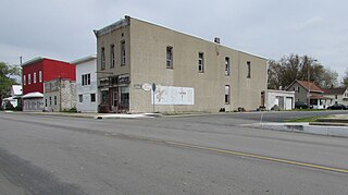
Lynnville, Indiana.jpg
Warrick County Indiana Incorporated and Unincorporated areas Lynnville Highlighted 1845486.svg
Location of Lynnville in Warrick County, Indiana.
Coordinates: 38°11′59″N87°18′41″W / 38.19972°N 87.31139°W / 38.19972; -87.31139
Country United States
State Indiana
County Warrick
Township Hart
Area
[1]
  Total1.98 sq mi (5.12 km2)
  Land1.74 sq mi (4.51 km2)
  Water0.24 sq mi (0.61 km2)
Elevation
[2]
476 ft (145 m)
Population
 (2020)
  Total830
  Density476.46/sq mi (183.95/km2)
Time zone UTC-6 (Central (CST))
  Summer (DST) UTC-5 (CDT)
ZIP code
47619
Area code 812
FIPS code 18-45486 [3]
GNIS feature ID2396730 [2]

Lynnville is a town in Hart Township, Warrick County, in the U.S. state of Indiana. [2] The population was 888 at the 2010 census.

Contents

History

Lynnville was platted in 1839. [4] The town was named for its founder, John Lynn, who also established the first store at the site. [5] A post office has been in operation at Lynnville since 1839. [6]

Geography

Lynnville is located at 38°11′59″N87°18′41″W / 38.199662°N 87.311327°W / 38.199662; -87.311327 . [7]

According to the 2010 census, Lynnville has a total area of 1.98 square miles (5.13 km2), of which 1.74 square miles (4.51 km2) (or 87.88%) is land and 0.24 square miles (0.62 km2) (or 12.12%) is water. [8]

Demographics

Historical population
CensusPop.Note
1880 304
1910 297
1920 41238.7%
1930 264−35.9%
1940 37140.5%
1950 4048.9%
1960 4091.2%
1970 55635.9%
1980 5661.8%
1990 64013.1%
2000 78122.0%
2010 88813.7%
2020 830−6.5%
U.S. Decennial Census [9]

2010 census

As of the census [10] of 2010, there were 888 people, 352 households, and 239 families living in the town. The population density was 510.3 inhabitants per square mile (197.0/km2). There were 396 housing units at an average density of 227.6 per square mile (87.9/km2). The racial makeup of the town was 98.9% White, 0.1% African American, 0.2% Native American, and 0.8% from two or more races. Hispanic or Latino of any race were 0.8% of the population.

There were 352 households, of which 33.8% had children under the age of 18 living with them, 51.4% were married couples living together, 9.7% had a female householder with no husband present, 6.8% had a male householder with no wife present, and 32.1% were non-families. 26.7% of all households were made up of individuals, and 9.9% had someone living alone who was 65 years of age or older. The average household size was 2.50 and the average family size was 3.03.

The median age in the town was 38.9 years. 24.5% of residents were under the age of 18; 7.1% were between the ages of 18 and 24; 27.4% were from 25 to 44; 27.9% were from 45 to 64; and 13.2% were 65 years of age or older. The gender makeup of the town was 52.0% male and 48.0% female.

2000 census

As of the census [3] of 2000, there were 781 people, 346 households, and 226 families living in the town. The population density was 457.5 inhabitants per square mile (176.6/km2). There were 384 housing units at an average density of 224.9 per square mile (86.8/km2). The racial makeup of the town was 98.85% White, 0.13% Asian, 0.13% Pacific Islander, and 0.90% from two or more races.

There were 346 households, out of which 26.9% had children under the age of 18 living with them, 55.8% were married couples living together, 7.5% had a female householder with no husband present, and 34.4% were non-families. 28.9% of all households were made up of individuals, and 13.0% had someone living alone who was 65 years of age or older. The average household size was 2.26 and the average family size was 2.78.

In the town, the population was spread out, with 21.1% under the age of 18, 7.8% from 18 to 24, 28.8% from 25 to 44, 29.4% from 45 to 64, and 12.8% who were 65 years of age or older. The median age was 39 years. For every 100 females, there were 99.7 males. For every 100 females age 18 and over, there were 93.7 males.

The median income for a household in the town was $35,556, and the median income for a family was $41,964. Males had a median income of $36,518 versus $22,250 for females. The per capita income for the town was $16,288. About 5.3% of families and 8.0% of the population were below the poverty line, including 8.5% of those under age 18 and 5.1% of those age 65 or over.

Education

Lynnville has a public library, a branch of the Boonville-Warrick County Public Library. [11]

Lynnville has a elementary. and middle and high school. [12]

Related Research Articles

<span class="mw-page-title-main">Lynnville, Illinois</span> Village in Illinois, United States

Lynnville is a village in Morgan County, Illinois, United States. The population was 96 at the 2020 census. It is part of the Jacksonville Micropolitan Statistical Area.

<span class="mw-page-title-main">Utica, Indiana</span> Town in Indiana, United States

Utica is a town in Utica Township, Clark County, Indiana, United States. The population was 776 at the 2010 census.

<span class="mw-page-title-main">Center Point, Indiana</span> Town in Indiana, United States

Center Point is a town in Sugar Ridge Township, Clay County, Indiana, United States. The population was 242 at the 2010 census. It is part of the Terre Haute Metropolitan Statistical Area.

<span class="mw-page-title-main">Milltown, Indiana</span> Town in Indiana, United States

Milltown is a town in Whiskey Run Township in Crawford County, Indiana and in Blue River and Spencer townships in Harrison County. The population was 818 at the time of the 2010 census.

<span class="mw-page-title-main">St. Leon, Indiana</span> Town in Indiana, United States

St. Leon or Saint Leon is a town in Kelso Township, Dearborn County, Indiana, United States. The population was 678 at the 2010 census.

<span class="mw-page-title-main">Chesterfield, Indiana</span> Town in Indiana, United States

Chesterfield is a town in the U.S. state of Indiana which lies in Union Township, Madison County, and Salem Township, Delaware County. The population was 2,490 at the 2020 census. It is part of the Indianapolis–Carmel–Anderson metropolitan statistical area.

<span class="mw-page-title-main">Lyons, Indiana</span> Town in Indiana, United States

Lyons is a town in Washington Township, Greene County, Indiana, United States. The population was 742 at the 2010 census. It is part of the Bloomington, Indiana Metropolitan Statistical Area.

<span class="mw-page-title-main">Wheatland, Indiana</span> Town in Indiana, United States

Wheatland is a town in Steen Township, Knox County, Indiana, United States. The population was 480 at the 2010 census.
<span class="mw-page-title-main">Sidney, Indiana</span> Town in Indiana, United States

Sidney is a town in Jackson Township, Kosciusko County, in the U.S. state of Indiana. The population was 83 at the 2010 census.

<span class="mw-page-title-main">Ingalls, Indiana</span> Town in Indiana, United States

Ingalls is a town in Green Township, Madison County, Indiana, United States. It is part of the Indianapolis–Carmel–Anderson metropolitan statistical area. The population was 2,223 at the 2020 census.

<span class="mw-page-title-main">Losantville, Indiana</span> Town in Indiana, United States

Losantville is a town in Union Township, Randolph County, in the U.S. state of Indiana. The population was 237 at the 2010 census.

<span class="mw-page-title-main">Chrisney, Indiana</span> Town in Indiana, United States

Chrisney is a town in Grass Township, Spencer County, in the U.S. state of Indiana. The population was 481 at the 2010 census.

<span class="mw-page-title-main">Dale, Indiana</span> Town in Indiana, United States

Dale is a town in Carter Township, Spencer County, in the U.S. state of Indiana. The population was 1,593 at the 2010 census.

<span class="mw-page-title-main">Clear Lake, Indiana</span> Town in Indiana, United States

Clear Lake is a town located in the northeast corner of Steuben County, Indiana, in Clear Lake Township. As such, is the northeasternmost community in the State of Indiana. The population was 339 at the 2010 census.

<span class="mw-page-title-main">Elberfeld, Indiana</span> Town in Indiana, United States

Elberfeld is a town in Greer Township, Warrick County, in the U.S. state of Indiana. The population was 625 as of the 2010 census.

<span class="mw-page-title-main">Tennyson, Indiana</span> Town in Indiana, United States

Tennyson is a town in Skelton Township, Warrick County, in the U.S. state of Indiana. The population was 279 at the 2010 census.

<span class="mw-page-title-main">Lynnville, Iowa</span> City in Iowa, United States

Lynnville is a city in Jasper County, Iowa, United States. The population was 380 at the time of the 2020 census.

<span class="mw-page-title-main">Searsboro, Iowa</span> Unincorporated community in Iowa, United States

Searsboro in an unincorporated community in Poweshiek County, Iowa, United States. The population was 148 at the 2010 census. The city attempted to disincorporate in 2011, but the move failed when Poweshiek County refused to take control of the city's infrastructure.

<span class="mw-page-title-main">Lynnville, Tennessee</span> Town in Tennessee, United States

Lynnville is a town in Giles County, Tennessee. The population was 287 at the 2010 census. The name is from a local creek. Richland High School is located in Lynnville and serves the town and surrounding areas.

<span class="mw-page-title-main">Rocky Ripple, Indiana</span> Town in Indiana, United States

Rocky Ripple is a town in Marion County, Indiana, United States. The population was 655 at the 2020 census. It was founded in 1927, and the town was incorporated as an "included town" as part of Unigov in 1970. It is part of Indianapolis, but retains a separate functioning town government under IC 36-3-1-11. Although not far from the city center, Rocky Ripple is a somewhat isolated area, located between the Central Canal and the White River; only two traffic-supporting bridges over the canal provide access to the town.

References

  1. "2020 U.S. Gazetteer Files". United States Census Bureau. Retrieved March 16, 2022.
  2. 1 2 3 U.S. Geological Survey Geographic Names Information System: Lynnville, Indiana
  3. 1 2 "U.S. Census website". United States Census Bureau . Retrieved January 31, 2008.
  4. Baker, Ronald L. (October 1995). From Needmore to Prosperity: Hoosier Place Names in Folklore and History . Indiana University Press. p.  205. ISBN   978-0-253-32866-3. ...platted it in 1839...
  5. Fortune, William (1881). Warrick and Its Prominent People: A History of Warrick County, Indiana from the Time of Its Organization and Settlement. Courier Company. p.  37.
  6. "Warrick County". Jim Forte Postal History. Retrieved October 3, 2015.
  7. "US Gazetteer files: 2010, 2000, and 1990". United States Census Bureau. February 12, 2011. Retrieved April 23, 2011.
  8. "G001 - Geographic Identifiers - 2010 Census Summary File 1". United States Census Bureau. Archived from the original on February 13, 2020. Retrieved July 17, 2015.
  9. "Census of Population and Housing". Census.gov. Retrieved June 4, 2015.
  10. "U.S. Census website". United States Census Bureau . Retrieved December 11, 2012.
  11. "Boonville-Warrick County Public Library (Lynnville Branch)". librarything. Retrieved March 15, 2018.
  12. "Locations of Lynnville schools" . Retrieved January 1, 2022.