
The Western Bypass is a section of the N1 and the Johannesburg Ring Road located in the city of Johannesburg, South Africa. Known at the time as the Concrete Highway, the freeway was initially opened in 1975 as a route to avoid the city centre of Johannesburg and to provide access to the western areas of the Witwatersrand. From the south, the Western Bypass begins at the Diepkloof Interchange in Soweto, where it splits from the N12 freeway and ends at the Buccleuch Interchange, where it merges with the N3 Eastern Bypass, M1 South and N1 Ben Schoeman freeways.
Dobsonville is a township in greater Soweto, Johannesburg, South Africa. It lies to the west of Meadowlands, a part of Diepmeadow, and is adjacent to Mofolo North and Zondi, which are suburbs of Soweto on its southern border.

The R24 is a major East-West provincial route in the Gauteng and North West provinces that links OR Tambo International Airport with Rustenburg via Johannesburg, Krugersdorp and Magaliesburg. The process of renaming the streets and freeway that form the route from Krugersdorp eastward to OR Tambo International after anti-apartheid stalwart Albertina Sisulu was completed in 2013.

The R28 is a provincial route in Gauteng, South Africa that connects Krugersdorp with Vereeniging via Randfontein. The R28 used to connect with Pretoria, but that section of the road is now part of the N14.
The R41 is a provincial route in Gauteng, South Africa, that connects Johannesburg with Randfontein via Roodepoort.

The N12 is a national route in South Africa which runs from George through Beaufort West, Kimberley, Klerksdorp and Johannesburg to eMalahleni.

The Dobsonville Stadium, formerly Volkswagen Dobsonville Stadium and also referred to as Dobsie Stadium, is a multi-purpose stadium in Soweto, a suburb of Johannesburg, South Africa. The venue is managed by Stadium Management SA (SMSA).
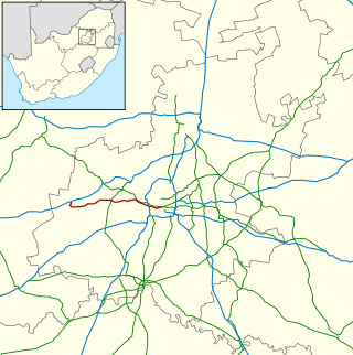
The R554 is a Regional Route in Gauteng, South Africa. The road connects the southern suburbs of Soweto with Springs on the East Rand via Lenasia, Alberton and Brakpan.
The R564 is a Regional Route in the City of Johannesburg Metropolitan Municipality in Gauteng, South Africa. It connects Roodepoort with Buccleuch via Northriding and Fourways.
M7 is a metropolitan route in the Greater Johannesburg metropolitan area. The road connects Thokoza and the southern suburbs of Alberton with suburbs to the west of the Johannesburg CBD.
The M10 is a long metropolitan route in Greater Johannesburg, South Africa. It connects Lenasia with Johannesburg Central via Soweto.
The M18 is a long metropolitan route in Greater Johannesburg, South Africa. It connects Krugersdorp with Bruma via Constantia Kloof, Florida, Auckland Park, Braamfontein and Observatory.
The M38 is a short metropolitan route in Johannesburg, South Africa. The entire route is in the Johannesburg South area, connecting Southgate with Tulisa Park via Ridgeway. It is parallel to the Johannesburg Southern Bypass for its entire route.
The M47 is a short metropolitan route in the City of Johannesburg, South Africa. It connects the N14 at Cradlestone Mall with the M18 at Maraisburg in Roodepoort. It consists of only one street, named Hendrik Potgieter Road.
The M53 is a short metropolitan route in Greater Johannesburg, South Africa. It connects Germiston with Vosloorus via Elsburg.
The M68 is a short metropolitan route in Johannesburg, South Africa. It connects the south-western part of Soweto with Mulbarton via Diepkloof, Southgate and Glenvista.
The M70 road is a short metropolitan route in Johannesburg, South Africa. It connects Booysens with Dobsonville via Diepkloof, Orlando and Meadowlands. For much of its route, it is known as the Soweto Highway.
The M72 road is a short metropolitan route in Johannesburg, South Africa. Its a single ring-road through the centre of Soweto.
The M79 is a short metropolitan route in Greater Johannesburg, South Africa. It connects Jabavu in the western part of Soweto with Nasrec via Orlando and Diepkloof. On physical street signs, it is signposted as the M12 on the eastern part of the route.
The M86 is a short metropolitan route in the Greater Johannesburg, South Africa. It connects Krugersdorp with Randpark Ridge via Roodepoort.
