Maesbury Castle

Last updated

Maesbury Castle
Maesbury Camp Somerset Map.jpg
Plan of earthworks at Maesbury Castle
Location Croscombe, Somerset, England
Coordinates 51°13′20″N2°33′35″W / 51.22222°N 2.55972°W / 51.22222; -2.55972
Area2.5 hectares (6.2 acres)
Built Iron Age
Reference no.200279 [1]
Somerset UK location map.svg
Red pog.svg
Location of Maesbury Castle in Somerset
The ditch and bank at Maesbury Castle Maesbury Castle - geograph.org.uk - 179138.jpg
The ditch and bank at Maesbury Castle

Maesbury Castle is an Iron Age hill fort within the parish of Croscombe on the Mendip Hills, just north of Shepton Mallet, Somerset, England. It has been listed as a Scheduled Ancient Monument. [2] [3]

Contents

The name is derived from maes, meaning field or plain in Brythonic Welsh, and burh , meaning fort in Old English. There is also a record of the name Merksburi in 705 AD, meaning boundary fort. The area was a boundary between the Romano-British Celts and West Saxons during the period 577-652 AD, when the nearby Wansdyke fortification comprised part of the border.

The enclosure has an area of 2.5 hectares (6.2 acres), and lies at a height of 292 m (950 ft), [4] with views in many directions. This includes the Somerset Levels to Glastonbury Tor and Brent Knoll which are the closest and probably the most easily identifiable landmarks from the site. The fort has a single rampart up to 6 m high, with an outer ditch (univallate). Entrances are to the south-east and north-east (with possible outworks).

The Fort and surrounding grounds are now owned by the Stevens' family who have been farming in Somerset for over 60 years. [5]

Background

Hill forts developed in the Late Bronze and Early Iron Age, roughly the start of the first millennium BC. [6] The reason for their emergence in Britain, and their purpose, has been a subject of debate. It has been argued that they could have been military sites constructed in response to invasion from continental Europe, sites built by invaders, or a military reaction to social tensions caused by an increasing population and consequent pressure on agriculture. The dominant view since the 1960s has been that the increasing use of iron led to social changes in Britain. Deposits of iron ore were located in different places to the tin and copper ore necessary to make bronze, and as a result trading patterns shifted and the old elites lost their economic and social status. Power passed into the hands of a new group of people. [7] Archaeologist Barry Cunliffe believes that population increase still played a role and has stated "[the forts] provided defensive possibilities for the community at those times when the stress [of an increasing population] burst out into open warfare. But I wouldn't see them as having been built because there was a state of war. They would be functional as defensive strongholds when there were tensions and undoubtedly some of them were attacked and destroyed, but this was not the only, or even the most significant, factor in their construction." [8]

The site rises to 292 metres (958 ft) above sea level and enables a view over the surrounding valleys and hills. The hill has not eroded as fast as the surrounding limestone as it is made of Old Red Sandstone deposited in the Devonian period approximately 400 million years ago. [9]

See also

Related Research Articles

<span class="mw-page-title-main">Cadbury Castle, Somerset</span> Hillfort in Somerset, England

Cadbury Castle is a Bronze and Iron Age hillfort in the civil parish of South Cadbury in the English county of Somerset. It is a scheduled monument and has been associated with King Arthur's legendary court at Camelot.

<span class="mw-page-title-main">Maes Knoll</span> Iron Age hillfort in Somerset, England

Maes Knoll is an Iron Age hill fort in Somerset, England, located at the eastern end of the Dundry Down ridge, south of the city of Bristol and north of the village of Norton Malreward near the eastern side of Dundry Hill. It is a Scheduled Ancient Monument.

<span class="mw-page-title-main">Burledge Hill</span> Iron Age hillfort in Somerset, England

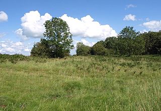
Burledge Hill is on the southern edge of the village of Bishop Sutton, Somerset, England. It is the site of a Site of Special Scientific Interest and an univallate Iron Age hillfort.

<span class="mw-page-title-main">Plainsfield Camp</span> Iron Age earthwork in Somerset, England

Plainsfield Camp is a possible Iron Age earthwork on the Quantock Hills near Aisholt in Somerset, England.

<span class="mw-page-title-main">Bat's Castle</span> Iron Age hillfort in Somerset, England

Bats Castle is an Iron Age hillfort at the top of a 213 metres (699 ft) high hill in the parish of Carhampton south south west of Dunster in Somerset, England.

<span class="mw-page-title-main">Black Ball Camp</span> Iron Age hillfort in Somerset, England

Black Ball Camp is an Iron Age hillfort South West of Dunster, Somerset, England on the northern summit of Gallox Hill. It is a Scheduled Monument.

<span class="mw-page-title-main">Clatworthy Camp</span> Iron Age hillfort in Somerset, England

Clatworthy Camp is an Iron Age hill fort 3 miles (4.8 km) North West of Wiveliscombe, Somerset, England. It has been scheduled as an Ancient Monument. Due to the vulnerability to scrub and tree growth it has been added to the Heritage at Risk Register.

<span class="mw-page-title-main">Cow Castle</span> Iron Age hillfort in Somerset, England

Cow Castle is an Iron Age hillfort 5.75 kilometres (4 mi) West South West of Exford, Somerset, England within the Exmoor National Park. It is a Scheduled Monument. It has been added to the heritage at Risk register because of the risk from bracken.

<span class="mw-page-title-main">Kenwalch's Castle</span> Historic site in Somerset, England

Kenwalch's Castle is probably an Iron Age hill fort that may have been converted into a Roman fortress, near Penselwood, Somerset, England, 6.6 kilometres (4 mi) east south east of Bruton at grid reference ST747335. It is a Scheduled Ancient Monument. It is believed to be named after Cenwalh of Wessex.

Kingsdown Camp is an Iron Age hillfort at Buckland Dinham 4.5 kilometres (3 mi) South East of Radstock, Somerset, England. It is a Scheduled Monument.

<span class="mw-page-title-main">Stantonbury Camp</span> Iron Age hillfort in Somerset, England

Stantonbury Camp is the site of an Iron Age hill fort near Stanton Prior within the parish of Marksbury in Somerset, England. It is a Scheduled Ancient Monument.

<span class="mw-page-title-main">Banwell Camp</span> Iron Age hillfort in Somerset, England

Banwell Camp is a univallate Iron Age hill fort in the North Somerset district of Somerset, England. The hill fort is situated approximately 1.6 miles (2.6 km) east from the Village of Banwell. Some artefacts found on the site dates back to the Bronze Age and the Stone Age. In places it is surrounded by a 4 metres (13 ft) high bank and ditch.

<span class="mw-page-title-main">Burrington Camp</span> Iron Age hillfort in Somerset, England

Burrington Camp, also known as Burrington Ham, is an Iron Age hill fort in the North Somerset district of Somerset, England. The hill fort is situated in the Mendip Hills approximately 0.6 miles (0.97 km) south from the village of Burrington.

Westbury Camp is a univallate Iron Age hill fort in the Mendip Hills in Somerset, England. The hill fort is situated in the parish of Rodney Stoke, approximately 1 mile (1.6 km) north-east of the village of Draycott and 1.5 miles (2.4 km) north-west of Westbury-sub-Mendip. The camp is largely situated in a hill slope. The north east defences have largely been destroyed by small quarries over the years. The narrow top of the hill bank suggests that it may have been surmounted by a dry stone wall. Along part of the east side of the camp there are traces of a berm between the bank and the outer ditch and at the western angle shallow quarry pits occur internally and externally set back from the 'rampart'.

<span class="mw-page-title-main">Charterhouse Camp</span> Iron Age hillfort in Somerset, England

Charterhouse Camp is a univallate Iron Age hillfort in the Mendip district of Somerset, England. The hillfort is situated approximately 0.6 miles (0.97 km) east from the village of Charterhouse. There is some evidence, in the form of burials in local caves, of human occupation since the late Neolithic times and the early Bronze Age. The site is associated with Charterhouse Roman Town and may have been the site of Iscalis. The site is a scheduled monument.

Tunley Camp is an vallate Iron Age hill fort situated approximately 0.8 miles (1.3 km) north-east from the small village of Camerton in the Bath and North East Somerset district of Somerset, England. The hill fort comprises the slight earthwork remains of a univallate Iron Age hillfort which now nearly ploughed down.

Brewer's Castle is a defended Iron Age settlement in the West Somerset district of Somerset, England. The hill fort is situated approximately 2 miles (3.2 km) west from the town of Dulverton.

Berry Castle is an early Roman hillslope enclosure in the West Somerset district of Somerset, England. The hill fort is situated approximately 3.2 miles (5.1 km) west from the village of Luccombe. A series of earthworks survive in Berry Castle; it dates from the late Iron Age or early Romano British period. It has been protected as a scheduled monument.

<span class="mw-page-title-main">King's Castle, Wells</span> Iron Age hillfort in Somerset, England

King's Castle is an Iron Age enclosed hilltop settlement at the south-western edge of the Mendip Hills near Wells in Somerset, England. Though there are many prehistoric sites in the surrounding area, it remains one of the earliest known settlements in the immediate vicinity of Wells, and may have been a precursor to the present day city. It consists of two or three interlinked sub-enclosures, with what appears to be a field system extending to the east; an unusual layout, the site remains relatively little studied and has not been archaeologically excavated. It is a Scheduled Ancient Monument, and shares its name with the surrounding King's Castle Wood—today a Somerset Wildlife Trust nature reserve—though this name is probably a modern invention.

References

  1. "Measbury Castle". National Monuments Record. English Heritage . Retrieved 24 March 2011.
  2. Firth, Hannah (2007). Mendip from the air. Taunton: Somerset County Council. ISBN   978-0-86183-390-0.
  3. "Maesbury Castle Hillfort, Croscombe". Somerset Historic Environment Record. Somerset County Council . Retrieved 30 December 2010.
  4. Tratman, E.K. (1959). "Maesbury Castle, Somerset" (PDF). Proceedings of the University of Bristol Spelaeological Society. 8 (3): 172–178.
  5. Gearing, Sue (November 2016). "Fortify yourself with this special winter circle". Mendip Times. 12 (7): 58–59.
  6. Payne, Andrew; Corney, Mark; Cunliffe, Barry (2007), The Wessex Hillforts Project: Extensive Survey of Hillfort Interiors in Central Southern England, English Heritage, p. 1, ISBN   978-1-873592-85-4
  7. Sharples, Niall M (1991), English Heritage Book of Maiden Castle, London: B. T. Batsford, pp. 71–72, ISBN   0-7134-6083-0
  8. Time Team: Swords, skulls and strongholds, Channel 4, 19 May 2008, retrieved 16 September 2009
  9. Haslett, Simon K. (2010). Somerset Landscapes: Geology and landforms. Usk: Blackbarn Books. pp. 31–34. ISBN   9781456416317.

Further reading