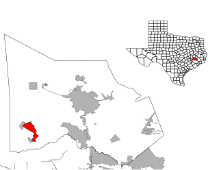
Calhoun County is a county located in the U.S. state of Texas. As of the 2020 census, the population was 20,106. Its county seat is Port Lavaca. The county is named for John Caldwell Calhoun, the seventh vice president of the United States. Calhoun County comprises the Port Lavaca, TX Micropolitan Statistical Area, which is also included in the Victoria-Port Lavaca, TX Combined Statistical Area.

Muir Beach is a census designated place (CDP), unincorporated community, and beach on the Pacific Ocean. The community is located 16.5 miles (26.6 km) northwest of San Francisco in western Marin County, California, United States. Unlike many other entities in the area, it is not named directly in honor of conservationist John Muir; instead, it was named after Muir Woods National Monument to capitalize on the latter's popularity. The population was 304 at the 2020 census. The community itself flanks the northwest side of the beach.

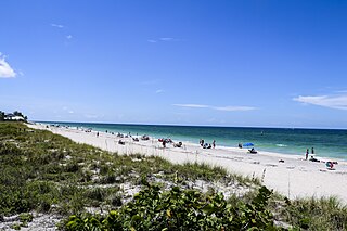
Manasota Key is a census-designated place (CDP) consisting mainly of the community of Englewood Beach in Charlotte County, Florida, United States. The population of the CDP was 1,326 at the 2020 census. It is part of the Sarasota-Bradenton-Punta Gorda Combined Statistical Area.

Apollo Beach is an unincorporated census-designated place in Hillsborough County, Florida, United States. The population was 14,055 at the 2010 census, up from 7,444 at the 2000 census.

Kailua is a census-designated place (CDP) in Honolulu County, Hawaii, United States. It lies in the Koʻolaupoko District of the island of Oʻahu on the windward coast at Kailua Bay. It is in the judicial district and the ahupua'a named Ko'olaupoko. It is 12 miles (19 km) northeast of Honolulu – over Nu‘uanu Pali.

Kawela Bay is a census-designated place and small community in the Koʻolauloa District on the northern coast of the island of Oʻahu, City & County of Honolulu, Hawaii, United States. In Hawaiian, ka wela means "the heat". As of the 2020 census, the CDP had a population of 325.

Garden City, sometimes known as Garden City Beach, is a census-designated place (CDP) in Horry County, South Carolina, United States. The population was 9,209 at the 2010 census. Garden City Beach is located directly south of Surfside Beach. The developed part of the beach extends south beyond the limits of the Garden City CDP, into Georgetown County, and ends on a peninsula at the mouth of Murrells Inlet.

Port Lavaca is a city in Calhoun County, located in the U.S. state of Texas. The population was 12,248 at the 2010 census and 11,557 at the 2020 census. It is the county seat of Calhoun County and part of the Port Lavaca, Texas micropolitan statistical area. Port Lavaca is 130 miles (210 km) southwest of Houston.

Bolivar Peninsula is a census-designated place (CDP) in Galveston County, Texas, United States. The population was 2,417 at the 2010 census. The communities of Port Bolivar, Crystal Beach, Caplen, Gilchrist, and High Island are located on Bolivar Peninsula.

Crosby is a census-designated place in Harris County, Texas, United States. The population was 3,417 at the 2020 census.

Pinehurst is a census-designated place (CDP) in Montgomery County, Texas, United States. The population was 5,195 at the 2020 census.

Birch Bay is a protected bay of the east shore of the Salish Sea, between Semiahmoo Bay and Lummi Bay; approximately 100 miles (160 km) north of Seattle and 35 miles (56 km) south of Vancouver, BC, Canada.

Lavaca Bay is a northwestern extension of the Matagorda Bay system found mostly in Calhoun County, Texas, United States. The ports of Port Lavaca and Point Comfort have been established on the bay, and are the main areas of human habitation. Linnville was located on the bay until its abandonment after the Great Raid of 1840, and the major port of Indianola was found near the confluence with the main Matagorda Bay, until the town's final destruction following the massive hurricane of 1886. Smaller communities include Olivia, Alamo Beach and Magnolia Beach. Lavaca Bay is approximately 82 miles (130 km) northeast of Corpus Christi, about 121 miles (190 km) southwest of Houston, and 145 miles (230 km) southeast of San Antonio.
Port O'Connor is an unincorporated community and census-designated place (CDP) in Calhoun County, Texas, United States, near the Gulf coastline between Galveston and Corpus Christi. The CDP had a population of 1,253 at the 2010 census. It is part of the Victoria, Texas metropolitan statistical area.

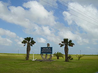
Matagorda is a census-designated place in Matagorda County, Texas, United States. It is located near the mouth of the Colorado River on the upper Texas coast in the United States. In 2020, its population was 313. Matagorda is primarily a tourist town, with commercial and recreational fishing being the top industries. Approximately 23 miles (37 km) of the beach are accessible by vehicle and 35 additional miles are accessible only by boat. Matagorda is at the end of State Highway 60 and the beginning of Farm to Market Road 2031, which runs over the Intracoastal Waterway and south to the Gulf of Mexico.

The Victoria Metropolitan Statistical Area, as defined by the United States Census Bureau, is an area consisting of three counties in the Coastal Bend region of Texas, anchored by the city of Victoria. The area is sometimes referred to as the Golden Crescent Region, though this term is sometimes used to refer to a larger area than just these 3 counties. As of the 2000 census, the MSA had a population of 111,663.
Holiday Beach is an unincorporated community and census-designated place in Aransas County, Texas, United States. As of the 2010 census it had a population of 514. This was a new CDP for the 2010 census.
Alamo Beach is an unincorporated community and census-designated place (CDP) in Calhoun County, Texas, United States. It was first listed as a CDP in the 2020 census with a population of 254. It is located just north of the junction of Farm Roads 2717 and 2760, approximately two miles southeast of Port Lavaca and northwest of Magnolia Beach. The community is situated along the waterfront of Lavaca Bay. It is part of the Victoria, Texas Metropolitan Statistical Area.
Magnolia Beach may refer to:
Captree is a census-designated place (CDP) in the towns of Islip and Babylon in Suffolk County, New York, United States. It occupies Captree Island in Great South Bay, as well as the east end of Jones Beach Island to the south, comprising Captree State Park. It was first listed as a CDP prior to the 2020 census. Prior to that it was part of the Oak Beach–Captree CDP.


