Malmsmead

Last updated
Malmsmead
Badgworthy Water Malmsmead.jpg
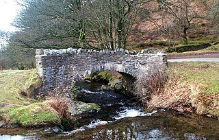
Malmsmead Bridge and the old ford
United Kingdom adm location map.svg
Red pog.svg
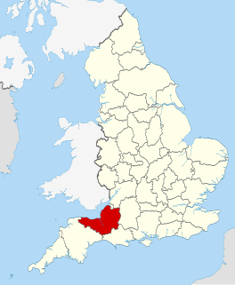
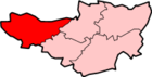
Malmsmead
Malmsmead shown within Devon
OS grid reference SS790478
Civil parish
District
Shire county
Region
Country England
Sovereign state United Kingdom
Post town LYNTON
Postcode district EX35 6
Police Devon and Cornwall
Fire Devon and Somerset
Ambulance South Western
EU Parliament South West England
List of places
UK
England
Devon
51°13′01″N3°43′59″W / 51.217°N 3.733°W / 51.217; -3.733 Coordinates: 51°13′01″N3°43′59″W / 51.217°N 3.733°W / 51.217; -3.733

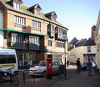
Malmsmead is a hamlet on the border between the English counties of Devon and Somerset. The nearest town is Lynton, which lies approximately 4.7 miles (7.6 km) west of the hamlet. The hamlet is situated in the Doone Valley within the Exmoor National Park. [1] [2]

Devon County of England

Devon, also known as Devonshire, which was formerly its common and official name, is a county of England, reaching from the Bristol Channel in the north to the English Channel in the south. It is part of South West England, bounded by Cornwall to the west, Somerset to the north east, and Dorset to the east. The city of Exeter is the county town. The county includes the districts of East Devon, Mid Devon, North Devon, South Hams, Teignbridge, Torridge, and West Devon. Plymouth and Torbay are each geographically part of Devon, but are administered as unitary authorities. Combined as a ceremonial county, Devon's area is 6,707 km2 and its population is about 1.1 million.

Somerset County of England

Somerset is a county in South West England which borders Gloucestershire and Bristol to the north, Wiltshire to the east, Dorset to the south-east and Devon to the south-west. It is bounded to the north and west by the Severn Estuary and the Bristol Channel, its coastline facing southeastern Wales. Its traditional border with Gloucestershire is the River Avon. Somerset's county town is Taunton.

Lynton town in Devon, England

Lynton is a small town on the Exmoor coast in Devon, England standing on top of the cliffs above the picturesque harbour village of Lynmouth, to which it is connected by the Lynton and Lynmouth Cliff Railway. Lynton was once the terminus for the narrow-gauge Lynton & Barnstaple Railway, which served both towns.

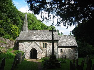
The border between the counties is along Badgworthy Water, which is crossed by the 17th-century Malmsmead Bridge and an even older adjacent ford. Badgworthy Water is also the boundary between the parishes of Oare (Somerset) and Brendon and Countisbury (Devon).

Badgworthy Water

Badgworthy Water is a small river which flows through Malmsmead on Exmoor, close to the border between Devon and Somerset, England.

Malmsmead Bridge bridge in United Kingdom

Malmsmead Bridge is a 17th-century stone bridge which crosses Badgworthy Water in the hamlet of Malmsmead, on the road between Oare and Brendon. The Badgworthy Water forms the boundary between the counties of Somerset and Devon, and the bridge is therefore shared between both counties, as well as being within the Exmoor National Park. It has been scheduled as an ancient monument and is a Grade II listed building.

Oare, Somerset

Oare is a village and civil parish on Oare Water on Exmoor in the West Somerset district of Somerset, England. The parish includes the hamlet of Oareford and the village of Culbone which contains its own tiny church.

Malmsmead is both on the route of the Coleridge Way and Samaritans Way South West. Just to the north of the hamlet, Badgworthy Water merges with Oare Water to form the East Lyn River that flows into the sea at Lynmouth.

Coleridge Way

The Coleridge Way is a 51-mile (82 km) footpath in Somerset and Devon, England.

Samaritans Way South West

Samaritans Way South West is a 103 miles (166 km) Long-distance footpath in South West England. It was officially opened on 21 April 2004 by the Ramblers Vice Chairman, the Samaritans (charity) Chief Executive and a farmer from Gloucestershire who headed the Farmers Helpline. In the same year it appeared on the Ordnance Survey maps supported and encouraged by Local Authorities, National Parks and Area of Outstanding Natural Beauty by giving their consent; however Somerset County Council later asked the Ordnance Survey to remove the route from their maps.

Oare Water

Oare Water passes through the village of Oare, on Exmoor in Somerset, England.

Related Research Articles

<i>Lorna Doone</i> novel by Richard Doddridge Blackmore

Lorna Doone: A Romance of Exmoor is a novel by English author Richard Doddridge Blackmore, published in 1869. It is a romance based on a group of historical characters and set in the late 17th century in Devon and Somerset, particularly around the East Lyn Valley area of Exmoor. In 2003, the novel was listed on the BBC's survey The Big Read.

Exmoor area of hilly open moorland in west Somerset and north Devon in South West England

Exmoor is loosely defined as an area of hilly open moorland in west Somerset and north Devon in South West England. It is named after the River Exe, the source of which is situated in the centre of the area, two miles north-west of Simonsbath. Exmoor is more precisely defined as the area of the former ancient royal hunting forest, also called Exmoor, which was officially surveyed 1815–1818 as 18,810 acres (7,610 ha) in extent. The moor has given its name to a National Park, which includes the Brendon Hills, the East Lyn Valley, the Vale of Porlock and 55 km (34 mi) of the Bristol Channel coast. The total area of the Exmoor National Park is 692.8 km2 (267.5 sq mi), of which 71% is in Somerset and 29% in Devon.

Wiveliscombe town and civil parish in Somerset, England

Wiveliscombe is a small town and civil parish in Somerset, England, situated 9 miles (14 km) west of Taunton in the Taunton Deane district. The town has a population of 2,893. The Square, fronted by several listed structures, held the former market. The parish includes the nearby hamlet of Maundown.

Geology of Somerset

Somerset is a rural county in the southwest of England, covering 4,171 square kilometres (1,610 sq mi). It is bounded on the north-west by the Bristol Channel, on the north by Bristol and Gloucestershire, on the north-east by Wiltshire, on the south-east by Dorset, and on the south west and west by Devon. It has broad central plains with several ranges of low hills. The landscape divides into four main geological sections from the Silurian through the Devonian and Carboniferous to the Permian which influence the landscape, together with water-related features.

Brendon village in the United Kingdom

Brendon is a village in Devon, England, close to the border with Somerset within the Exmoor National Park. The village is 1.5 miles (2.4 km) southeast of Lynton and 15 miles (24 km) west of Minehead in the East Lyn Valley. It is located just off the A39 and is on two long distance footpaths, the Coleridge Way and the Samaritans Way South West. The Church of St Brendon is 2 mi (3 km) from the village and was built in 1738, possibly with building material brought from another site.

Glenthorne

Glenthorne is a 13.3 hectare geological Site of Special Scientific Interest in the parish of Oare within the Exmoor National Park, on the border of Somerset and Devon, notified in 1989.

Exford, Somerset

Exford is a rural village at the centre of Exmoor National Park, 7 miles (11 km) north-west of Dulverton, and 10 miles (16 km) south-west of Minehead, in Somerset, England. Less than a mile away is the hamlet of Lyncombe.

Culbone Church Church in England

Culbone Church, located in the village of Culbone in Somerset, is said to be the smallest parish church in England. The church, dedicated to the Welsh saint Beuno, has been designated by English Heritage as a Grade I listed building and the churchyard cross is Grade II*.

East Lyn River river in Somerset, United Kingdom

The East Lyn is a river which rises high in Exmoor, in the English county of Somerset. It flows through the East Lyn Valley in Devon.

Simonsbath a village located in Exmoor, United Kingdom

Simonsbath is a small village high on Exmoor in the English county of Somerset. It is the principal settlement in the Exmoor civil parish, which is the largest and most sparsely populated civil parish on Exmoor, covering nearly 32 square miles (83 km2) but with a population, at the time of the 2001 census, of 203 in 78 households, reducing to 156 at the 2011 Census. The River Exe rises from a valley to the north, and the River Barle runs through the village and is crossed by a triple-arched medieval bridge that was extensively repaired after floods in 1952.

Geography of Somerset

The county of Somerset is in South West England, bordered by the Bristol Channel and the counties of Bristol and Gloucestershire to the north, and Wiltshire to the east, Dorset to the south, and Devon to the west. The climate, influenced by its proximity to the Atlantic Ocean and the prevailing westerly winds, tends to be mild, damp and windy.

Robbers Bridge

Robber's Bridge, or Robbers Bridge, is an old masonry arch bridge in the royal forest of Exmoor near Doone Valley, carrying the minor road from Porlock Hill to Oare. It crosses Weir Water and is located down a steep, wooded lane beneath overhanging trees.

East Lyn Valley is a valley of Exmoor, covering northern Devon and western Somerset, England.

Church of St Mary, Oare church in West Somerset, United Kingdom

The Anglican Church of St Mary in Oare, Somerset, England was built in the 15th century. It is a Grade II* listed building.

References

  1. "Malmsmead". Visit Exmoor. Retrieved 16 February 2016.
  2. "Doone Valley Campsite, Malmsmead" . Retrieved 16 February 2016.