Mansfield, South Dakota

Last updated

Mansfield, South Dakota
USA South Dakota location map.svg
Red pog.svg
Mansfield
Location within the state of South Dakota
Usa edcp location map.svg
Red pog.svg
Mansfield
Mansfield (the United States)
Coordinates: 45°14′47″N98°33′29″W / 45.24639°N 98.55806°W / 45.24639; -98.55806
Country United States
State South Dakota
Counties Brown, Spink
Area
[1]
  Total2.41 sq mi (6.24 km2)
  Land2.41 sq mi (6.24 km2)
  Water0.00 sq mi (0.00 km2)
Elevation
[2]
1,286 ft (392 m)
Population
 (2020) [3]
  Total86
  Density35.67/sq mi (13.77/km2)
Time zone UTC-6 (Central (CST))
  Summer (DST) UTC-5 (CDT)
ZIP code
57460
Area code 605
FIPS code 46-40580
GNIS feature ID2628848 [2]

Mansfield is an unincorporated community and census-designated place on the border between Brown and Spink counties, South Dakota, United States. The population was 86 according to the 2020 census. [4]

Contents

Located 2 miles (3 km) west of Highway 281, it is approximately 18 miles (29 km) south of Aberdeen, the third largest city in South Dakota. The James River flows 7 miles (11 km) east of Mansfield, and the surrounding James River Valley is some of the richest farmland in the state. Additionally, this area is widely known for its large variety of game and is a popular pheasant hunting venue.

Demographics

Historical population
CensusPop.Note
2020 86
U.S. Decennial Census [5]

History

Mansfield was named for John Mansfield, who owned the land where the community is located. [6] John Mansfield was also credited with bringing the railroad to the site. [7]

Related Research Articles

<span class="mw-page-title-main">Columbia, South Dakota</span> City in South Dakota, United States

Columbia is an incorporated small town on the James River in Brown County, South Dakota, United States. The population was 160 at the 2020 census. There is a large granary co-op at Columbia, also a post office, a bank, a bar, a church, a town park, and a community center, in addition to the city hall; and many homes.

<span class="mw-page-title-main">Hecla, South Dakota</span> City in South Dakota, United States

Hecla is a city in Brown County, South Dakota, United States, located only a few miles south of the North Dakota border. The population was 193 at the 2020 census. State Highway 37 runs along the east side of town.

<span class="mw-page-title-main">Mitchell, South Dakota</span> City in South Dakota, United States

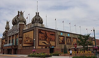
Mitchell is a city in and the county seat of Davison County, South Dakota, United States. The population was 15,660 at the 2020 census making it the sixth most populous city in South Dakota.

<span class="mw-page-title-main">Gary, South Dakota</span> City in South Dakota, United States

Gary is a city in Deuel County, South Dakota, United States. The population was 240 at the 2020 census. South Dakota Highway 101 serves as the main route of the community. In 2022, the town celebrated its 150th anniversary.

<span class="mw-page-title-main">Oelrichs, South Dakota</span> Town in South Dakota, United States

Oelrichs is a town in Fall River County, South Dakota, United States. The population was 117 at the 2020 census.

<span class="mw-page-title-main">Rockham, South Dakota</span> Town in South Dakota, United States

Rockham is a town in Faulk County, South Dakota, United States, off U.S. Route 212, and was a stop on the old Chicago and North Western Railway. The population was 22 at the 2020 census.

<span class="mw-page-title-main">Dallas, South Dakota</span> Town in South Dakota, United States

Dallas is a town in Gregory County, South Dakota, United States. The population was 89 at the 2020 census.

<span class="mw-page-title-main">Gregory, South Dakota</span> City in South Dakota, United States

Gregory is a city in western Gregory County, South Dakota, United States. The population was 1,221 at the 2020 census.

<span class="mw-page-title-main">Midland, South Dakota</span> Town in South Dakota, United States

Midland is a rural small town in the southeastern corner of Haakon County, South Dakota, United States. The population was 112 at the 2020 census.

<span class="mw-page-title-main">Philip, South Dakota</span> City in South Dakota, United States

Philip is a town in and the county seat of rural Haakon County, South Dakota, United States. The population was 759 at the 2020 census.

<span class="mw-page-title-main">Blackhawk, South Dakota</span> CDP in South Dakota, United States

Black Hawk is an unincorporated census-designated place (CDP) in Meade County, South Dakota, United States. The population was 3,026 at the 2020 census. Black Hawk has been assigned the ZIP code of 57718. Located along Interstate 90, Black Hawk is part of the Rapid City metropolitan area.

<span class="mw-page-title-main">Brandon, South Dakota</span> City in South Dakota, United States

Brandon is a city in Minnehaha County, South Dakota, United States. Brandon is located five miles east of Sioux Falls. The population was 11,048 as of the 2020 census.

<span class="mw-page-title-main">Quinn, South Dakota</span> Town in South Dakota, United States

Quinn is a town in Pennington County, South Dakota, United States. The population was 63 at the 2020 census. The town is the home of the Badlands Observatory, located in the former community hospital, built in 1950.

<span class="mw-page-title-main">Amasa, Michigan</span> Census-designated place & unincorporated community in Michigan, United States

Amasa is an unincorporated community and census-designated place (CDP) in Iron County in the U.S. state of Michigan. The population of the CDP was 195 at the 2020 census. The community is located within Hematite Township.

<span class="mw-page-title-main">Watersmeet, Michigan</span> Census-designated place & unincorporated community in Michigan, United States

Watersmeet is an unincorporated community and census-designated place (CDP) in Watersmeet Township, Michigan. As of the 2010 census, the CDP had a population of 428, out of a total population in the township of 1,417. The community was platted in 1884, designated as a station of the Milwaukee Lake Shore and Western Railroad.

<span class="mw-page-title-main">Oral, South Dakota</span> Unincorporated community in South Dakota, United States

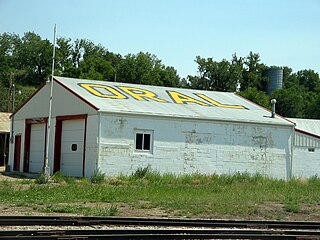
Oral is an unincorporated community and census-designated place (CDP) in Fall River County, South Dakota, United States. The population was 66 at the 2020 census.

Saint Onge is an unincorporated community and census-designated place (CDP) in Lawrence County, South Dakota, United States. As of the 2020 census, the population was 170.

Smithwick is an unincorporated community and census-designated place (CDP) in Fall River County, South Dakota, United States. The population was 39 at the 2020 census. Smithwick has been assigned the ZIP code of 57782.

Shindler is an unincorporated community and census-designated place (CDP) in Lincoln County, South Dakota, United States. The population was 607 at the 2020 census.

Dudley is an unincorporated community and census-designated place (CDP) in Fall River County, South Dakota, United States. The population was 28 at the 2020 census. It was first listed as a CDP prior to the 2020 census.

References

  1. "ArcGIS REST Services Directory". United States Census Bureau. Retrieved October 15, 2022.
  2. 1 2 U.S. Geological Survey Geographic Names Information System: Mansfield, South Dakota
  3. "Census Population API". United States Census Bureau. Retrieved October 15, 2022.
  4. "U.S. Census Bureau: Mansfield CDP, South Dakota". www.census.gov. United States Census Bureau. Retrieved February 12, 2022.
  5. "Census of Population and Housing". Census.gov. Retrieved June 4, 2016.
  6. Chicago and North Western Railway Company (1908). A History of the Origin of the Place Names Connected with the Chicago & North Western and Chicago, St. Paul, Minneapolis & Omaha Railways. p. 97.
  7. Federal Writers' Project (1940). South Dakota place-names, v.1-3. University of South Dakota. p. 49. Archived from the original on October 27, 2016.