
Parksville is a city on Vancouver Island in British Columbia, Canada. As of the 2021 Census, Parksville's population was 13,642, representing a 9.5% increase over the 2016 Census.

Madeira Park is an unincorporated community in the area of Pender Harbour on the Sunshine Coast of southwestern British Columbia, Canada.

Lasqueti Island is an island off the east coast of Vancouver Island in the Strait of Georgia, qathet Regional District, British Columbia, Canada and has a population of 498. A passenger-only ferry connects the island to the community of French Creek, near Parksville. The ferry makes two to three runs per day, six days per week, weather permitting. The ferry service is run by Western Pacific Marine for BC Ferries.
Wilmer is a small settlement near Invermere, British Columbia. The settlement was originally known as Peterborough and was founded in 1886. The explorer David Thompson founded a Northwest trading company post near the present-day site of Wilmer after crossing the Rockies via Howse Pass in 1807. Thompson spent a winter there while mapping the region. The site of the fort is now the National Historic Site Kootenae House.
Merville is an unincorporated community in the Comox Valley between the City of Courtenay, Mount Washington, Dove Creek, and Black Creek near the east coast of Vancouver Island. It was named by Canadian World War I soldiers returning to the Island after fighting in France; they named it after Merville-Franceville-Plage, where the Canadians had their first field headquarters.

Copeland Islands Marine Provincial Park is a provincial park in British Columbia, Canada, located in Desolation Sound to the northwest of Lund on the northern Sunshine Coast off the west coast of the Malaspina Peninsula.
Norbury Lake Provincial Park is a 97-hectare (240-acre) provincial park in British Columbia, Canada.
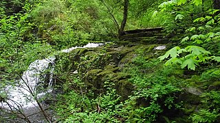
Walsh Cove Provincial Park is a provincial park in located on the northeast corner of West Redonda Island in British Columbia, Canada. The park is approximately 85 ha. in size and overlooks Waddington Channel.
Roscoe Bay Provincial Park is a provincial park in British Columbia, Canada, comprising the southeast portion of West Redonda Island, facing Desolation Sound and Waddington Channel.
Honeymoon Bay is an unincorporated community in the Canadian province of British Columbia. It is located on Cowichan Lake in the southeastern part of Vancouver Island — approximately 75 kilometres (47 mi) northwest of Victoria — at 48°49′N124°10′W. In 2011, its population was listed at 580.
Errington is a small community on Vancouver Island, British Columbia, Canada, located on Errington Road, off Highway 4, just south of Parksville and Qualicum Beach.

De Courcy Island is one of the Gulf Islands of the coast of southwestern British Columbia, Canada, located between the Pylades and Stuart Channels approximately 16 km (9.9 mi) southeast of Nanaimo and approximately 38 km (24 mi) west of Vancouver.

Cortes Island is an island in the Discovery Islands archipelago on the coast of British Columbia, Canada. The island is 25 km (16 mi) long, 13 km (8 mi) wide, and 130 km2 (50 sq mi) in area. It has a population of 1,035 permanent residents. Cortes Island lies within Electoral Area B of the Strathcona Regional District, which provides water and sewage systems, fire protection, land use planning, parks, recreation, and emergency response.
Bliss Landing, formerly Bishop Landing or Bishops Landing, was a cannery town on the South Coast of British Columbia, Canada, located on the northwest side of the Malaspina Peninsula on the upper Sunshine Coast, north of the town of Lund and across the mouth of Desolation Sound from Cortes Bay and Manson's Landing on Cortes Island.
Robson Bight is a small Vancouver Island bay at the west end of Johnstone Strait across from West Cracroft Island in British Columbia, Canada that includes a protected killer whale habitat famous for its whale-rubbing beaches. The bight is adjacent to Lower Tsitika River Provincial Park. The nearest access point is Telegraph Cove on the east coast of Northern Vancouver Island.
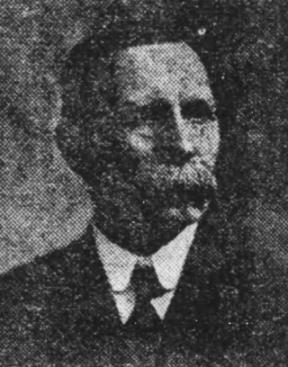
Michael Manson was a Scottish-born farmer and political figure in British Columbia. He represented Comox from 1909 to 1916 and Mackenzie from 1924 to 1933 in the Legislative Assembly of British Columbia as a Conservative.

The Ballenas Islands are a pair of islands in the Strait of Georgia off the coast of British Columbia, Canada. West Ballenas Island is a BC Provincial Park while South Ballenas Island remains Crown land held by the Government of Canada. The Ballenas Island Light is on the northern tip of West Ballenas Island.
Topley Landing is an unincorporated community at the outlet of the Fulton River on the western shore of Babine Lake in northwest British Columbia, Canada.
Cape Lazo is a headland at the tip of the Comox Peninsula on Vancouver Island, British Columbia, Canada. The community of Lazo is located near the cape.
Irvines Landing was the first post-contact settlement in the ḵalpilin area, and quickly became a hub for supplies and provisions. The first settler in Pender Harbour was an English immigrant named Charles Irvine, who established a small trading post in 1865. Steve Dames, a displaced seaman from Riga, Latvia, and Joe Perry of Cape Verde became familiar with Irvines Landing, and purchased it in 1898. Perry's father-in-law, Joseph Gonsalves of Madeira Island, later moved up from Brockton Point. Under the name Gonsalves and Dames General Traders, they expanded their holdings and built the Irvines Landing Hotel and Store. An early Union Steamer stop for settlers and loggers, it grew into a fish-processing centre and later a yacht anchorage and vacation spot. Often referred to as Irvine's Landing, the official name has no apostrophe according to the BC Geographical Names service, Irvines Landing. This is in keeping with the convention established in the late 1800s of removing apostrophes from place names in Canada.
