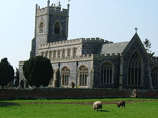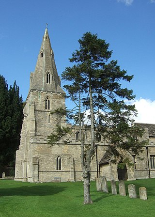
Edington is a village and civil parish in Wiltshire, England, about 4 miles (6 km) east-northeast of Westbury. The village lies under the north slope of Salisbury Plain and the parish extends south onto the Plain. Its Grade I listed parish church was built for Edington Priory in the 14th century.

Colwinston is both a village and a community in the Vale of Glamorgan, Wales, approximately 4 miles (6.4 km) southeast of the centre of Bridgend and 21 miles (34 km) west of the centre of Cardiff. The village is located within 1⁄2 mile (0.80 km) of the A48. The population in 2005 was approximately 400 but with recent building development, the population is now estimated at over 600 people.

Stratford St. Mary is a village in Suffolk, England in the heart of 'Constable Country'. John Constable painted a number of paintings in and around Stratford.

Great Casterton is a village and civil parish in the county of Rutland in the East Midlands of England. It is located at the crossing of the Roman Ermine Street and the River Gwash.

North Luffenham is a village in Rutland, in the East Midlands of England. The population of the civil parish at the 2001 census was 704, decreasing to 679 at the 2011 census. It lies to the north of the River Chater, 5 miles (8.0 km) east of Uppingham and 7 miles (11 km) west of Stamford. Located to the north of the village is St George's Barracks, formerly RAF North Luffenham.

Empingham is a village in the county of Rutland in the East Midlands of England. The population of the civil parish was 815 at the 2001 census including Horn and increasing to 880 at the 2011 census. It lies close to the dam of Rutland Water and the A606 runs through the village. During construction, Empingham Reservoir was the name of the reservoir but it was renamed Rutland Water to preserve the name of the county which was being merged with Leicestershire.
Gunthorpe is a civil parish and a hamlet in the county of Rutland in the East Midlands of England.

Stoke Dry is a village and civil parish in the county of Rutland in the East Midlands of England, about three miles (5 km) southwest of Uppingham.

Martinsthorpe is a civil parish in the county of Rutland in the East Midlands of England.

Docking is a village and ancient civil parish in the north-west of the English county of Norfolk. It is near the North Norfolk Coast Site of Special Scientific Interest.

Tatsfield is a village and civil parish in the Tandridge District of Surrey, England. It is located 3.3 miles north west of Westerham and 3.9 miles north east of Oxted, and is adjacent to the Surrey border with both Greater London and Kent.
Linchmere, also spelled Lynchmere, is a village and a civil parish, the northernmost parish in the Chichester district of West Sussex, England. It is between Haslemere and Liphook, south of the B2131 road. As well as Linchmere village, the parish contains the settlements of Hammer and Camelsdale.

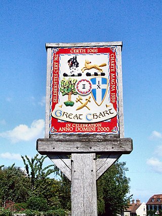
Great Chart is a village and former civil parish, now in the parish of Great Chart with Singleton, in the Ashford borough of Kent, England. The parish is split between the ancient village of Great Chart and the modern Singleton neighbourhood on the western outskirts of Ashford. The village centre of Great Chart is 2 miles (3.2 km) from the town centre. In 1961 the parish had a population of 969.
Cogges is an area beside the River Windrush in Witney, Oxfordshire, 0.5 miles (800 m) east of the town centre. It had been a separate village and until 1932 it was a separate civil parish.

Newington is a village and civil parish in the borough of Swale in Kent, England. The parish is located beside the A2 road between Rainham to the west and Sittingbourne to the east. The population of the parish in 2011 was 2,551.

Fiskerton is a village and former civil parish, now in the parish of Fiskerton cum Morton, in the Newark and Sherwood district, in the county of Nottinghamshire, England. It is on the west bank of the River Trent about 3 miles southeast of Southwell. The waterfront is home to million-pound residential properties, previously residences of merchants and businessmen who commuted in the 1800s to nearby Nottingham by rail from Fiskerton Station. In 1881 the parish had a population of 283.

Wardley is a village and civil parish in the county of Rutland in the East Midlands of England. The population at the 2001 census was 32. At the 2011 census the population remained less than 100 and is included in the civil parish of Ridlington. It is located about two miles (3 km) west of Uppingham, close to the A47.

Greasley is a civil parish north west of Nottingham in Nottinghamshire, England. Although it is thought there was once a village called Greasley, there is no settlement of that name today as it was destroyed by the Earl of Rutland. The built up areas in the parish are Beauvale, Giltbrook, Moorgreen, Newthorpe, Watnall and parts of Eastwood, Kimberley and Nuthall. There is also a small hamlet known as Bog-End. The parish is one of the largest in Nottinghamshire at 7.63 square miles (19.8 km2), the 2001 UK Census reporting it had a total population of 10,467, increasing to 11,014 in 2011, and 11,241 at the 2021 census.

Duddington is a village and former civil parish, now in the parish of Duddington-with-Fineshade, in the North Northamptonshire district, in the ceremonial county of Northamptonshire, England. It is by the junction of the A47 and A43 roads, and is 9 kilometres (6 mi) southwest of the town of Stamford. The village is on the east bank of the River Welland which is the county boundary of Rutland. In 1961 the parish had a population of 184.

South Newington is a village and civil parish on the south bank of the River Swere in the Cotswold Hills in Oxfordshire, England, about 5 miles (8 km) southwest of Banbury. The 2011 Census recorded the parish's population as 285.


