Marsh Farmhouse

Last updated

Marsh Farmhouse
Marsh Farm
Marsh House Farm
Marsh Farmhouse.jpg
The farmhouse in 1925
Location Thornton-Cleveleys, Lancashire, England
Coordinates 53°52′18″N3°01′09″W / 53.87162°N 3.01928°W / 53.87162; -3.01928
Area Borough of Wyre
Built1803(221 years ago) (1803)
Listed Building – Grade II
Designated16 August 1983
Reference no. 1073153
Location map United Kingdom Borough of Wyre.svg
Red pog.svg
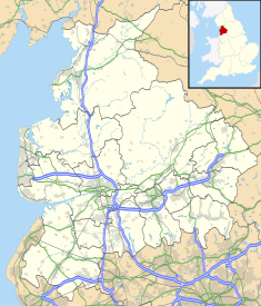
Location of Marsh Farmhouse in the Borough of Wyre
Lancashire UK location map.svg
Red pog.svg
Marsh Farmhouse (Lancashire)

Marsh Farmhouse is an historic building in Thornton-Cleveleys, Lancashire, England. Built in 1803, it is a Grade II listed building. [1] It is located to the southeast of today's Amounderness Way roundabout at Victoria Road East (known as Ramper Road at the time). [2]

Contents

The farmhouse is in brick with stone dressings, partly rendered, with a concrete tiled roof. It has two storeys and a symmetrical two-bay front. The central doorway has a semicircular relieving brick arch with stone imposts and a keystone inscribed with the name "B. F. Hesketh Esq 1803", [1] referring to Bold Fleetwood Hesketh, [2] son of Fleetwood Hesketh and Frances Bold. The windows are sashes. [3]

Hesketh died in 1819, aged 57, and was buried in the churchyard of St Chad's Church, Poulton-le-Fylde, alongside his parents. [4]

See also

Related Research Articles

<span class="mw-page-title-main">Borough of Wyre</span> Borough and non-metropolitan district in England

Wyre is a local government district with borough status on the coast of Lancashire, England. The council is based in Poulton-le-Fylde and the borough also contains the towns of Cleveleys, Fleetwood, Garstang, Preesall and Thornton, along with numerous villages and surrounding rural areas. Some of the borough's built-up areas form part of the wider Blackpool urban area. Eastern parts of the borough lie within the Forest of Bowland, a designated Area of Outstanding Natural Beauty.

<span class="mw-page-title-main">Poulton-le-Fylde</span> Human settlement in England

Poulton-le-Fylde, commonly shortened to Poulton, is a market town in Lancashire, England, situated on the coastal plain called the Fylde. In the 2021 United Kingdom census, it had a population of 18,115.

<span class="mw-page-title-main">Cleveleys</span> Human settlement in England

Cleveleys is a town on the Fylde Coast of Lancashire, England, about 4 miles (6 km) north of Blackpool and 2 miles (3 km) south of Fleetwood. It is part of the Borough of Wyre. With its neighbouring settlement of Thornton, Cleveleys was part of the former urban district of Thornton-Cleveleys and is part of the Blackpool Urban Area. In 2011 the Cleveleys Built-up area sub division had a population of 10,754.

<span class="mw-page-title-main">Thornton, Lancashire</span> Human settlement in England

Thornton is a village in the Borough of Wyre, about 4 miles (6 km) north of Blackpool and 2 miles (3 km) south of Fleetwood. The civil parish of Thornton became an urban district in 1900, and was renamed Thornton-Cleveleys in 1927. In 2011 the Thornton built-up area sub division had a population of 18,941.

Thornton-Cleveleys is a conurbation consisting of the village of Thornton and the town of Cleveleys. The two settlements formed a joint urban district from 1927 until 1974, before becoming part of Wyre. The two settlements constitute part of the Blackpool Urban Area.

Rossall is a settlement in Lancashire, England and a suburb of the market town of Fleetwood. It is situated on a coastal plain called The Fylde. Blackpool Tramway runs through Rossall, with two stations: Rossall School on Broadway and Rossall Square on South strand.

<span class="mw-page-title-main">Thornton–Cleveleys railway station</span> Station in Lancashire, UK (1865–1970)

Thornton–Cleveleys was a railway station in England which served the Lancashire village of Thornton and town of Cleveleys. Located on the now disused line between Poulton-le-Fylde and Fleetwood, the station also had a shunting yard for the making-up of freight trains for Preston and beyond. During its life it was also known at times as Thornton station and Thornton for Cleveleys station. In the 1860s and early 1870s the line was of great importance, being the direct route from London to Glasgow. Before the Shap route was opened, passengers would travel from Euston to Fleetwood and then onwards via steamer to Scotland.

<span class="mw-page-title-main">Peter Hesketh-Fleetwood</span> English politician

Sir Peter Hesketh-Fleetwood, 1st Baronet, was an English landowner, developer and Member of Parliament who founded the town of Fleetwood, in Lancashire, England. Born Peter Hesketh, he changed his name by Royal assent to Hesketh-Fleetwood, incorporating the name of his ancestors, and was later created Baronet Fleetwood. Predeceased by an older brother, he inherited estates in west Lancashire in 1824. Inspired by the transport developments of the early 19th century, he decided to bring the railway to the Lancashire coast and develop a holiday resort and port. He hired architect Decimus Burton to design his new town, which he named Fleetwood; construction began in 1836. Hesketh-Fleetwood was instrumental in the formation of the Preston and Wyre Railway Company and with his financial support, a railway line was built between Preston and Fleetwood which opened in 1840.

<span class="mw-page-title-main">St Chad's Church, Poulton-le-Fylde</span> Church in Lancashire, England

St Chad's Church is an Anglican church in Poulton-le-Fylde, Lancashire, England. It is an active parish church in the Diocese of Blackburn and the archdeaconry of Lancaster. It is recorded in the National Heritage List for England as a designated Grade II* listed building. A church on the site was built no later than the 11th century and may have existed prior to the Norman conquest of England. The tower dates from the 17th century, and much of the remainder of the building from a major renovation in the 18th century, although some of the fabric of the original structure remains. Further renovation and additions took place in the 19th, 20th and 21st centuries.

<span class="mw-page-title-main">St Peter's Church, Fleetwood</span> Church in Lancashire, England

St Peter's Church is in the seaside town of Fleetwood, Lancashire, England, situated on the Fylde coast. It is an active Anglican parish church in the Diocese of Blackburn. It was completed in 1841, to a design by Decimus Burton. Burton had been employed by Peter Hesketh-Fleetwood in 1836 to lay out the new planned town of Fleetwood. It is protected as a Grade II listed building.

<span class="mw-page-title-main">Marsh Mill</span>

Marsh Mill is an 18th-century tower windmill in Thornton, Lancashire, England. It was built in 1794 by Ralph Slater for local landowner Bold Hesketh. It functioned as a corn mill until the 1920s and has been fully restored. It is a good example of a complete English windmill and has been designated a Grade II* listed building.

<span class="mw-page-title-main">Burn Naze</span> Human settlement in England

Burn Naze is a residential area of Thornton-Cleveleys, in the Borough of Wyre, Lancashire, England. It is located about 5 miles (8 km) northeast of Blackpool and 2 miles (3 km) southeast of Fleetwood. Cleveleys is about 1.3 miles (2.1 km) to the west, while the River Wyre is about 0.8 miles (1.3 km) to the east.

<span class="mw-page-title-main">Skippool</span> Human settlement in England

Skippool is an area of Thornton-Cleveleys, Lancashire, England. It is situated between Little Thornton and Poulton-le-Fylde along the western banks of the River Wyre, about three miles south of its mouth between Fleetwood and Knott End. These banks are known as Skippool Creek, an historic docks area now home to mostly run-down vessels. The MV Good Hope, for example, may date from the 1830s. Skippool Creek is a short branch off Main Dyke, which empties into the River Wyre in front of Blackpool and Fleetwood Yacht Club.

Thornton-Cleveleys is an unparished area in the Wyre district of Lancashire, England. It contains eleven buildings that are recorded in the National Heritage List for England as designated listed buildings. Of these, one is at Grade II*, the middle grade, and the others are at Grade II, the lowest grade. The parish has an agricultural background, and is now largely residential. The listed buildings consist of former farmhouses, other houses and cottages, a windmill, a war memorial, and two churches.

<span class="mw-page-title-main">Illawalla</span> Edwardian mansion in Lancashire, England

Illawalla was an Edwardian single-story building in the Skippool area of Thornton, Lancashire, England. Built in 1902, it was demolished in 1996, after lying derelict for six years, to make way for three exclusive homes. Its name is preserved in the name of the road on which these houses now stand and also in the name of the adjacent cricket club, whose grounds partly occupy the land Illawalla stood on.

<span class="mw-page-title-main">Raikes Farmhouse</span> Historic building in Lancashire, England

Raikes Farmhouse is an historic building in Thornton-Cleveleys, Lancashire, England. Replacing a building dating from at least 1595, the current structure was built in 1692, with a rear extension added in the 19th century. It has been designated a Grade II listed building by Historic England. The property is located on Raikes Road, just southeast of its junction with Stanah Road and Hillylaid Road.

<span class="mw-page-title-main">Hackensall Hall</span> Building in Preesall, Lancashire, England

Hackensall Hall, also known as Hackensall Hall Farmhouse, is an historic building on Whinny Lane in Preesall, Lancashire, England. It is Grade II listed, built in 1873.

<span class="mw-page-title-main">Four Lane Ends, Thornton-Cleveleys</span> Junction in Thornton-Cleveleys, England

Four Lane Ends is a road junction in Thornton-Cleveleys, Lancashire, England. It is formed by the meeting of the north–south-running Fleetwood Road and the east–west-bound Victoria Road, the B5412. The names of both roads change in line with their directions at the junction, with Fleetwood Road North becoming Fleetwood Road South and Victoria Road East becomes Victoria Road West.

<span class="mw-page-title-main">Cockle Hall</span> Human settlement in England

Cockle Hall is an historic location in Thornton-Cleveleys, Lancashire, England. Located in today's Wyre Estuary Country Park, it was the location of one of the earliest crossings of the River Wyre, and was used as such until the 1930s. It is also the former site of a two-storey cottage occupied by the Lawrenson family of thirteen. It was located a short distance along today's footpath running from the car park at Wyre Estuary, along the western banks of the river. The ferryman who took people to and brought people from Wardleys Creek, on the eastern side of the river, also lived there.

<span class="mw-page-title-main">Victoria Road, Thornton-Cleveleys</span> Road in Lancashire, England

Victoria Road is a major thoroughfare in Thornton-Cleveleys, Lancashire, England. Originally known as Ramper Road, it runs for about 2 miles (3.2 km) from Station Road in Thornton in the east to South Promenade in Cleveleys in the west. Its addresses are denoted as "Victoria Road East" or "Victoria Road East", the split occurring at the Amounderness Way roundabout carrying traffic of the A585 between Poulton-le-Fylde and Fleetwood. The road picks up the B5412 designation from Station Road until The Crescent and Brighton Avenue in Cleveleys.

References

  1. 1 2 Marsh FarmhouseHistoric Environment Scotland
  2. 1 2 A History of Blackpool, the Fylde and South Wyre – Nick Moore (2018), p. 230
  3. Historic England & 1073153
  4. Porter, John (1876). History of the Fylde of Lancashire. p. 160.
Sources