
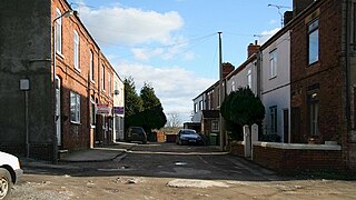
Marsh Lane village is located in the civil parish of Eckington in North-East Derbyshire, England. [1] It is 6 miles north east of Chesterfield. In 2011 the village had a population of 895.[ citation needed ]
Marsh Lane village is located in the civil parish of Eckington in North-East Derbyshire, England. [1] It is 6 miles north east of Chesterfield. In 2011 the village had a population of 895.[ citation needed ]
Marsh Lane has a primary school which was built in the 1870s. [2] It also has a nursery for children aged 3–4 years of age.[ citation needed ]
As the village is located on the border of South Yorkshire and Derbyshire, it has its own accent. A cross between the Sheffield (as opposed to Yorkshire) and Chesterfield accents, Chesterfield being the predominant.[ citation needed ]

Chesterfield is a market town in the Borough of Chesterfield, Derbyshire, England. It is 24 miles (39 km) north of Derby and 11 miles (18 km) south of Sheffield at the confluence of the River Rother and River Hipper. In 2011, the built-up-area subdivision had a population of 88,483, making it the second-largest settlement in Derbyshire, after Derby. The wider borough had a population of 103,801 in 2011. In 2011, the town had a population of 76,753.


North East Derbyshire is a local government district in Derbyshire, England. The council is based in the large village of Wingerworth. The district also includes the towns of Dronfield and Clay Cross as well as numerous villages and surrounding rural areas.

Dronfield is a town in North East Derbyshire, England, which includes Dronfield Woodhouse and Coal Aston. It lies in the valley of the River Drone between Chesterfield and Sheffield. The Peak District National Park is three miles (4.8 km) to the west. The name comes from the Old English Dranfleld, probably meaning an open land infested with drone bees.

Bolsover District is a local government district in Derbyshire, England. It is named after the town of Bolsover, which is near the geographic centre of the district, but the council is based in the large village of Clowne to the north. The district also includes the town of Shirebrook and several villages and surrounding rural areas.

Wales is a village and a civil parish in the Metropolitan Borough of Rotherham in South Yorkshire, England. Historically part of the West Riding of Yorkshire, it borders to the south Derbyshire and is astride the M1 motorway. The civil parish of Wales, which has a population of 6,455, increasing to 7,069 at the 2011 Census, encompasses the village and neighbouring settlement Kiveton Park.

Clay Cross is a town and a civil parish in the North East Derbyshire district of Derbyshire, England. It is a former industrial and mining town, about 5 miles (8.0 km) south of Chesterfield. It is directly on the A61. Surrounding settlements include North Wingfield, Tupton, Pilsley and Ashover.

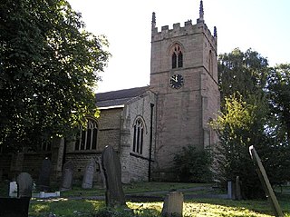
Eckington is a village and civil parish in North East Derbyshire, England. It is 7 miles (11 km) northeast of Chesterfield and 9 miles (14 km) southeast of Sheffield city centre, on the border with South Yorkshire.
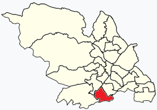


North East Derbyshire is a constituency created in 1885 represented in the House of Commons of the UK Parliament since 2017 by Lee Rowley of the Conservative Party. This was the first time a Conservative candidate had been elected since 1935.
Killamarsh is a village and civil parish in North East Derbyshire, England, bordering Rotherham to the north and Sheffield to the north-west.

Ridgeway is a village in Eckington parish, North East Derbyshire in the English county of Derbyshire.
Pilsley is a village and civil parish in the district of North East Derbyshire in the county of Derbyshire, England. It is located near to the town of Chesterfield. At the 2011 Census the population was 3,487.

Newbold is a village north of Chesterfield, Derbyshire, England, which in 2001 had a population of just under 8,000.

Newton is a village in the Bolsover district of Derbyshire, England, about a mile south of Tibshelf. Population details are included in the civil parish of Blackwell.
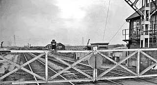
Beighton railway station is a former railway station near the village of Beighton on the border between Derbyshire and South Yorkshire, England.

Plumbley is a hamlet in the City of Sheffield borough, within the county of South Yorkshire in England.
Eckington Parish ... includes the villages of Marsh Lane, ...
53°18′29″N1°23′31″W / 53.308039°N 1.391859°W
| | This Derbyshire location article is a stub. You can help Wikipedia by expanding it. |