St Hilda's College is one of the constituent colleges of the University of Oxford in England. The college is named after the Anglo-Saxon Saint, Hilda of Whitby and was founded in 1893 as a hall for women; remaining a women's college until 2008. St Hilda's was the last single-sex college in the university as Somerville College had admitted men in 1994. The college now has almost equal numbers of men and women at both undergraduate and postgraduate level.
Marston is a village in the civil parish of Old Marston about 2 miles (3 km) northeast of the centre of Oxford, England. It was absorbed within the city boundaries in 1991. It is commonly called Old Marston to distinguish it from the suburb of New Marston that developed between St. Clement's and the village in the 19th and 20th centuries. The A40 Northern Bypass, part of the Oxford Ring Road forms a long north-west boundary of the village and parish and a limb, namely a distributary, of the Cherwell forms the western boundary.

Oxford Brookes University is a public university in Oxford, England. It is a new university, having received university status through the Further and Higher Education Act 1992. It can trace its origins to 1865, when it was founded as the Oxford School of Art. The university was named after its first principal, John Henry Brookes, who played a major role in the development of the institution.
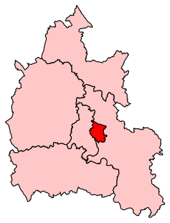
Oxford East is a constituency represented in the House of Commons of the UK Parliament by Anneliese Dodds of the Labour Party, who also serves as party chair.

Headington is an eastern suburb of Oxford, England. It is at the top of Headington Hill overlooking the city in the Thames valley below, and bordering Marston to the north-west, Cowley to the south, and Barton and Risinghurst to the east. The life of the large residential area is centred upon London Road, the main road between London and Oxford.
Risinghurst is an outlying residential area of Oxford, England, just outside the Eastern Bypass Road which forms part of the Oxford ring road. It is about 1 mile (1.6 km) east of the centre of Headington and 3 miles (4.8 km) east of Oxford city centre. It is part of the Risinghurst and Sandhills civil parish and is typical of housing estates built between the wars to house an increasingly prosperous working class who were moving into new urban centres—in this instance to take advantage of the burgeoning motor industry in Oxford.

New Marston is a suburb about 1.25 miles (2 km) northeast of the centre of Oxford, England.

The A420 is a road between Bristol and Oxford in England. Between Swindon and Oxford it is a primary route.

St Clement's is a district in Oxford, England, on the east bank of the River Cherwell. "St Clement's" is usually taken to describe a small triangular area from The Plain bounded by the Cherwell in the West, Cowley Road in the East. to the foot of Headington Hill in the South. It also refers to the ecclesiastical parish of St Clement's which includes some neighbouring areas and is used in the names of local City and County electoral districts.

The Plain is an important junction, now a roundabout constructed in 1950, just east of Magdalen Bridge in Oxford, England. To the east and southeast are St Clement's, Cowley Road and Iffley Road which leads to the Liddell Buildings of Christ Church on the other side of the Christ Church Meadow. Magdalen College School is to the south. Cowley Place, also to the south, leads to St Hilda's College, the most easterly college of the University of Oxford.
Headington Road is an arterial road in the east of Oxford, England. The road connects the junction of St Clements and Marston Road with the suburb of Headington, up Headington Hill. When it reaches the Headley Way junction, it becomes London Road, as the Boundary Brook runs under the road at this point.

Cotuit Hall is part of the EF International Academy's campus in Oxford, England. Until 2011 it was one of the halls of residence at Oxford Brookes University.
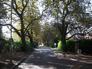
Pullens Lane is in Headington, east Oxford, England. It is located at the top of Headington Hill, leading north off Headington Road to Jack Straw's Lane and Harberton Mead. The cul-de-sac Pullens Field leads off west from Pullens Lane.
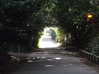
Jack Straw's Lane is a residential road in Oxford, England. It runs between the north end of Pullens Lane on Headington Hill and Marston Road.

Milham Ford School was a girls' secondary school in Oxford, England, located in the suburb of New Marston on Marston Road. It was founded in East Oxford in the 1880s and closed in 2003.
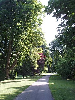
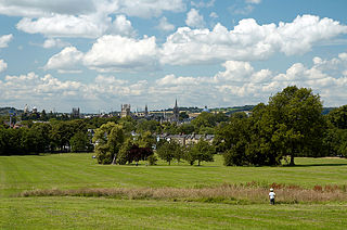
Headington Hill Park is a park on Headington Hill in the east of Oxford, England.
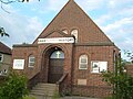
St Clement's Church is an evangelical Church of England parish church situated just to the east of central Oxford, England.
Thomas Lawrence Dale, FRIBA, FSA was an English architect. Until the First World War he concentrated on designing houses for private clients. From the 1930s Dale was the Oxford Diocesan Surveyor and was most noted for designing, restoring, and furnishing Church of England parish churches.