Martletwy (electoral ward)

Last updated
Location of the Martletwy ward within Pembrokeshire Pembrokeshire UK wards - Martletwy locator.png
Location of the Martletwy ward within Pembrokeshire

Martletwy is the name of an electoral ward in Pembrokeshire, Wales. [1] It is bordered to the west by the River Cleddau and includes three communities within its boundaries, namely Llawhaden, Martletwy, and Uzmaston, Boulston and Slebech. The ward elects a councillor to Pembrokeshire County Council.

The wards and electoral divisions in the United Kingdom are electoral districts at sub-national level represented by one or more councillors. The ward is the primary unit of English electoral geography for civil parishes and borough and district councils, electoral ward is the unit used by Welsh principal councils, while the electoral division is the unit used by English county councils and some unitary authorities. Each ward/division has an average electorate of about 5,500 people, but ward-population counts can vary substantially. As at the end of 2014 there were 9,456 electoral wards/divisions in the UK.

Pembrokeshire County in Wales

Pembrokeshire is a county in the southwest of Wales. It is bordered by Carmarthenshire to the east, Ceredigion to the northeast, and the sea everywhere else.

Wales Country in northwest Europe, part of the United Kingdom

Wales is a country that is part of the United Kingdom and the island of Great Britain. It is bordered by England to the east, the Irish Sea to the north and west, and the Bristol Channel to the south. It had a population in 2011 of 3,063,456 and has a total area of 20,779 km2 (8,023 sq mi). Wales has over 1,680 miles (2,700 km) of coastline and is largely mountainous, with its higher peaks in the north and central areas, including Snowdon, its highest summit. The country lies within the north temperate zone and has a changeable, maritime climate.

According to the 2011 UK Census the population of the ward was 1,970. [2]

County elections

Martletwy has been a ward to Pembrokeshire County Council since 1995. [3]

At the May 2017 Pembrokeshire County Council election the sitting Independent councillor was beaten by the Welsh Conservative Party candidate, Di Clements. [4]

2017 Pembrokeshire County Council election

An election to Pembrokeshire County Council will be held on 4 May 2017 as part of wider local elections across Wales. The election was preceded by the 2012 election.

An independent or nonpartisan politician is an individual politician not affiliated with any political party. There are numerous reasons why someone may stand for office as an independent.

2017 Pembrokeshire County Council election [4]
PartyCandidateVotes%±
Conservative Di Clements 591
Independent Rob Lewis *263

Lewis had represented the ward since May 2004. [3] He had been a member of the ruling Independent Plus Political Group which had suffered heavy losses in 2017, losing almost two thirds of its councillors. [5]

Elections to Pembrokeshire County Council were held on 10 June 2004. It was preceded by the 1999 election and followed by the 2008 election. The results were drawn from the Pembrokeshire County Council website but the relevant page has now (2013) been deleted. On the same day there were elections to the other 21 local authorities in Wales, and to community council elections in Wales. There were also elections elsewhere in the United Kingdom

Related Research Articles

Pembrokeshire County Council

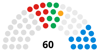
Pembrokeshire County Council is the governing body for Pembrokeshire, one of the Principal Areas of Wales.

Amroth is the name of an electoral ward in Pembrokeshire, Wales. It covers the community of Amroth which, as well as the village of Amroth included Summerhill, Stepaside, Pleasant Valley and Wiseman's Bridge and well as the hamlets at Llanteg and Llanteglos.

Camrose, Pembrokeshire (electoral ward)

Camrose is the name of an electoral ward in Pembrokeshire, Wales. The ward consists of the communities of Camrose and Nolton and Roch. The community of Camrose consists of part of Pembrokeshire Coast National Park

Milford Central

Milford Central is the name of an electoral ward in Pembrokeshire, Wales. It covers the central area of the town of Milford Haven including Pill and Milford Haven Docks. It elects a county councillor to Pembrokeshire County Council and three town councillors to Milford Haven Town Council.

Haverfordwest Castle (electoral ward)

Haverfordwest Castle is the name of an electoral ward in Pembrokeshire, Wales. It covers the centre of the town of Haverfordwest west of the river including the High Street, Winch Lane and north along Crowhill Road. It elects a councillor to Pembrokeshire County Council.

Milford Hakin

Milford Hakin is the name of an electoral ward in Pembrokeshire, Wales. It covers the Hakin area of the Milford Haven community, to the west of Milford Haven Docks. It elects a councillor to Pembrokeshire County Council and three councillors to Milford Haven Town Council.

Goodwick (electoral ward)

Goodwick is the name of an electoral ward in Pembrokeshire, Wales, covering the town of the same name. The ward elects a councillor to Pembrokeshire County Council. Six councillors are elected to the Fishguard and Goodwick Town Council.

Maenclochog (electoral ward)

Maenclochog is the name of an electoral ward in Pembrokeshire, Wales. It covers the Maenclochog community and four neighbouring communities, namely New Moat, Mynachlog-ddu, Llandissilio West and Clynderwen. The Maenclochog ward elects a councillor to Pembrokeshire County Council.

Haverfordwest Priory (electoral ward)

Haverfordwest Priory is the name of an electoral ward in Pembrokeshire, Wales. It covers the southern edge of the town of Haverfordwest, mostly west of the river but including Haverfordwest railway station at its eastern extreme, the Haverfordwest Priory from which it takes its name and the residential areas bounded by Freeman's Way and surrounding the Pembrokeshire College campus. The ward elects a councillor to Pembrokeshire County Council.

St Davids (Pembrokeshire electoral ward)

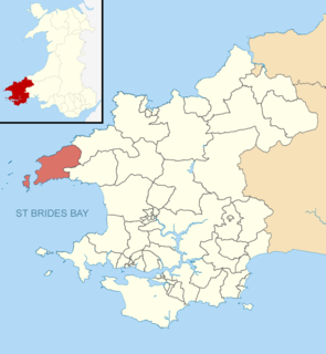
St David's is the name of an electoral ward in Pembrokeshire, Wales. It covers the small city of St Davids and the ward's boundaries are coterminous with those of the community of St Davids and the Cathedral Close. The ward elects a councillor to Pembrokeshire County Council.

Milford West

Milford West is the name of an electoral ward in Pembrokeshire, Wales. It covers the area of the town of Milford Haven immediately east of Milford Haven railway station and Hubberston Pill.

Pembroke St Mary South

Pembroke St Mary South is the name of an electoral ward in the town of Pembroke, Pembrokeshire, Wales. It covers the area including the town centre and Pembroke Castle and the town immediately to the west of St Daniel's Hill.

Pembroke St Mary North

Pembroke St Mary North is the name of an electoral ward in the town of Pembroke, Pembrokeshire, Wales. It covers the area of the town north of the Pembroke River and the Mill Pond.

Pembroke Dock Market

Pembroke Dock Market is the name of an electoral ward in the town of Pembroke Dock, Pembrokeshire, Wales.

Pembroke Dock Llanion

Pembroke Dock Llanion is the name of an electoral ward in the town of Pembroke Dock, Pembrokeshire, Wales.

Llanllwchaiarn West

Llanllwchaiarn West is the name of an electoral ward in the community of Newtown and Llanllwchaiarn, Powys, Wales.

Yscir (electoral ward)

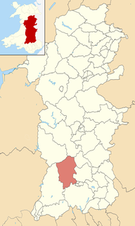
Yscir is the name of an electoral ward in southern Powys, Wales. It covers three local government communities and elects a councillor to Powys County Council.

Pembroke St Michael

Pembroke St Michael is the name of an electoral ward in the town of Pembroke, Pembrokeshire, Wales. It covers the east area of the town.

Narberth (electoral ward)

Narberth is the name of an electoral ward in Pembrokeshire, Wales. Since 1995 it has elected one councillor to Pembrokeshire County Council.

References

  1. "The County of Pembrokeshire (Electoral Arrangements) Order 1998". Legislation.gov.uk. Retrieved 19 February 2018.
  2. UK Census (2011). "Local Area Report – Martletwy 2011 Census Ward (1237328249)". Nomis. Office for National Statistics . Retrieved 20 February 2018.
  3. 1 2 "Pembrokeshire County Council Election Results 1995-2012" (PDF). The Elections Centre (Plymouth University). Retrieved 2 May 2019.
  4. 1 2 "All the results from the Pembrokeshire County Council elections as they happen". Western Telegraph. 5 May 2017. Retrieved 20 February 2018.
  5. "Jamie Adams: I wouldn't change how we handled Bryn Parry-Jones situation". Western Telegraph. 23 May 2017. Retrieved 20 February 2018.

Coordinates: 51°46′N4°52′W / 51.77°N 4.86°W / 51.77; -4.86

Geographic coordinate system Coordinate system

A geographic coordinate system is a coordinate system that enables every location on Earth to be specified by a set of numbers, letters or symbols. The coordinates are often chosen such that one of the numbers represents a vertical position and two or three of the numbers represent a horizontal position; alternatively, a geographic position may be expressed in a combined three-dimensional Cartesian vector. A common choice of coordinates is latitude, longitude and elevation. To specify a location on a plane requires a map projection.