Masasi Airport Uwanja wa Ndege wa Masasi (Swahili) | |||||||||||
---|---|---|---|---|---|---|---|---|---|---|---|
Summary | |||||||||||
Airport type | Public | ||||||||||
Owner | Government of Tanzania | ||||||||||
Operator | Tanzania Airports Authority | ||||||||||
Location | Masasi, Tanzania | ||||||||||
Elevation AMSL | 1,700 ft / 518 m | ||||||||||
Coordinates | 10°44′20″S38°46′20″E / 10.73889°S 38.77222°E Coordinates: 10°44′20″S38°46′20″E / 10.73889°S 38.77222°E | ||||||||||
Website | www | ||||||||||
Map | |||||||||||
Runways | |||||||||||
| |||||||||||
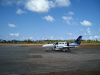
Masasi Airport( IATA : XMI, ICAO : HTMI) is an airport serving the town of Masasi in the Mtwara Region of Tanzania. It is 3 kilometres (1.9 mi) west of Masasi town.
An IATA airport code, also known as an IATA location identifier, IATA station code or simply a location identifier, is a three-letter code designating many airports around the world, defined by the International Air Transport Association (IATA). The characters prominently displayed on baggage tags attached at airport check-in desks are an example of a way these codes are used.
The ICAOairport code or location indicator is a four-letter code designating aerodromes around the world. These codes, as defined by the International Civil Aviation Organization and published in ICAO Document 7910: Location Indicators, are used by air traffic control and airline operations such as flight planning.
Mtwara Region is one of Tanzania's 31 administrative regions. The regional capital is the municipality of Mtwara. According to the 2012 national census, the region had a population of 1,270,854, which was lower than the pre-census projection of 1,374,767. For 2002-2012, the region's 1.2 percent average annual population growth rate was the 26th highest in the country. It was also the fourteenth most densely populated region with 76 people per square kilometer.
Transport in Tanzania includes road, rail, air and maritime networks. The road network is 86,472 kilometres (53,731 mi) long, of which 12,786 kilometres (7,945 mi) is classified as trunk road and 21,105 kilometres (13,114 mi) as regional road. The rail network consists of 3,682 kilometres (2,288 mi) of track. Commuter rail service is in Dar es Salaam only. There are 28 airports, with Julius Nyerere International being the largest and the busiest. Ferries connect Mainland Tanzania with the islands of Zanzibar. Several other ferries are active on the countries' rivers and lakes.
Bukoba Airport is an airport in northwestern Tanzania serving the town of Bukoba and the surrounding Kagera Region. It is adjacent to Lake Victoria.
Lindi Airport is an airport serving Lindi, the capital of the Lindi Region of Tanzania. It is also known as Kikwetu Airport.
Musoma Airport is an airport in northern Tanzania serving Musoma and the surrounding Mara Region.
Tabora Airport is an airport in west-central Tanzania serving Tabora. It is 8 kilometres (5.0 mi) south of the town. Surface access from Tabora is via the gravel Tabora to Ndembelwa village road, and then a three kilometre airport access gravel road. The airport is subject to flooding during heavy rains. Adjacent to the airport is the Tabora Command Military Base 202.
Mutukula Airport is an airport serving the town of Mutukula in the Rakai District of the Central Region of Uganda.
Lake Manyara Airport is an airport serving the Lake Manyara National Park in the Arusha Region of Tanzania.
Mafia Airport is an airport on Mafia Island in the Pwani Region of Tanzania. The island is in the Indian Ocean, 17 kilometres (11 mi) off the Tanzanian coast.
Mpanda Airport is an airport in western Tanzania serving the town of Mpanda and the surrounding Katavi Region. It is on the southeastern side of the town. The UN Refugee Agency UNHCR helped the Government of Tanzania to finance the upgrade of the airstrip into an airport as a gesture of its appreciation for hosting Burundian refugees for more than 30 years.
Iringa Airport is an airport in Tanzania serving Iringa and the surrounding Iringa Region. It is 13 kilometres (8.1 mi) northeast of the municipality. The airport's single runway lies parallel to the A104 trunk road.
Sumbawanga Airport is an airport in western Tanzania serving the town of Sumbawanga in Rukwa Region. The government has sought funds from the European Investment Bank for the upgrade of the airport.
Kilwa Masoko is an airport serving the town of Kilwa Masoko in the Lindi Region of Tanzania.
Nachingwea Airport is an airport in southern Tanzania serving Nachingwea. It is on the northeast side of the town.
Songea Airport is an airport in southern Tanzania serving the town of Songea and the surrounding Ruvuma Region. The runway is 7 kilometres (4.3 mi) west of the municipality.
Ngara Airport is an airport in northwestern Tanzania serving the town of Ngara.
Moshi Airport is an airport in the Kilimanjaro Region of north-eastern Tanzania, serving the municipality of Moshi.
Same Airstrip is an airstrip serving the town of Same in the Kilimanjaro Region of Tanzania.
Morogoro Airstrip is an airstrip serving the city of Morogoro in the Morogoro Region of Tanzania. It is 3.5 kilometres (2.2 mi) north of the town. The airstrip location is just off the western side of the prohibited airspace (HTP6) of the Ngerengere Air Force Base but lies within the restricted airspace (HTR7).
Mombo Airstrip is an airstrip in northeastern Tanzania in the Korogwe District of the Tanga Region of Tanzania. It is 5 kilometres (3.1 mi) west of the town, and near the Usambara Mountains.
Singida Airstrip is an airstrip in central Tanzania serving the municipality of Singida. It is 3 kilometres (1.9 mi) west of the town.
Songo Songo Airstrip is a private airstrip in eastern Tanzania on Songo Songo Island in Lindi Region.
The Aviation Safety Network (ASN) is a website that keeps track of aviation accidents, incidents, and hijackings. Their database contains details of over 10,700 reports. The ASN includes an aviation database with aviation investigations, news, photos, and statistics.
This article about an airport in Tanzania is a stub. You can help Wikipedia by expanding it. |