Cartography is the study and practice of making and using maps. Combining science, aesthetics and technique, cartography builds on the premise that reality can be modeled in ways that communicate spatial information effectively.

A geographer is a physical scientist, social scientist or humanist whose area of study is geography, the study of Earth's natural environment and human society, including how society and nature interacts. The Greek prefix "geo" means "earth" and the Greek suffix, "graphy," meaning "description," so a geographer is someone who studies the earth. The word "geography" is a Middle French word that is believed to have been first used in 1540.

Arthur H. Robinson was an American geographer and cartographer, who was professor in the Geography Department at the University of Wisconsin–Madison from 1947 until he retired in 1980. He was a prolific writer and influential philosopher on cartography, and one of his most notable accomplishments is the Robinson projection of 1961.
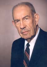
Richard Hartshorne was a prominent American geographer, and professor at the University of Wisconsin-Madison, who specialized in economic and political geography and the philosophy of geography. He is known in particular for his methodological work The Nature of Geography, published in 1939.

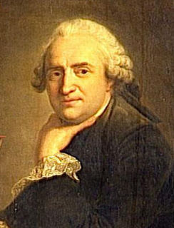
Jean-Baptiste Bourguignon d'Anville was a French geographer and cartographer who greatly improved the standards of map-making. D'Anville became cartographer to the king, who purchased his cartographic materials, the largest collection in France. He made more than 200 maps during his lifetime, which are characterized by a careful, accurate work largely based on original research. In particular, D'Anville left unknown areas of continents blank and noted doubtful information as such, contrary to the lavish maps of his predecessors. His maps remained the reference point in cartography throughout the 19th century and were used by numerous explorers and travellers.

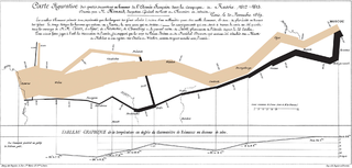
A thematic map is a type of map that portrays the geographic pattern of a particular subject matter (theme) in a geographic area. This usually involves the use of map symbols to visualize selected properties of geographic features that are not naturally visible, such as temperature, language, or population. In this, they contrast with general reference maps, which focus on the location of a diverse set of physical features, such as rivers, roads, and buildings. Alternative names have been suggested for this class, such as special-subject or special-purpose maps, statistical maps, or distribution maps, but these have generally fallen out of common usage. Thematic mapping is closely allied with the field of Geovisualization.

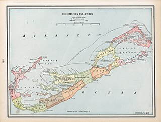
George Franklin Cram (1842-1928) was an American map publisher. He served in the U.S. Army during the American Civil War as a first sergeant in Company F of the 105th Illinois Volunteers serving until the end of the war. Upon mustering out he then joined his uncle Rufus Blanchard's Evanston map business in 1867. Two years later, he became sole proprietor of the firm and renamed it the George F. Cram Co. which became a leading map firm in the United States. The best known atlas began as The Standard Atlas of the United States which eventually was renamed the Unrivaled Family Atlas which ran for dozens of editions over many decades. His was one of the first American firms to publish a world atlas. Cram's firm was instrumental in developing the cerography technique, in which metal printing plates were created by electroplating a wax engraved model. It made large and vastly less expensive print runs possible, which brought more affordable maps into people's homes.
The history of cartography traces the development of cartography, or mapmaking technology, in human history. Maps have been one of the most important human inventions for millennia, allowing humans to explain and navigate their way through the world. The earliest surviving maps include cave paintings and etchings on tusk and stone, followed by extensive maps produced by ancient Babylon, Greece and Rome, China, and India. In their most simple form maps are two dimensional constructs, however since the age of Classical Greece maps have also been projected onto a three-dimensional sphere known as a globe. The Mercator Projection, developed by Flemish geographer Gerardus Mercator, was widely used as the standard two-dimensional projection of the earth for world maps until the late 20th century, when more accurate projections were formulated. Mercator was also the first to use and popularise the concept of the atlas as a collection of maps.
Mark Stephen Monmonier is a Distinguished Professor of Geography and the Environment at the Maxwell School of Citizenship and Public Affairs of Syracuse University. He specializes in toponymy, geography, and geographic information systems.
David Woodward was an English-born American historian of cartography and cartographer.
Critical cartography is a set of mapping practices and methods of analysis grounded in critical theory, specifically the thesis that maps reflect and perpetuate relations of power, typically in favor of a society's dominant group. Critical cartographers aim to reveal the “‘hidden agendas of cartography’ as tools of socio-spatial power”. While the term "critical cartography" often refers to a body of theoretical literature, critical cartographers also call for practical applications of critical cartographic theory, such as counter-mapping, participatory mapping, and neogeography.
(John) Brian Harley was a geographer, cartographer, and map historian at the universities of Birmingham, Liverpool, Exeter and Wisconsin–Milwaukee. He helped found the History of Cartography Project and was the founding co-editor of the resulting The History of Cartography. In recent years, Harley's work has gained broad prominence among geographers and social theorists, and it has contributed greatly to the emerging discipline of critical cartography.
Borden D. Dent (1938–2000) was an American geographer and cartographer who served as professor emeritus and chairman of the Department of Geography and Anthropology at Georgia State University. His textbook, Cartography: Thematic Map Design, is one of the seminal texts in the field, and its sixth edition was reissued in 2009.
Cartographic propaganda is a map created with the goal of achieving a result similar to traditional propaganda. The map can be outright falsified, or created using subjectivity with the goal of persuasion. The idea that maps are subjective is not new; cartographers refer to maps as a human-subjective product and some view cartography as an "industry, which packages and markets spatial knowledge" or as a communicative device distorted by human subjectivity. However, cartographic propaganda is widely successful because maps are often presented as a miniature model of reality, and it is a rare occurrence that a map is referred to as a distorted model, which sometimes can "lie" and contain items that are completely different from reality. Because the word propaganda has become a pejorative, it has been suggested that mapmaking of this kind should be described as "persuasive cartography", defined as maps intended primarily to influence opinions or beliefs – to send a message – rather than to communicate geographic information.
The History of Cartography Project is a publishing project in the Department of Geography at the University of Wisconsin–Madison. It was founded by David Woodward in 1981. Woodward directed the project until his death in August 2004; Matthew H. Edney became director in July 2005.
Jean-Baptiste Nolin was a French cartographer and engraver.
Lawrence Martin was an American geographer and President of the American Association of Geographers.
James Richard Akerman is an American geographer, director of the Newberry Library's Hermon Dunlap Smith Center for the History of Cartography. At the Newberry he serves as Curator of Maps. He is known for his work on the history of cartography.

This article covers the science, art and industry of cartography by the people of the Low Countries in the early modern period, especially in the early 16th to early 18th centuries. It includes cartography of the Northern Netherlands, Southern Netherlands and Low Countries in general. It also includes Dutch colonial cartography, i.e. cartography in the Dutch overseas world, in the early modern period.
Giovan Battista Nicolosi, D.D., was a Sicilian priest and geographer. Nicolosi proposed a new projection for the construction of the world map in two hemispheres, known today as the Nicolosi globular projection, in which the parallels and meridians are arcs of the circle and equidistant along the equator and central meridian.


