
NatureScot is the operating name for the body formally called Scottish Natural Heritage. It is an executive non-departmental public body of the Scottish Government responsible for the country's natural heritage, especially its natural, genetic and scenic diversity. It advises the Scottish Government on nature conservation, and acts as a government agent in the delivery of conservation designations, i.e. national nature reserves, local nature reserves, national parks, Sites of Special Scientific Interest (SSSIs), Special Areas of Conservation, Special Protection Areas and the national scenic areas. It receives annual funding from the Government in the form of Grant in Aid to deliver Government priorities for the natural heritage.

The national nature reserves (NNRs) of Scotland are areas of land or water designated under the Wildlife and Countryside Act 1981 as containing habitats and species of national importance. National nature reserves can be owned by public, private, community or voluntary organisations but must be managed to conserve their important habitats and species, as well as providing opportunities for the public to enjoy and engage with nature. There are currently 43 NNRs in Scotland, which cover 154,250 hectares (1,542.5 km2), or less than 1.5% of the land area of Scotland. They range in size from Corrieshalloch Gorge at 7 ha to Mar Lodge Estate, which covers 29,324 ha.
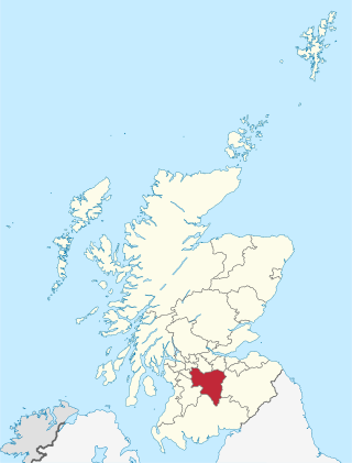
South Lanarkshire is one of 32 unitary authorities of Scotland. It borders the south-east of the Glasgow City council area and contains some of Greater Glasgow's suburban towns, as well as many rural towns and villages. It also shares borders with Dumfries and Galloway, East Ayrshire, East Renfrewshire, North Lanarkshire, the Scottish Borders and West Lothian. It includes most of the historic county of Lanarkshire.

North Lanarkshire is one of the 32 council areas of Scotland. It borders the north-east of the Glasgow City council area and contains many of Glasgow's suburbs, commuter towns, and villages. It also borders East Dunbartonshire, Falkirk, Stirling, South Lanarkshire, and West Lothian. The council area covers parts of the historic counties of Dunbartonshire, Lanarkshire, and Stirlingshire. The council is based in Motherwell.

Rutherglen is a town in South Lanarkshire, Scotland, immediately south-east of the city of Glasgow, three miles from its centre and directly south of the River Clyde. Having previously existed as a separate Lanarkshire burgh, in 1975 Rutherglen lost its own local council and administratively became a component of the City of Glasgow District within the Strathclyde region. In 1996 the towns were reallocated to the South Lanarkshire council area.

Lanark is a town in South Lanarkshire, Scotland, located 20 kilometres to the south-east of Hamilton. The town lies on the River Clyde, at its confluence with Mouse Water. In 2016, the town had a population of 9,050.

Motherwell is a town and former burgh in North Lanarkshire, Scotland, United Kingdom, south east of Glasgow. It has a population of around 32,120. Historically in the parish of Dalziel and part of Lanarkshire, Motherwell is the headquarters for North Lanarkshire Council. Geographically the River Clyde separates Motherwell from Hamilton to the west whereas the South Calder Water separates Motherwell from Carfin to the north-east and New Stevenston and Bellshill towards the north.

The Falls of Clyde is the collective name of three linn on the River Clyde near New Lanark, South Lanarkshire, Scotland. The Falls of Clyde comprise the upper falls of Bonnington Linn, Corra Linn, and Dundaff Linn. Corra Linn is the highest, with a fall of 26 metres (84 ft). Bonnington Linn, and Dundaff Linn are above New Lanark and located within the Falls of Clyde Reserve managed by the Scottish Wildlife Trust, a national nature conservation charity. Stonebyres Linn is located several miles downstream from the reserve and New Lanark.

Toryglen is a district in southern Glasgow, Scotland, falling within the Langside ward under Glasgow City Council. It is approximately two miles south of the city centre, bounded to the west by Mount Florida, the north-west by Polmadie, to the north-east by the West Coast Main Line railway and the M74 motorway the south by King's Park, and immediately to the east by the town of Rutherglen.
Braidwood is a small village near Carluke, in South Lanarkshire, Scotland. The medieval barony of Braidwood included the Tower of Hallbar.

The Clyde Walkway is a foot and mountain bike path which runs from Glasgow, Scotland, to just above the UNESCO World Heritage Site of New Lanark. The path runs close to the River Clyde for most of its length. It was completed in 2005, and is now designated as one of Scotland's Great Trails by NatureScot. The route is 65 kilometres (40 mi) long, and combines rural sections on the upper Clyde in South Lanarkshire, including the Clyde Valley Woodlands National Nature Reserve and the Falls of Clyde, with urban walking through the centre of Glasgow. About 155,000 people use the path every year, of whom about 7,750 undertake multi-day journeys including those covering the entire route.

Cleghorn Glen is a site of special scientific interest which lies outside Lanark and Cleghorn in South Lanarkshire, Scotland. It is one of the six ancient woodlands, along with Cartland Craigs, Falls of Clyde, Chatelherault, Nethan Gorge and Mauldslie Woods, which make up the Clyde Valley Woodlands National Nature Reserve.

Cleghorn is a village in Lanark in South Lanarkshire, Scotland. Cleghorn Village is around 2+1⁄4 miles (3.6 km) north-east of Lanark town, and is a small close community with about 250–300 residents and under 50 houses. The village is in the catchment area of Lanark Grammar School.

Cartland Craigs is a woodland on the outskirts of Lanark, South Lanarkshire, in Scotland. It is a national nature reserve and is one of six areas which together form the Clyde Valley Woodlands. The reserve is maintained by Scottish Natural Heritage.

Rosebank is a small hamlet situated in South Lanarkshire, Scotland. With a population of around 200, Rosebank is one of the least-populated settlements in South Lanarkshire. The hamlet is situated on the banks of the River Clyde, and was constructed by Lord Newlands of Mauldslie Castle for estate workers.

The River Nethan is a river which flows between Glenbuck in East Ayrshire and Crossford, South Lanarkshire where it feeds into the River Clyde, with the town of Lesmahagow and surrounding villages sitting on the river course. The area of woodland surrounding the River Nethan at Crossford and Auchenheath has been declared a site of special scientific interest and forms a part of the Clyde Valley Woodlands National Nature Reserve as Nethan Gorge. Craignethan Castle, a 16th-century fortification, overlooks the river.

The Clyde Valley Woodlands National Nature Reserve (NNR) comprises six separate woodland sites in the Clyde Valley region of South Lanarkshire, Scotland. These six sites are located along a 12 km section of the River Clyde and its tributaries, and lie close to built-up areas such as Hamilton and Lanark on the southern outskirts of Greater Glasgow. The sites can be easily accessed by about two million people living in the surrounding urban areas, making the reserve unique amongst Scotland's NNRs, most of which tend to be located in more remote areas. The six sites are:
Nethan Gorge is a natural gorge carved by the River Nethan, in South Lanarkshire, Scotland.

Mouse Water is a river in South Lanarkshire which is a tributary of the River Clyde. It is popular with canoeists. In the past, the fast flowing river was used to power mills and factories along its route and is still used today to produce hydroelectricity.

Mauldslie Castle West Lodge is a 19th-century gatehouse in Dalserf, South Lanarkshire, Scotland. A Category A listed building, it was completed in 1861, believed to be the work of David Bryce.
