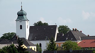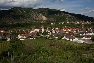
Mauthausen is a small market town in the Austrian state of Upper Austria. It is located at about 20 kilometres east of the city of Linz. The town lies on the banks of the Danube river, opposite the town of Enns, where the major Danube tributary of Enns joins it.

Krems an der Donau is a town of 23,992 inhabitants in Austria, in the federal state of Lower Austria. It is the fifth-largest city of Lower Austria and is approximately 70 kilometres west of Vienna. Krems is a city with its own statute, and therefore it is both a municipality and a district.

Zwentendorf an der Donau is a small market municipality in the Austrian state of Lower Austria. It is located at 48°21′N15°54′E, in the Tulln Basin on the southern bank of the Danube. The place attained public attention as the site of the only Austrian nuclear power station, which was completed but never went into operation. In a referendum on 5 November 1978, a narrow majority of 50.5% voted against putting the Zwentendorf nuclear plant into operation.

Dürnstein is a small town on the Danube river in the Krems-Land district, in the Austrian state of Lower Austria. It is one of the most-visited tourist destinations in the Wachau region and also a well-known wine growing area. The municipality consists of the Katastralgemeinden of Dürnstein, Oberloiben, and Unterloiben.

Hainburg an der Donau is a town in the Bruck an der Leitha district, Lower Austria, Austria.

Ybbs an der Donau is a town in Austria. It was established in 1317. Throughout the town, from the intersection of the important trade routes and along the Danube the town has preserved a site that already had great economic importance during the Middle Ages.
Petronell-Carnuntum is a community of Bruck an der Leitha in Austria. It is known for its annual World Theatre Festival.

Tulln an der Donau is a historic town in the Austrian state of Lower Austria, the administrative seat of Tulln District. Because of its abundance of parks and gardens, Tulln is often referred to as Blumenstadt, and "The City of Togetherness" following the initiative of Peter Eisenschenk, Mayor of Tulln.

Kirchdorf an der Krems is a town in the Austrian state of Upper Austria on the river Krems, in the district of Kirchdorf an der Krems. Apparently settled by the year 903, it has 4,104 inhabitants in a relatively small area of 3 km2.

Neustadtl an der Donau is a town in the district of Amstetten in Lower Austria in Austria.

Bad Deutsch-Altenburg, until 1928 Deutsch-Altenburg is a market town and spa in the district of Bruck an der Leitha in Lower Austria in Austria.

Orth an der Donau is a town in the district of Gänserndorf in the Austrian state of Lower Austria.
Rohrendorf bei Krems is a municipality in the district of Krems-Land in the Austrian state of Lower Austria.

Rossatz-Arnsdorf is a town in the district of Krems-Land in the Austrian state of Lower Austria. It is located in the Wachau valley of the Danube, a popular destination for tourists, and has excellent views of the ruins of castle Dürnstein, where King Richard the Lion-Heart of England was held captive by Duke Leopold V.

Spitz an der Donau is a market town in the district of Krems-Land in the Austrian state of Lower Austria, in the midst of the UNESCO World Heritage area Wachau, further down from Willendorf on the left bank of the Danube. The ferry across the Danube here is interesting in that it has no motor or sail: it is powered by rudder set against the river current, anchored to a cable above the river. The ferry carries passengers, bicycles, motorcycles, and automobiles.

Weißenkirchen in der Wachau is a town in the district of Krems-Land in the Austrian state of Lower Austria. The ferry across the Danube here is interesting in that it has no motor or sail: it is powered by rudder set against the river current, anchored to a cable above the river. The ferry carries passengers, bicycles, motorcycles, and automobiles.

Persenbeug-Gottsdorf is a town in the district of Melk in the Austrian state of Lower Austria on the left bank of the river Danube.

Aschach an der Donau is a municipality in the district Eferding in the Austrian state of Upper Austria.

Mautern in Steiermark is a municipality in the district of Leoben in Styria, Austria.

The Wachau is an Austrian valley with a picturesque landscape formed by the Danube river. It is one of the most prominent tourist destinations of Lower Austria, located midway between the towns of Melk and Krems that also attracts "connoisseurs and epicureans" for its high-quality wines. It is 36 kilometres (22 mi) in length and was already settled in prehistoric times. A well-known place and tourist attraction is Dürnstein, where King Richard the Lionheart of England was held captive by Duke Leopold V of Austria and Styria. The architectural elegance of its ancient monasteries, castles and ruins combined with the urban architecture of its towns and villages, and the cultivation of vines as an important agricultural produce are the dominant features of the valley.


