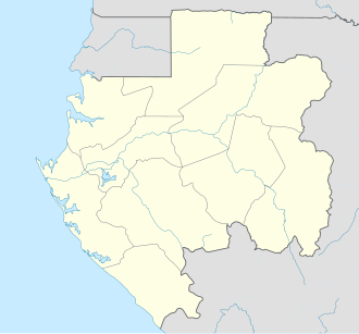
Mayumba, Gabon

Last updated
Mayumba
Coat of arms of Mayumba, Gabon.svg
Gabon location map.svg
Red pog.svg
Mayumba
Location in Gabon
Coordinates: 3°25′S10°39′E / 3.417°S 10.650°E / -3.417; 10.650
CountryFlag of Gabon.svg  Gabon
Province Nyanga Province
Population
  Total5 208 (2,010)

Mayumba is a Vili- and Shira-speaking town of about 5,208 people on the Atlantic Ocean coast of Gabon, at the end of the N6 road, lying on a peninsula separated from the mainland by the Banio Lagoon.

Contents

Description

It is known for its long sandy beach where leatherback turtles nest. The most common ethnic groups are Vili, Lumbu, and Punu, and locals of Mayumba town call themselves 'Mayesiens'. It is home to an airport, several small restaurants, and a market. There are seven primary schools in the area, and one junior high school of about 500 students. Mayumba lies 20 kilometers (12 mi) north of Mayumba National Park, the only national park in Gabon that is dedicated to the protection of marine species.

Mayumba town is nestled among three small hills separating the lagoon from the ocean. Sleepy at the best of times, its two main streets only come to life at twilight when the townspeople meander past the market and a scattered small bars, exchanging greetings and the news of the day.

Oysters are part of Mayesien life. Each dry season (June to September) salt water floods in from the ocean, turning the lagoon near Mayumba clear and salty. This has two exciting effects. First, the clear sea water cleans the oyster beds near the lagoon mouth, making this wonderful seafood deliciously palatable. Secondly, the greater water visibility permits locals to dive for oysters and take them back for sale at Mayumba’s market. Oysters are purchased alive or already cooked ‘kebab’ style. Visitors can even try their hand at diving for an oyster (the usual depth of the water is only 3 meters (10 feet)) after which the diving party retires to the beach front where the oysters are grilled in their shells on open fires.

Mayumba is home to a very relaxed pace of life, but for those with energy to spare after a hard morning of tanning, swimming or sampling the local seafood, there are several good walks to be had in and around the town, with excellent views of the lagoon and the ocean. The seashore itself draws walkers like a magnet, and the wild coast to the immediate south of the town offers hiking limited only by your own stamina. Return home through the savannah for the chance to catch a glimpse of a rare bird or a sitatunga antelope.

Climate

Mayumba has a tropical savanna climate (Köppen climate classification Aw).

Climate data for Mayumba
MonthJanFebMarAprMayJunJulAugSepOctNovDecYear
Mean daily maximum °C (°F)28.3
(82.9)
28.9
(84.0)
30.4
(86.7)
30.5
(86.9)
29.1
(84.4)
25.9
(78.6)
25.7
(78.3)
25.9
(78.6)
26.6
(79.9)
27.6
(81.7)
28.2
(82.8)
27.2
(81.0)
27.9
(82.2)
Daily mean °C (°F)25.7
(78.3)
26.2
(79.2)
27.0
(80.6)
27.1
(80.8)
26.1
(79.0)
23.4
(74.1)
22.5
(72.5)
22.9
(73.2)
24.0
(75.2)
25.1
(77.2)
25.5
(77.9)
25.1
(77.2)
25.1
(77.2)
Mean daily minimum °C (°F)23.1
(73.6)
23.4
(74.1)
23.5
(74.3)
23.6
(74.5)
23.0
(73.4)
20.8
(69.4)
19.2
(66.6)
19.8
(67.6)
21.3
(70.3)
22.5
(72.5)
22.8
(73.0)
22.9
(73.2)
22.2
(72.0)
Average precipitation mm (inches)236.6
(9.31)
245.7
(9.67)
219.3
(8.63)
126.3
(4.97)
74.6
(2.94)
5.5
(0.22)
0.4
(0.02)
5.9
(0.23)
44.7
(1.76)
214.4
(8.44)
335.9
(13.22)
163.7
(6.44)
1,673
(65.87)
Average precipitation days12.612.413.810.27.20.90.73.913.918.918.611.5124.6
Average relative humidity (%)87858386878482838587888785
Source: NOAA [1]

3°25′S10°39′E / 3.417°S 10.650°E / -3.417; 10.650

Related Research Articles

<span class="mw-page-title-main">Willapa Bay</span>

Willapa Bay is a bay located on the southwest Pacific coast of Washington state in the United States. The Long Beach Peninsula separates Willapa Bay from the greater expanse of the Pacific Ocean. With over 120 square miles (310 km2) of surface area Willapa Bay is the second-largest riverine estuary on the Pacific coast of the continental United States. Early settlers called the bay Shoalwater Bay and this name is found on old maps and charts of the region.

<span class="mw-page-title-main">Point Reyes National Seashore</span> Park preserve in California, United States

Point Reyes National Seashore is a 71,028-acre (287.44 km2) park preserve located on the Point Reyes Peninsula in Marin County, California. As a national seashore, it is maintained by the US National Park Service as an important nature preserve. Some existing agricultural uses are allowed to continue within the park. Clem Miller, a US Congressman from Marin County, wrote and introduced the bill for the establishment of Point Reyes National Seashore in 1962 to protect the peninsula from development which was proposed at the time for the slopes above Drake's Bay.

<span class="mw-page-title-main">Bora Bora</span> Island in French Polynesia

Bora Bora is an island group in the Leeward Islands in the South Pacific. The Leeward Islands comprise the western part of the Society Islands of French Polynesia, which is an overseas collectivity of the French Republic in the Pacific Ocean. Bora Bora has a total land area of 30.55 km2 (12 sq mi). The main island, located about 230 kilometres northwest of Papeete, is surrounded by a lagoon and a barrier reef. In the center of the island are the remnants of an extinct volcano, rising to two peaks, Mount Pahia and Mount Otemanu; the highest point is at 727 m (2,385 ft). Bora Bora is part of the Commune of Bora-Bora, which also includes the atoll of Tūpai. The main languages spoken in Bora Bora are Tahitian and French. However, due to the high tourist population, many natives of Bora Bora have learned to speak English.

Foz do Arelho is one of twelve civil parishes (freguesias) in the municipality of Caldas da Rainha, Portugal. The population in 2011 was 1,339, in an area of 9.62 km2.

<span class="mw-page-title-main">Puerto Escondido, Oaxaca</span> City in Oaxaca, Mexico

Puerto Escondido is a small port and tourist center in the municipality of San Pedro Mixtepec Distrito 22 in the Mexican state of Oaxaca. Prior to the 1930s, there was no town. The bay had been used as a port intermittently to ship coffee, but there was no permanent settlement due to the lack of potable water. The name "Puerto Escondido" had roots in the legend of a woman who escaped her captors and hid here. The Nahuatl word for this area was Zicatela, meaning “place of large thorns". Today, it refers to the area's most famous beach.

<span class="mw-page-title-main">Paternoster, South Africa</span> Place in Western Cape, South Africa

Paternoster is one of the oldest fishing villages on the West Coast of South Africa. It is situated 15 km north-west of Vredenburg and 145 km north of Cape Town, at Cape Columbine between Saldanha Bay and St Helena Bay. The town covers an area of 194.8 hectare and has approximately 1883 inhabitants.

<span class="mw-page-title-main">Rangiroa</span> Atoll in French Polynesia

Rangiroa or Te Kokōta is the largest atoll in the Tuamotus and one of the largest in the world.

<span class="mw-page-title-main">Gamba, Gabon</span> Place in Ogooué-Maritime Province, Gabon

Gamba is a small town in Gabon lying on the southern bay of the Ndogo Lagoon.

<span class="mw-page-title-main">Terrigal</span> Town in New South Wales, Australia

Terrigal is a coastal town on the Central Coast of New South Wales, Australia, located 12 kilometres (7 mi) east of Gosford on the Pacific Ocean. It is part of the Central Coast Council local government area.

<span class="mw-page-title-main">Rías Baixas</span> Series of estuarine inlets in Galicia, Spain

The Rías Baixas are a series of four estuarine inlets located on the southwestern coast of Galicia, Spain. They are the Ría de Muros e Noia, the Ría de Arousa, the Ría de Pontevedra, and the Ría de Vigo. The northernmost Rías Baixas begin below Cape Finisterre while the southernmost borders the Portuguese coast, taking up the southern part of the Province of Coruña and the entire Province of Pontevedra. Its capital is the city of Pontevedra. Due to unique conditions, the Rías Baixas are rich in marine life which helps the fishing and aquaculture industry of the area. Beaches, marinas, distinctive towns, and plenty of water activities attract tourists, providing another source of income.

<span class="mw-page-title-main">Ettalong Beach</span> Suburb of Central Coast, New South Wales, Australia

Ettalong Beach is a suburb of the Central Coast region of New South Wales, Australia south of Woy Woy on Brisbane Water at the point where it meets Broken Bay, about 86 km north of Sydney. It is part of the Central Coast Council local government area. Ettalong Beach is the natural eastward continuation of Umina Beach and Ocean Beach. The village is serviced by a small retail centre along Ocean View Road.

<span class="mw-page-title-main">Poneloya, Nicaragua</span> Town in Nicaragua

Poneloya is a town on the west coast of Nicaragua bordering the Pacific Ocean. It lies within the León Department and borders Las Peñitas, Nicaragua. Poneloya is about 21 kilometers (13 mi) from the city of León. The town is a vacation home area for wealthy Nicaraguans, while local residents are mostly fishermen, caretakers, or those who commute to León for work..

<span class="mw-page-title-main">Araruama</span> Municipality in Southeast, Brazil

Araruama is a municipality in the state of Rio de Janeiro, Brazil. Located at 22°52'22" of latitude South and 42°20'35" of longitude west, at an altitude of fifty feet. In 2020, its population was 134,293 inhabitants, which places it the second largest population in the Região dos Lagos.

<span class="mw-page-title-main">Puerto Ángel</span> Town in Oaxaca, Mexico

Puerto Ángel is a small coastal town in the Mexican state of Oaxaca located in the municipality of San Pedro Pochutla. It, along with San Agustinillo and Playa Zipolite are known as the "Riviera Oaxaqueña". It is located 9 km south of city of Pochutla approximately 50 kilometers west of Huatulco and 80 kilometers east of Puerto Escondido. Despite tourism development since the 1960s, the town is still mostly a fishing village, located on a small bay surrounded by rocky hills that lead into the Sierra Madre del Sur. It was founded in the mid-19th century as a port for the region's coffee and lumber industries but since then other means of shipping these products has replaced it.

<span class="mw-page-title-main">Boca del Cielo</span> Place in Chiapas, Mexico

Boca de Cielo is a small fishing town and beach in the municipality of Tonalá, Chiapas, Mexico. It and Puerto Arista, fifteen km away, are the two best known beaches on the Chiapas coast. Boca de Cielo is part of Chiapas’ Istmus-Costa Region on the north coast. it is one of many beaches in the region that stretch uninterrupted by anything except estuaries and lagoons formed by the small rivers that run from the nearby Sierra Madre de Chiapas mountains to the Pacific Ocean. The climate is semi moist with rain mostly in the summer and an average annual temperature of 27C, with weather is hottest in the spring and summer. The area around Boca del Cielo is filled with pastures for cattle as this is the main economic activity of the northern coast region.

<span class="mw-page-title-main">Basse-Banio (department)</span> Department in Nyanga Province, Gabon

Basse-Banio is a department of Nyanga Province in southern Gabon. The capital lies at Mayumba. It had a population of 7,192 in 2013.

<span class="mw-page-title-main">Paraíso, Tabasco</span> Town and municipality in the Mexican state of Tabasco

Paraíso is a town and municipality located in the north of the Mexican state of Tabasco, about 75 km due north of the state capital of Villahermosa on the Gulf of Mexico. Much of the area is traditionally dedicated to fishing and agriculture. Today, it is also an oil-producing area with the mostly oil-dedicated port of Dos Bocas. There is also some tourism connected to the area's beaches and natural attractions, and the area is promoted under the state's Cacao Route tourism program.

<span class="mw-page-title-main">Sánchez Magallanes</span>

Sánchez Magallanes is a small fishing town and port located in the far northwest of the state of Tabasco, Mexico in the municipality of Cárdenas. It is named after a leader in the French Intervention in Mexico, Coronel Andrés Sánchez Magallanes. The town is located on small peninsula which is between the Gulf of Mexico and a lagoon called Del Carmen, which the port faces. Fishing is the main economic activity here, especially the production of oysters, although there is tourism and oil production as well. The last has been problematic for fishing and tourism due to pollution. The most serious environmental problem is the erosion of the area’s fragile beaches, especially the thin strips of land between the Gulf and the lagoons.

<span class="mw-page-title-main">Vili people</span> Ethnic group in Gabon, Republic of the Congo, and Democratic Republic of the Congo

The Vili people are a Central African ethnic group, established in southwestern Gabon, the Republic of Congo, Angola and the Democratic Republic of Congo. It's a subgroup of Bantu and Kongo peoples.

References

  1. "Mayumba Climate Normals 1961–1990". National Oceanic and Atmospheric Administration . Retrieved March 8, 2015.