McCoy, Colorado | |
|---|---|
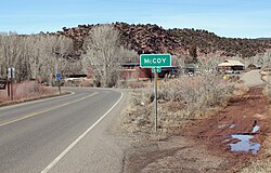 Entering McCoy | |
 Location of the McCoy CDP in Eagle County, Colorado. | |
 McCoy Location of the McCoy CDP in the United States. | |
| Coordinates: 39°54′52″N106°43′33″W / 39.91444°N 106.72583°W [1] | |
| Country | |
| State | |
| County | Eagle County |
| Area | |
• Total | 0.294 sq mi (0.761 km2) |
| • Land | 0.294 sq mi (0.761 km2) |
| • Water | 0 sq mi (0.000 km2) |
| Elevation | 6,683 ft (2,037 m) |
| Population | |
• Total | 30 |
| • Density | 100/sq mi (39/km2) |
| Time zone | UTC-7 (MST) |
| • Summer (DST) | UTC-6 (MDT) |
| ZIP Code [4] | 80463 |
| Area code | 970 |
| GNIS feature | 2583263 [1] |
McCoy is an unincorporated town, a census-designated place (CDP), and a post office located in and governed by Eagle County, Colorado, United States. The CDP is a part of the Edwards, CO Micropolitan Statistical Area. The McCoy post office has the ZIP Code 80463. [4] At the United States Census 2020, the population of the McCoy CDP was 30. [3]
