Melissa, Texas

Last updated

Melissa, Texas
Collin County Texas Incorporated Areas Melissa highlighted.svg
Location of Melissa in Collin County, Texas
Coordinates: 33°17′1″N96°34′19″W / 33.28361°N 96.57194°W / 33.28361; -96.57194
Country United States
State Texas
County Collin
Area
[1]
  Total11.52 sq mi (29.83 km2)
  Land11.45 sq mi (29.66 km2)
  Water0.07 sq mi (0.17 km2)
Elevation
679 ft (207 m)
Population
 (2020)
  Total13,901
  Density1,058.07/sq mi (408.52/km2)
Time zone UTC-6 (Central (CST))
  Summer (DST) UTC-5 (CDT)
ZIP codes
75071, 75454
Area code 972
FIPS code 48-47496 [2]
GNIS feature ID1362586 [3]
Website cityofmelissa.com

Melissa is a city in Collin County, Texas, United States. The population was 4,695 at the 2010 census, [4] up from 1,350 at the 2000 census; in 2020, its population grew to 13,901. [5]

Contents

History

Among Melissa's earliest inhabitants were Paleo-Indians; archaeological finds in the area have been dated to approximately 9500 BC. [6] In the centuries since, several Native American tribes called the area home, including the Caddo, Cherokee, Delaware, and the Kickapoo. [7] The Tonkawa people had a settlement in the area, northeast of McKinney. [7] These people were focused primarily on agriculture and a hunting-and-gathering lifestyle, living peacefully from the land’s bounty. [7]

Initial white settlers came from the old Highland community, two and a half miles north of present-day Melissa. C.H. Wysong, a blacksmith, was one of the earliest settlers. A post office was established in 1853 at Highland. The Houston and Texas Central Railroad arrived in Melissa in 1872 and established a depot. The town was laid out at this time. The railroad encouraged many families to come to Melissa. The town is believed to have been named for the daughter of a railroad executive, George A. Quinlan (1838–1901) of the Houston and Texas Central Railroad. There is some disagreement about this, as others argue that the town was named after Melissa Huntington, daughter of C. P. Huntington, another well-known railroad executive. Anna, Texas, is named after Anna Elizabeth Quinlan (1878–1952), the only daughter of George Austin Quinlan and his wife Mary Kate Saunders (1851–1884). Quinlan, Texas, is named after George Austin Quinlan himself.

Tornado hits school edited.jpg

The first school in Melissa was built on land purchased in 1882 by trustees James Graves, John Gibson, and George Fitzhugh (son of William F. Fitzhugh), who were early settlers of the area. The first teacher was Mary Huckerston, who taught there for five years. The school began with 38 pupils. Church services were held there for all faiths on Sundays. A two-story brick schoolhouse was built on this site in 1910 to accommodate growth brought by the railroad.

Melissa was an important shipping point in the early 1900s. Corn, wheat, alfalfa hay, wood, and livestock were all sent out on the railroad.

A deadly F4 tornado struck Melissa on April 13, 1921, killing 13 people and injuring many more. The tornado tore the roof off of the brick school building, but the children inside were not seriously injured. However, all churches in the town, three cotton gins, every business house except a bank, the post office, and the Houston and Texas Central railway station, were wrecked. The Waldon Hotel was lifted by the winds, turned halfway around, and thrown up against the school building.

Eight years later, on August 8, 1929, a fire burned down many of the buildings that had been rebuilt after the tornado. Population declined from a high of 500 in 1925 down to 285 in 1949.

Geography

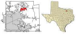
Melissa is located in north-central Collin County at 33°17′01″N96°34′19″W / 33.283534°N 96.571851°W / 33.283534; -96.571851 . [8] State Highway 5 passes through the center of the city, State Highway 121 passes through the eastern part, and the U.S. Route 75 freeway passes through the western side. US 75 and Highway 121 converge in the southwest part of Melissa, then head 6 miles (10 km) southwest to McKinney, the Collin County seat. The center of Dallas is 40 miles (64 km) southwest of Melissa, and Denison is 37 miles (60 km) to the north via US 75.

According to the United States Census Bureau, Melissa has a total area of 10.2 square miles (26.4 km2), of which 10.1 square miles (26.2 km2) is land and 0.08 square miles (0.2 km2), or 0.66%, is water. [4]

Demographics

Historical population
CensusPop.Note
1880 57
1960 405
1980 604
1990 557−7.8%
2000 1,350142.4%
2010 4,695247.8%
2020 13,901196.1%
Melissa racial composition as of 2020 [5]
(NH = Non-Hispanic) [lower-alpha 1]
RaceNumberPercentage
White (NH)8,92664.21%
Black or African American (NH)1,55211.16%
Native American or Alaska Native (NH)1180.85%
Asian (NH)4753.42%
Pacific Islander (NH)100.07%
Some Other Race (NH)620.45%
Mixed/Multi-Racial (NH)7615.47%
Hispanic or Latino 1,99714.37%
Total13,901

As of the 2020 United States census, there were 13,901 people, 3,058 households, and 2,824 families residing in the city. As of the census [2] of 2010, there were 4,695 residents. As of 2000, there were 1,350 people, 472 households, and 365 families residing in the city. The population density was 294.4 inhabitants per square mile (113.7/km2). There were 501 housing units at an average density of 109.3 per square mile (42.2/km2).

In 2000, the racial makeup of the city was 89.63% White, 0.52% African American, 0.44% Native American, 0.52% Asian, 7.63% from other races, and 1.26% from two or more races. Hispanic or Latino of any race were 13.33% of the population.

There were 472 households, out of which 38.8% had children under the age of 18 living with them, 69.5% were married couples living together, 5.9% had a female householder with no husband present, and 22.5% were non-families. 18.6% of all households were made up of individuals, and 6.4% had someone living alone who was 65 years of age or older. The average household size was 2.86 and the average family size was 3.30.

In the city, the population was spread out, with 30.8% under the age of 18, 7.4% from 18 to 24, 28.2% from 25 to 44, 25.6% from 45 to 64, and 8.0% who were 65 years of age or older. The median age was 35 years. For every 100 females, there were 104.5 males. For every 100 females age 18 and over, there were 100.0 males.

According to the 2000 census, the median income for a household in the city was $60,909, and the median income for a family was $66,172. Males had a median income of $40,417 versus $30,435 for females. The per capita income for the city was $26,193. About 3.0% of families and 5.3% of the population were below the poverty line, including 8.9% of those under age 18 and 0.9% of those age 65 or over.

Education

The city is served by the Melissa Independent School District. In 2004, McKinney ISD and Anna ISD refused to educate anymore Melissa ISD high school classes. In 2007, Melissa High School graduated their first class with 46 students. Harry McKillop Elementary School opened its doors as the elementary school in fall 2008, housing Pre-K to third grade. The former Melissa Ridge Elementary School campus was converted to Melissa Ridge Intermediate School, serving fourth and fifth grades, and Melissa Middle School, serving sixth, seventh and eighth grades. In 2015, Melissa Middle School was awarded "A School to Watch" which gives them a high rank of schools in Texas. In 2019, Melissa Schools redistributed the allocation of campuses with the following changes. Melissa Ridge Education Center servicing pre-k through kindergarten, Harry McKillop Elementary School serving grades 1–5, North Creek Elementary School serving grades 1–5, Melissa Middle School grades 6–8, and Melissa High School serving traditional grades 9–12.

Notes

  1. Note: the U.S. Census treats Hispanic/Latino as an ethnic category. This table excludes Latinos from the racial categories and assigns them to a separate category. Hispanics/Latinos can be of any race. [9] [10]

Related Research Articles

<span class="mw-page-title-main">Hunt County, Texas</span> County in Texas, United States

Hunt County is a county in the U.S. state of Texas. As of the 2020 census, its population was 99,956. Its county seat is Greenville. The county is named for Memucan Hunt, Jr., the first Republic of Texas Minister to the United States from 1837 to 1838 and the third Texas Secretary of the Navy from 1838 to 1839. Hunt County is located in Northeast Texas, at the eastern edge of the Dallas/Fort Worth Metroplex and the western edge of East Texas. Hunt County is part of the Dallas-Fort Worth-Arlington metropolitan statistical area.

<span class="mw-page-title-main">Fannin County, Texas</span> County in Texas, United States

Fannin County is a county in the far northeast of the U.S. state of Texas, on the border with Oklahoma. As of the 2020 census, its population was 35,662. The county seat is Bonham.

<span class="mw-page-title-main">Collin County, Texas</span> County in Texas, United States

Collin County is located in the U.S. state of Texas. It is part of the Dallas-Fort Worth-Arlington metropolitan statistical area, and a small portion of the city of Dallas is in the county. At the 2020 United States census, the county's population is 1,064,465, making it the sixth-most populous county in Texas and the 43rd-largest county by population in the United States. Its county seat is McKinney.

<span class="mw-page-title-main">Sealy, Texas</span> City in Texas, United States

Sealy is a city in Austin County in southeastern Texas, United States. The population was 6,839 at the 2020 census. Sealy is located 49 miles (79 km) west of the downtown Houston area, on the most eastern part of the Texas-German belt region, an area settled by German emigrants.

<span class="mw-page-title-main">Freeport, Texas</span> City in Texas, United States

Freeport is a city in Brazoria County, Texas, United States, located on the Gulf of Mexico. According to the 2020 census, the city population was 10,696, down from 12,049 in 2010.

<span class="mw-page-title-main">Oyster Creek, Texas</span> City in Texas, United States

For the river in Fort Bend and Brazoria Counties, Texas see: Oyster Creek (Texas).

<span class="mw-page-title-main">McKinney, Texas</span> City in the United States

McKinney is a city in and the county seat of Collin County, Texas, United States. It is Collin County's third-largest city, after Plano and Frisco. A suburb of the Dallas–Fort Worth metroplex, McKinney is about 32 miles (51 km) north of Dallas.

<span class="mw-page-title-main">Murphy, Texas</span> City in Texas

Murphy is a city in suburban Collin County, Texas, United States. The 2020 census reported the population as 21,013 compared to 3,099 in 2000. Murphy is located northeast of Dallas and has a history that goes back to the late 1800s.

<span class="mw-page-title-main">Prosper, Texas</span> Town in Texas, United States

Prosper is a town in Collin and Denton counties in the U.S. state of Texas. Prosper is located within the Dallas-Fort Worth-Arlington metropolitan area. As of the 2010 census, its population was 9,423; As of 2023, the population was 37,746.

<span class="mw-page-title-main">Weston, Texas</span> City in Texas, United States

Weston is a city in Collin County, Texas, United States. The population was 563 at the 2010 census, and 283 at the 2020 census.

<span class="mw-page-title-main">Aldine, Texas</span> Place in Texas, United States

Aldine is a census-designated place (CDP) in unincorporated central Harris County, Texas, United States, located within the extraterritorial jurisdiction of Houston. The population was 15,999 at the 2020 census. The community is located on the Hardy Toll Road, Union Pacific Railroad, and Farm to Market Road 525. The Aldine area is near Houston's George Bush Intercontinental Airport, the second largest aviation facility in Texas.

<span class="mw-page-title-main">Quinlan, Texas</span> City in Texas, United States

Quinlan is a rural city in the southern part of Hunt County, Texas, United States, within the Dallas–Fort Worth metropolitan area. As of the 2010 census, it had a population of 1,394. It is 5 miles (8 km) west of Lake Tawakoni.

<span class="mw-page-title-main">Escobares, Texas</span> City in Texas, United States

Escobares is a city in Starr County, Texas, United States. The population was 2,588 at the 2020 census. The city was formed in 2005 from part of the deleted Escobares CDP, and parts of Garceno, and North Escobares CDPs, and additional area. Prior to its 2005 incorporation as a city, it was a census-designated place (CDP). The population of the CDP was 1,954 at the 2000 census.

<span class="mw-page-title-main">Falcon Heights, Texas</span> CDP in Texas, United States

Falcon Heights is a census-designated place (CDP) in Starr County, Texas, United States. The population was 18 at the 2020 census, down from 53 at the 2010 census.

<span class="mw-page-title-main">La Rosita, Texas</span> CDP in Texas, United States

La Rosita is a census-designated place (CDP) in Starr County, Texas, United States. The population was 85 at the 2010 census, a decline from the figure of 1,729 tabulated in 2000d due to the Census Bureau redefining the CDP.

<span class="mw-page-title-main">North Escobares, Texas</span> CDP in Texas, United States

North Escobares is a census-designated place (CDP) in Starr County, Texas, United States. The population was 118 at the 2010 census, a decline from the figure of 1,692 tablulated in 2000.

<span class="mw-page-title-main">Roma Creek, Texas</span> CDP in Texas, United States

Roma Creek is a former census-designated place (CDP) in Starr County, Texas, United States. The population was 350 at the 2010 census down from 610 at the 2000 census.

<span class="mw-page-title-main">Brushy Creek, Williamson County, Texas</span> CDP in Texas, United States

Brushy Creek is a census-designated place (CDP) in Williamson County, Texas, United States. The population was 22,519 at the 2020 census.

<span class="mw-page-title-main">Sachse, Texas</span> City in Texas, United States

Sachse is a city in Collin and Dallas counties in the U.S. state of Texas and is part of the DFW metroplex. A northeastern suburb of Dallas, the city population was 27,103, as of the 2020 census with an estimated population of 33, 768 people today. Sachse is located off Texas State Highway 78 and President George Bush Turnpike and is approximately 1 mile (1.6 km) north of the Firewheel Town Center.

<span class="mw-page-title-main">Wylie, Texas</span> City in Texas, United States of America

Wylie is a city and northeastern suburb of Dallas, that was once solely located in Collin County, but now extends into neighboring Dallas and Rockwall counties in the U.S. state of Texas. It is located on State Route 78 about 24 miles (39 km) northeast of central Dallas and centrally located between nearby Lavon Lake and Lake Ray Hubbard.

References

  1. "2019 U.S. Gazetteer Files". United States Census Bureau. Retrieved August 7, 2020.
  2. 1 2 "U.S. Census website". United States Census Bureau . Retrieved January 31, 2008.
  3. "US Board on Geographic Names". United States Geological Survey. October 25, 2007. Retrieved January 31, 2008.
  4. 1 2 "Geographic Identifiers: 2010 Census Summary File 1 (G001): Melissa city, Texas". U.S. Census Bureau, American Factfinder. Archived from the original on February 13, 2020. Retrieved July 31, 2015.
  5. 1 2 "Explore Census Data". data.census.gov. Retrieved May 22, 2022.
  6. "7 Pieces of History Near Melissa, Texas". tfdsupplies.com.
  7. 1 2 3 "Indians living in Collin County". CollinCountyHistory.com.
  8. "US Gazetteer files: 2010, 2000, and 1990". United States Census Bureau. February 12, 2011. Retrieved April 23, 2011.
  9. https://www.census.gov/ [ not specific enough to verify ]
  10. "About the Hispanic Population and its Origin". www.census.gov. Retrieved May 18, 2022.