Menacuddle

Last updated
Menacuddle holy well Menacuddle Well - geograph.org.uk - 983964.jpg
Menacuddle holy well

Menacuddle is a historic place, holy well and wooded area in St Austell, Cornwall, UK. [1]

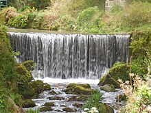
The holy well was built in the 15th century and restored by Admiral Sir Charles John Graves-Sawle shortly after the First World War in memory of his son who was killed in action. [2] It is a popular spot with ramblers. [3] Its name is recorded as Menequidel in 1250 and Menedcudel in 1284 and comes from the Old Cornish mened and cuydel and it means hillside with a small wood. The name does not include a saint's name, and there was no St Guidel. [4] The site has also been known as Pinni-menny. [5]

It is said that if a person drops a pin into the well and makes a wish, that wish will be granted. [5] The woods have a reputation for being haunted, with sightings of a "huge black beast" there. [6]

The weir at Menacuddle. Weir at Menacuddle Well.jpg
The weir at Menacuddle.

The site is a monument scheduled under the Ancient Monuments and Archaeological Areas Act 1979, NHLE list number 1019163. [7]

Related Research Articles

River Camel River in the United Kingdom

The River Camel is a river in Cornwall, England, United Kingdom. It rises on the edge of Bodmin Moor and with its tributaries its catchment area covers much of North Cornwall. The river flows into the eastern Celtic Sea between Stepper Point and Pentire Point having covered about 30 miles, making it the second longest river wholly in Cornwall. The river is tidal upstream to Egloshayle and is popular for sailing, birdwatching and fishing. The name Camel comes from the Cornish language for 'the crooked one', a reference to its winding course. Historically the river was divided into three named stretches. Heyl was the name for the estuary up to Egloshayle, the River Allen was the stretch between Egloshayle and Trecarne, whilst the Camel was reserved for the stretch of river between its source and Trecarne.

St Austell Human settlement in England

St Austell is a town in Cornwall, England, UK, 10 miles (16 km) south of Bodmin and 30 miles (48 km) west of the border with Devon.

Restormel

Restormel was a borough of Cornwall, England, United Kingdom, one of the six administrative divisions that made up the county. Its council was based in St Austell ; its other towns included Newquay.

St Columb Major Human settlement in England

St Columb Major is a town and civil parish in Cornwall, England, United Kingdom. Often referred to locally as St Columb, it is approximately seven miles (11 km) southwest of Wadebridge and six miles (10 km) east of Newquay The designation Major distinguishes it from the nearby settlement and parish of St Columb Minor on the coast. An electoral ward simply named St Columb exists with a population at the 2011 census of 5,050. The town is named after the 6th-century AD Saint Columba of Cornwall, also known as Columb.

London Apprentice Human settlement in England

London Apprentice is a village in south Cornwall, England, UK, on the banks of St Austell River in the Pentewan Valley approximately two miles (3 km) south of St Austell.

St Austell railway station Railway station in Cornwall, England

St Austell station is a Grade II listed station which serves the town of St Austell, Cornwall, England. It is 286 miles (460 km) from London Paddington via Bristol Temple Meads. The station is operated by Great Western Railway, as is every other station in Cornwall.

The Hurlers (stone circles)

The Hurlers is a group of three stone circles in the civil parish of St Cleer, Cornwall, England, UK. The site is half-a-mile (0.8 km) west of the village of Minions on the eastern flank of Bodmin Moor, and approximately four miles (6 km) north of Liskeard at grid reference SX 258 714.

St Austell and Newquay (UK Parliament constituency)

St Austell and Newquay is a constituency represented in the House of Commons of the UK Parliament since 2015 by Steve Double, a Conservative.

Roche, Cornwall

Roche is a civil parish and village in mid-Cornwall, United Kingdom. The village gets its name from a granite outcrop east of the village. Roche is the Norman-French word for Rock. On the southern flank of the village is the 20-metre (66-foot) high Roche Rock, a large granite outcrop. The parish population at the 2011 census including Belowda, Bilberry, Carbis, Coldvreath and Criggan is 3,381, and the ward population at the same census was 3,867.

Gover Stream

The Gover Stream is an approximately 3 kilometres (1.9 mi) long stream located in mid south Cornwall, England, United Kingdom.

Prideaux Castle is a multivallate Iron Age hillfort situated atop a 133 m (435 ft) high conical hill near the southern boundary of the parish of Luxulyan, Cornwall, England, United Kingdom. It is also sometimes referred to as Prideaux Warren, Prideaux War-Ring, or Prideaux Hillfort. The site is a scheduled monument and so protected from unauthorised works by the Ancient Monuments and Archaeological Areas Act 1979.

St Austell Brewery

St Austell Brewery is a brewery founded in 1851 by Walter Hicks in St Austell, Cornwall, England. The brewery's flagship beer is Tribute Ale, which accounts for around 80% of sales. Other popular ales include Proper Job, Tinner's Ale and Duchy Bitter.

Gribben Head

Gribbin Head is a promontory on the south coast of Cornwall, England, UK, owned and managed by the National Trust. It separates St Austell Bay from the estuary of the River Fowey and is marked by a large tower used to aid navigation of ships approaching the local harbours. The nearest town is Fowey. The western point of the headland is called Little Gribbin.

Merther Human settlement in England

Merther is a small hamlet 2 miles (3 km) east of Truro in Cornwall, England. It lies on the eastern side of the Tresillian River in the civil parish of St Michael Penkevil. It was formerly the churchtown of the small parish of Merther, and also the site of a manor house and medieval chapel dedicated to St Cohan. The former parish church is now in ruins.

Trelowth Human settlement in England

Trelowth is a hamlet in Cornwall, England, United Kingdom. It lies 2.3 miles (3.7 km) by road southwest of central St Austell, and is situated immediately to the northwest of Polgooth. The hamlet is part of the parish of St Mewan.

St Austell Clay Pits

St Austell Clay Pits, are a group of locations within active china clay quarries that form a single Site of Special Scientific Interest (SSSI) and Special Area of Conservation, noted for its biological characteristics. In particular, the site is known for the rare western rustwort, a plant that grows only at two other sites in the UK.

The Bucket of Blood

The Bucket of Blood is a public house in Phillack, Hayle, Cornwall, owned by St Austell Brewery. It is thought to be named after an incident where the landlord brought up a bucket of blood from the building's well, as a murdered smuggler had been dropped there and the name has been recognised as one of the quirkiest in the country. The building dates from the 18th century, built from rubble with a slater roof. It was designated Grade II listed status on 14 January 1988.

Little Treviscoe is a village near Treviscoe in Cornwall. It contains about 30 properties. There are numerous abandoned china clay workings in the area surrounding it. In 2013 the village had issues with a cat. It has typical Cornish weather.

Black Head (St Austell), Cornwall

Black Head is a headland at the western end of St Austell Bay, in Cornwall, England. It is owned by the National Trust.

References

  1. "Menacuddle Well, Menacuddle Woods, St Austell · cornishmemory.com". cornishmemory.com. Retrieved 8 October 2017.
  2. "'Beast' spotted at holy well | St Austell Voice". www.staustellvoice.co.uk. Retrieved 8 October 2017.
  3. "St Austell Walk" . Retrieved 8 October 2017.
  4. Craig Weatherhill, Placenames in Cornwall and Scilly 2005, page 122.
  5. 1 2 Fred W. P. Jago, The Ancient Language and the Dialect of Cornwall, 1882
  6. Millar, Joey (11 May 2016). "Walker finds HUMAN REMAINS in eerie wood haunted by BLACK BEAST". Express.co.uk. Retrieved 8 October 2017.
  7. Historic England. "Menacuddle Well, Treverbyn (1019163)". National Heritage List for England . Retrieved 8 October 2017.

Coordinates: 50°20′45″N4°47′46″W / 50.3457°N 4.7960°W / 50.3457; -4.7960