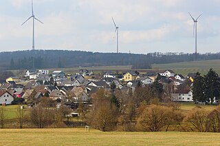
Mengerskirchen’s Ortsteile are, Dillhausen, Mengerskirchen, Probbach, Waldernbach and Winkels.
The community administration’s seat is the market centre of Mengerskirchen. Each of the constituent communities is represented on a municipal advisory board (Ortsbeirat) by a community head (Ortsvorsteher).
Around the Knoten, the highest elevation in the community of Mengerskirchen, those who are interested can give themselves over to cross-country skiing during the winter months. In summer, the two man-made lakes, Seeweiher and Waldsee, offer the opportunity to bathe.
History
Mengerskirchen Castle
Mengerskirchen had its first documentary mention in a document from the monastery St. Lubentius, Dietkirchen, in 1279. The outlying community of Winkels had already been mentioned in 1243, Waldernbach in 1296, Probbach in 1299 and Dillhausen in 1307. Mengerskirchen was described in 1307 as an “oppidum”. Town rights are documentarily confirmed only on 18 February 1321. In 1481 came market rights, too.
Near Mengerskirchen ran the hill fort wall Rentmauer, affording the community dwellers at that time some protection. There is proof that the community had its own priest and that it also served as the centre of the Calenberg tithing area in 1313, in which year it is believed building work began on Mengerskirchen Castle. Together with the courts of Beilstein, Haimau (today Löhnberg) and Nenderoth, a tithing court was kept on the Kalenbergskopf, a high ridge between Arborn, Mengerskirchen and Nenderoth. In 1481 Friedrich III conferred the privilege for a yearly fair to be held on 14 September near Mengerskirchen.
From 1343 to 1561, Mengerskirchen lay under Nassau-Beilstein rule, then passing along with all Nassau-Beilstein’s holdings back to Nassau-Dillenburg. Count Otto II of Nassau-Dillenburg bequeathed Mengerskirchen to his wife, Adelheid von Vianden as a widow’s seat.
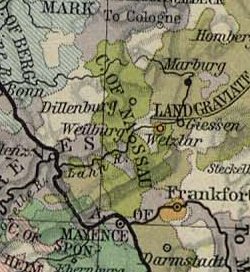
At the crossroads where the two old trade roads, the Hohe Straße (“High Road”) from Herborn to Limburg, and the Rheinstraße from Cologne to Frankfurt, meet, an important customs place was built. Its territory comprised Almenrod, Arborn, Cödlingen, Dillhausen, Helmenrod, Nenderoth, Nieder- and Oberprobbach (today simply Probbach), Obershausen, Odersberg and Winkels, thereby making Mengerskirchen bigger than the actual Residence of Beilstein. The castle in Mengerskirchen housed the Amt of Mengerskirchen with many interruptions until 1816. The last Amtmann retired in this year and the Amt was united with the Amt of Weilburg.
In 1867, Prussia created through a new ordering of the Duchy of Nassau, which it had annexed the year before this, among others, the district of Oberlahnkreis to which Mengerskirchen thereafter belonged. In the administrative reform in Hesse in 1974, it was grouped into the district of Limburg-Weilburg. On 1 January 1971, the market town of Mengerskirchen became the administrative seat of the like-named greater community.
Politics
Community council
Parts of this article (those related to this section) need to be updated. Please help update this article to reflect recent events or newly available information.(July 2021)
The municipal election held on 26 March 2006 yielded the following results:
Freie Wähler- und Wählerinnengemeinschaft Mengerskirchen
13.0
3
12.1
3
Total
100.0
25
100.0
25
voter turnout in%
47.3
56.9
Economy and infrastructure
Transport
Mengerskirchen is not directly linked to the long-distance road network. The nearest interchanges with Bundesstraße 49 are found in the communities of Merenberg and Löhnberg (about 5km or 3miles away). The nearest interchanges with the A45 (Dortmund–Aschaffenburg) are found in the town of Herborn (about 18km or 11miles away). Ever since the narrow-gauge Kerkerbachbahn (railway) was closed in 1958, there has been no railway line. Frankfurt and Frankfurt Airport lies some 85km (53mi) away.
In the main centre of Mengerskirchen stands the Franz-Leuninger-Schule, the community’s primary school. It was named after the German Resistance fighter against the Nazi régime, Franz Leuninger, who was from Mengerskirchen.
Westerwaldschule
In the outlying centre of Waldernbach is found the Westerwaldschule, opened on 21 October 1977, a Hauptschule and Realschule for the communities of Mengerskirchen, Merenberg, Waldbrunn (except Ellar[de]) and Beselich (constituent community of Heckholzhausen).
The County of Nassau was a German state within the Holy Roman Empire and later part of the German Confederation. Its ruling dynasty, the male line of which is now extinct, was the House of Nassau.
Weilburg is, with just under 13,000 inhabitants, the third biggest town in Limburg-Weilburg district in Hesse, Germany, after Limburg an der Lahn and Bad Camberg.
Elz is a municipality in Limburg-Weilburg district in western Hesse, Germany, on the boundary with Rhineland-Palatinate.
Otto I of Nassau, German: Otto I. von Nassau was Count of Nassau and is the ancestor of the Ottonian branch of the House of Nassau.
Selters (Taunus) is a municipality with 8,000 inhabitants north of Bad Camberg in Limburg-Weilburg district in Hesse, Germany.
Rennerod is a town in the Westerwaldkreis in Rhineland-Palatinate, Germany. It is the administrative seat of the Verbandsgemeinde of Rennerod, a kind of collective municipality. Within the municipal area, until German Reunification on 3 October 1990, lay the Federal Republic's geographical centre.
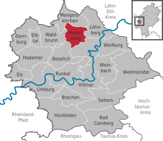
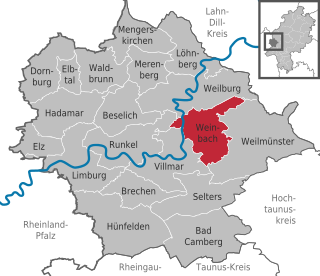
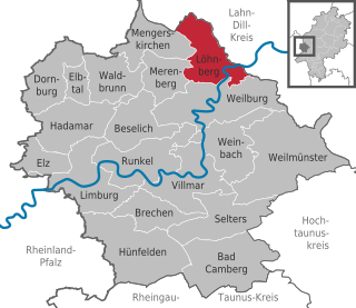
Merenberg is a municipality in Limburg-Weilburg district in Hesse, Germany.
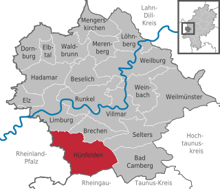
Hünfelden is a municipality in Limburg-Weilburg district in Hesse, Germany. Hünfelden lies on the Hühnerstraße, an historic part of Bundesstraße 417.
Greifenstein is a municipality in the Lahn-Dill-Kreis in Hesse, Germany. Its administrative seat is Beilstein. Greifenstein covers 67.43 km² on the eastern slope of the Westerwald range. It was named for the castle of the same name in the constituent community of the same name. This is the site of the German Bell Museum, which holds about 50 bells that show the historical development of bell pouring and manufacture.
Weinbach is a municipality in Limburg-Weilburg district in Hesse, Germany.
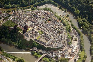
Runkel is a town on the river Lahn in Limburg-Weilburg district in Hesse, Germany.
Weilmünster is a municipality in Limburg-Weilburg district in Hesse, Germany.
Beselich is a municipality in Limburg-Weilburg district in Hesse, Germany.
Brechen is a municipality in Limburg-Weilburg district in Hesse, Germany.
Löhnberg is a municipality north of Weilburg in Limburg-Weilburg district in Hesse, Germany.
Selters is a village in the district Limburg-Weilburg, Hesse, Germany. It is situated at the Taunus side of the river Lahn and belongs to the municipality Löhnberg. The village has a total population of 319.
Villmar is a market village and municipality in the Limburg-Weilburg district in Hesse, Germany. The community is the centre for quarrying and processing the so-called Lahn Marble.
Waldbrunn (Westerwald) is a municipality in Limburg-Weilburg district in Hesse, Germany.
Kaden is an Ortsgemeinde – a community belonging to a Verbandsgemeinde – in the Westerwaldkreis in Rhineland-Palatinate, Germany.
This page is based on this Wikipedia article Text is available under the CC BY-SA 4.0 license; additional terms may apply. Images, videos and audio are available under their respective licenses.