Meredosia, Illinois

Last updated

Meredosia, Illinois
Meredosia Station - Meredosia, Illinois.jpg
Memorial and former train station in Meredosia
Morgan County Illinois Incorporated and Unincorporated areas Meredosia Highlighted.svg
Location in Morgan County, Illinois
Usa edcp location map.svg
Red pog.svg
Meredosia
Location in the United States
Coordinates: 39°49′51″N90°33′25″W / 39.83083°N 90.55694°W / 39.83083; -90.55694 [1]
CountryUnited States
StateIllinois
County Morgan
Area
[2]
  Total0.90 sq mi (2.33 km2)
  Land0.86 sq mi (2.24 km2)
  Water0.04 sq mi (0.10 km2)
Elevation
[1]
446 ft (136 m)
Population
 (2020) [3]
  Total826
  Density956.02/sq mi (369.08/km2)
Time zone UTC-6 (CST)
  Summer (DST) UTC-5 (CDT)
ZIP code
62665
Area code 217
FIPS code 17-48424
GNIS feature ID2399316 [1]
Wikimedia CommonsMeredosia, Illinois

Meredosia is a village in Morgan County, Illinois, United States. The population was 826 at the 2020 census, [3] down from 1,044 in 2010. It is part of the Jacksonville Micropolitan Statistical Area.

Contents

Geography

Meredosia is in far northwestern Morgan County, on the east bank of the Illinois River, the border with Pike County. Illinois Route 104 passes through the village as its Main Street, leading east and then southeast 21 miles (34 km) to Jacksonville, the county seat, and west across the river and 50 miles (80 km) to Quincy.

According to the U.S. Census Bureau, Meredosia has a total area of 0.90 square miles (2.33 km2), of which 0.04 square miles (0.10 km2), or 4.11%, are water. [2]

The Meredosia National Wildlife Refuge is directly north of the village, within the Illinois River floodplain.

Marais d'Osier, meaning willow swamp, was the original French name given to the area in the early 1800s.

Closing of Power Ameren power station

In 2011, Ameren Energy Resources Company announced the closure of its power station in Meredosia. The closure resulted in a loss of over 50 jobs, a major economic hit for the small community. The plant closure was related to the cost of meeting environmental regulations. The plant may reopen at some point as a facility to test clean coal technology, according to Ameren. [4]

New bridge

In June 2018 the community celebrated the opening of a new bridge over the Illinois River. The former bridge, constructed in 1936, had become too narrow for modern traffic, and was dismantled during the summer of 2018. The bridge not only links Meredosia to Quincy, Illinois, but serves as an important transportation link between western Illinois and the center of the state. [5]

Demographics

Historical population
CensusPop.Note
1880 750
1890 621−17.2%
1900 70012.7%
1910 95135.9%
1920 810−14.8%
1930 8201.2%
1940 99821.7%
1950 940−5.8%
1960 1,03410.0%
1970 1,17813.9%
1980 1,2728.0%
1990 1,134−10.8%
2000 1,041−8.2%
2010 1,0440.3%
2020 826−20.9%
U.S. Decennial Census [6]

As of the census [7] of 2000, there were 1,041 people, 450 households, and 301 families residing in the village. The population density was 1,130.3 inhabitants per square mile (436.4/km2). There were 486 housing units at an average density of 527.7 per square mile (203.7/km2). The racial makeup of the village was 99.90% White, and 0.10% from two or more races. Hispanic or Latino of any race were 0.10% of the population.

There were 450 households, out of which 28.2% had children under the age of 18 living with them, 55.1% were married couples living together, 8.7% had a female householder with no husband present, and 33.1% were non-families. 30.2% of all households were made up of individuals, and 16.7% had someone living alone who was 65 years of age or older. The average household size was 2.31 and the average family size was 2.85.

In the village, the population was spread out, with 24.0% under the age of 18, 6.4% from 18 to 24, 25.2% from 25 to 44, 25.2% from 45 to 64, and 19.2% who were 65 years of age or older. The median age was 41 years. For every 100 females, there were 97.5 males. For every 100 females age 18 and over, there were 95.3 males.

The median income for a household in the village was $32,961, and the median income for a family was $40,917. Males had a median income of $31,979 versus $16,842 for females. The per capita income for the village was $19,391. About 5.8% of families and 9.2% of the population were below the poverty line, including 11.6% of those under age 18 and 4.4% of those age 65 or over.

Related Research Articles

<span class="mw-page-title-main">East Cape Girardeau, Illinois</span> Village in Illinois, United States

East Cape Girardeau is a village in Alexander County, Illinois, United States. The population was 289 at the 2020 census. It is part of the Cape Girardeau–Jackson, MO-IL Metropolitan Statistical Area.

<span class="mw-page-title-main">Hutsonville, Illinois</span> Village in Illinois, United States

Hutsonville is a village in Crawford County, Illinois, United States. The population was 478 at the 2020 census.

<span class="mw-page-title-main">Grayville, Illinois</span> City in Illinois, United States

Grayville is a city in Edwards and White counties in the U.S. state of Illinois. As of the 2020 census, the city's population was 1,550, down from 1,666 at the 2010 census. Grayville is the birthplace of naval hero James Meredith Helm.

<span class="mw-page-title-main">Pontoosuc, Illinois</span> Village in Illinois, United States

Pontoosuc is a village in Hancock County, Illinois, United States. The population was 146 at the 2010 census, down from 171 at the 2000 census.

<span class="mw-page-title-main">Grand Tower, Illinois</span> City in Illinois, United States

Grand Tower is a city in Jackson County, Illinois, United States. The population was 605 at the 2010 census. The town gets its name from Tower Rock, a landmark island in the Mississippi River.

<span class="mw-page-title-main">Newton, Illinois</span> City in Illinois, United States

Newton is a city in and the county seat of Jasper County, Illinois, United States. The population was 2,849 at the 2010 census, down from 3,069 at the 2000 census. Newton is home to a large coal-fired power plant operated by Illinois Power Generating Co and is close to Newton Lake State Fish and Wildlife Area and Sam Parr State Fish and Wildlife Area.

<span class="mw-page-title-main">Bradley, Illinois</span> Village in Illinois, United States

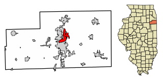
Bradley is a village in Kankakee County, Illinois, United States. It is a suburb of the city of Kankakee. The population was 15,895 at the 2010 census, up from 12,784 at the 2000 census.

<span class="mw-page-title-main">Sun River Terrace, Illinois</span> Village in Illinois, United States

Sun River Terrace is a village in Kankakee County, Illinois, United States. The population was 455 at the 2020 census. It is included in the Kankakee-Bradley, Illinois Metropolitan Statistical Area.

<span class="mw-page-title-main">Pontoon Beach, Illinois</span> Village in Illinois, United States

Pontoon Beach is a village in Madison County, Illinois, United States. The population was 5,876 at the 2020 census. It is part of the St. Louis metropolitan area.

<span class="mw-page-title-main">South Roxana, Illinois</span> Village in Illinois, United States

South Roxana, incorporated in March 1967, is a village in Madison County, Illinois, United States. The population was 1,891 at the 2020 census.

<span class="mw-page-title-main">Kinmundy, Illinois</span> City in Illinois, United States

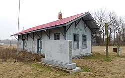
Kinmundy is a city in Marion County, Illinois, United States. The population was 733 at the 2020 census.

<span class="mw-page-title-main">Joppa, Illinois</span> Village in Illinois, United States

Joppa is a village in Massac County, Illinois, United States, along the Ohio River. The population was 350 as of the 2020 census. It is part of the Paducah, KY-IL Metropolitan Statistical Area.

<span class="mw-page-title-main">Joy, Illinois</span> Village in Illinois, United States

Joy is a village in Mercer County, Illinois, United States. The population was 372 as of the 2020 census.

<span class="mw-page-title-main">Matherville, Illinois</span> Village in Illinois, United States

Matherville is a village in Mercer County, Illinois, United States. The population was 707 at the 2020 census.

<span class="mw-page-title-main">Sherrard, Illinois</span> Village in Illinois, United States

Sherrard is a village in Mercer County, Illinois, United States. The population was 692 at the 2020 census.

<span class="mw-page-title-main">Chapin, Illinois</span> Village in Illinois, United States

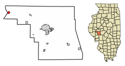
Chapin is a village in Morgan County, Illinois, United States. The population was 475 at the 2020 census. It is part of the Jacksonville Micropolitan Statistical Area.

<span class="mw-page-title-main">Bartonville, Illinois</span> Village in Illinois, United States

Bartonville is a village in Peoria County, Illinois, United States. The population was 6,471 at the 2010 census. Bartonville is a suburb of Peoria and is part of the Peoria, Illinois Metropolitan Statistical Area.

<span class="mw-page-title-main">Pinckneyville, Illinois</span> City in Illinois, United States

Pinckneyville is a city in and the county seat of Perry County, Illinois, United States. The population was 5,066 at the 2020 census. It is named for Charles Cotesworth Pinckney, an early American diplomat and presidential candidate.

<span class="mw-page-title-main">Rockton, Illinois</span> Village in Illinois, United States

Rockton is a village in Winnebago County, Illinois. It is located in the Rock River Valley and is part of the Rockford metropolitan area. The population was 7,685 at the time of the 2010 census, up from 5,296 at the time of the 2000 census.

<span class="mw-page-title-main">Hagener Township, Cass County, Illinois</span> Township in Illinois, United States

Hagener Township is one of eleven townships in Cass County, Illinois, USA. As of the 2020 census, its population was 352 and it contained 157 housing units.

References

  1. 1 2 3 U.S. Geological Survey Geographic Names Information System: Meredosia, Illinois
  2. 1 2 "2022 U.S. Gazetteer Files: Illinois". United States Census Bureau. Retrieved April 3, 2023.
  3. 1 2 "P1. Race – Meredosia village, Illinois: 2020 DEC Redistricting Data (PL 94-171)". U.S. Census Bureau. Retrieved April 3, 2023.
  4. Hasch, B. (October 4, 2011). "Plant closing, Meredosia to lose 53 local jobs", Hannibal, Missouri: KHQA-TV. Accessed here on 11/10/17: http://khqa.com/news/local/plant-closing-meredosia-to-lose-53-local-jobs
  5. "New bridge opens in Meredosia". June 19, 2018.
  6. "Census of Population and Housing". Census.gov. Retrieved June 4, 2015.
  7. "U.S. Census website". United States Census Bureau . Retrieved January 31, 2008.