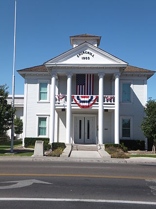
Churchill County is a county in the western U.S. state of Nevada. As of the 2020 census, the population was 25,516. Its county seat is Fallon. Named for Mexican–American War hero brevet Brigadier General Sylvester Churchill, the county was formed in 1861. Churchill County comprises the Fallon, NV Micropolitan Statistical Area. It is in northwestern Nevada. Churchill County is noteworthy in that it owns and operates the local telephone carrier, Churchill County Communications.

Benson is a city in Cochise County, Arizona, United States. As of the 2010 census, the population of the city was 5,105. It was founded as a rail terminal for the area, and located approximately 45 miles (72 km) east-southeast of the city of Tucson.

Cameron is a census-designated place (CDP) in Coconino County, Arizona, United States, on the Navajo Nation. The population was 885 at the 2010 census. Most of the town's economy is tourist food and craft stalls, restaurants, and other services for north–south traffic from Flagstaff and Page. There is a ranger station supplying information and hiking permits for the Navajo Nation. There is also a large craft store run by the Nation itself. It is named after Ralph H. Cameron, Arizona's first senator.

Elgin is a census-designated place (CDP) in Santa Cruz County, Arizona, United States. The population was 161 at the 2010 census.

Valle is a census-designated place in Coconino County, Arizona, United States. As of the 2010 US Census the population of Valle was 832. It lies at an altitude of 5,994 feet (1,827 m), at the junction of U.S. Route 180 and State Route 64. Its attractions include the Valle Airport (40G), the Planes of Fame Air Museum, and Birds of Prey, formally Bedrock City (Arizona), amusement park. Drivers often stop at the town on their way to the Grand Canyon from either Williams or Flagstaff, as it is approximately at the halfway point.
Brooks is an unincorporated community and census-designated place (CDP) in Yolo County, California, located in the Capay Valley in the northwest of the county. Brooks' ZIP Code is 95606 and its area code 530. The Yocha Dehe Wintun Nation is headquartered in Brooks. The town is home to a large casino Cache Creek Casino Resort. It lies at an elevation of 341 feet.

Rio Rico is an unincorporated community and census-designated place (CDP) in Santa Cruz County, Arizona, United States. The population was 18,962 at the 2010 census. The Rio Rico CDP replaced the former CDPs of Rio Rico Northwest, Rio Rico Northeast, Rio Rico Southwest, and Rio Rico Southeast.

Richland Township is one of eleven townships in Fountain County, Indiana, United States. As of the 2020 census, its population was 842 and it contained 384 housing units.
Perkins is a census-designated place and unincorporated community in Jenkins County, Georgia, United States. As of the 2010 census it had a population of 91.
Shaft is a census-designated place (CDP) in Allegany County, Maryland, United States. As of the 2010 census, the CDP had a population of 235. It is located south of Frostburg, in the Georges Creek Valley. It lies at an elevation of 1,795 feet (547 m).
Galloway is a census-designated place (CDP) and coal town in northwestern Barbour County, West Virginia, United States. It lies along West Virginia Route 76 northwest of the city of Philippi, the county seat of Barbour County. Its elevation is 1,073 feet (327 m). It has a post office with the ZIP code 26349. As of the 2010 census, its population is 143.

St. Libory or Saint Libory is an unincorporated community and census-designated place (CDP) in southeastern Howard County, Nebraska, United States. As of the 2010 census it had a population of 264.
Watkins is an unincorporated community and census-designated place in southeastern Benton County, Iowa, United States. As of the 2010 census, it had a population of 118. Watkins lies along local roads south of the city of Vinton, the county seat of Benton County. Its elevation is 830 feet (250 m) above sea level. Although Watkins is unincorporated, it has a post office, with the ZIP code of 52354, which opened on 15 December 1873.
South Amana is an unincorporated community and census-designated place (CDP) in northern Iowa County, Iowa, United States, and is part of the "seven villages" of the Amana Colonies. As of the 2010 census, it had a population of 159.

Bayside is a census-designated place (CDP) in Accomack County, Virginia, United States. Per the 2020 census, the population was 107.

Theba is an unincorporated community and census-designated place (CDP) in Maricopa County, Arizona, United States. Its elevation is 728 feet (222 m). Theba is located along Interstate 8 and is served by Exit 106. As of the 2020 census, it had a population of 111, down from 158 in 2010.

Dragoon is an unincorporated community and census-designated place (CDP) in Cochise County, Arizona, United States. As of the 2010 census it had a population of 209. Dragoon is 17 miles (27 km) east-northeast of the city of Benson. Dragoon has the ZIP code of 85609.
Beyerville is a census-designated place (CDP) in Santa Cruz County, Arizona, United States. The population was 177 at the 2010 census.

Antares is an unincorporated community and census designated place (CDP) in Mohave County, Arizona, United States. As of the 2020 census, it had a population of 132. It exists along part of historic U.S. Route 66.

Ak Chin, is a rural native village and a census-designated place on the Tohono Oʼodham Reservation, in Pima County, Arizona, United States. It had a population of 30 as of the 2010 U.S. Census and an estimated population of 31 as of July 1, 2015. Ak Chin has an estimated elevation of 1,854 feet (565 m) above sea level.


