Miami, Missouri

Last updated
Miami, Missouri
Saline County Missouri Incorporated and Unincorporated areas Miami Highlighted.svg
Location of Miami, Missouri
Coordinates: 39°19′22″N93°13′33″W / 39.32278°N 93.22583°W / 39.32278; -93.22583 Coordinates: 39°19′22″N93°13′33″W / 39.32278°N 93.22583°W / 39.32278; -93.22583
Country United States
State Missouri
County Saline
Area
[1]
  Total0.63 sq mi (1.63 km2)
  Land0.56 sq mi (1.45 km2)
  Water0.07 sq mi (0.19 km2)
Elevation
[2]
748 ft (228 m)
Population
 (2020)
  Total152
  Density271.91/sq mi (105.05/km2)
Time zone UTC-6 (Central (CST))
  Summer (DST) UTC-5 (CDT)
ZIP code
65344
Area code 660
FIPS code 29-47684 [3]
GNIS feature ID2395108 [2]

Miami is a city in Saline County, Missouri, United States. The population was 175 at the 2010 census.

Contents

History

Miami was originally called Greenville, under which name it was platted in 1838. [4] A post office called Miami has been in operation since 1838. [5] The present name is after the Miami Indians. [4] [6]

The Fisher-Gabbert Archeological Site, Guthrey Archeological Site, and Old Fort are listed on the National Register of Historic Places. [7]

Geography

Miami is located at 39°19′21″N93°13′30″W / 39.322460°N 93.224933°W / 39.322460; -93.224933 . [8]

According to the United States Census Bureau, the city has a total area of 0.63 square miles (1.63 km2), of which 0.56 square miles (1.45 km2) is land and 0.07 square miles (0.18 km2) is water. [9]

Demographics

Historical population
CensusPop.Note
1870 742
1880 8139.6%
1890 647−20.4%
1900 581−10.2%
1910 431−25.8%
1920 372−13.7%
1930 347−6.7%
1940 275−20.7%
1950 217−21.1%
1960 156−28.1%
1970 20531.4%
1980 177−13.7%
1990 142−19.8%
2000 16012.7%
2010 1759.4%
2020 152−13.1%
U.S. Decennial Census [10]

2010 census

As of the census [11] of 2010, there were 175 people, 60 households, and 46 families living in the city. The population density was 312.5 inhabitants per square mile (120.7/km2). There were 73 housing units at an average density of 130.4 per square mile (50.3/km2). The racial makeup of the city was 97.7% White, 0.6% African American, 0.6% from other races, and 1.1% from two or more races. Hispanic or Latino of any race were 1.7% of the population.

There were 60 households, of which 40.0% had children under the age of 18 living with them, 58.3% were married couples living together, 13.3% had a female householder with no husband present, 5.0% had a male householder with no wife present, and 23.3% were non-families. 16.7% of all households were made up of individuals, and 6.6% had someone living alone who was 65 years of age or older. The average household size was 2.92 and the average family size was 3.37.

The median age in the city was 39.3 years. 27.4% of residents were under the age of 18; 8.6% were between the ages of 18 and 24; 20.5% were from 25 to 44; 31.4% were from 45 to 64; and 12% were 65 years of age or older. The gender makeup of the city was 46.9% male and 53.1% female.

2000 census

As of the census [3] of 2000, there were 160 people, 58 households, and 40 families living in the city. The population density was 285.2 inhabitants per square mile (110.1/km2). There were 68 housing units at an average density of 121.2 per square mile (46.8/km2). The racial makeup of the city was 96.88% White, 0.62% African American, 1.88% Native American, 0.62% from other races. Hispanic or Latino of any race were 3.75% of the population.

There were 58 households, out of which 34.5% had children under the age of 18 living with them, 50.0% were married couples living together, 13.8% had a female householder with no husband present, and 31.0% were non-families. 24.1% of all households were made up of individuals, and 8.6% had someone living alone who was 65 years of age or older. The average household size was 2.76 and the average family size was 3.15.

In the city the population was spread out, with 32.5% under the age of 18, 6.9% from 18 to 24, 30.0% from 25 to 44, 22.5% from 45 to 64, and 8.1% who were 65 years of age or older. The median age was 34 years. For every 100 females, there were 88.2 males. For every 100 females age 18 and over, there were 89.5 males.

The median income for a household in the city was $27,750, and the median income for a family was $36,042. Males had a median income of $27,000 versus $13,750 for females. The per capita income for the city was $15,055. About 20.5% of families and 26.1% of the population were below the poverty line, including 42.6% of those under the age of eighteen and none of those 65 or over.

Related Research Articles

<span class="mw-page-title-main">Fairfax, Missouri</span> City in Missouri

Fairfax is a city in Clark Township, Atchison County, Missouri, United States. The population was 648 at the 2020 census.

<span class="mw-page-title-main">Amoret, Missouri</span> City in Missouri, United States

Amoret is a city in western Bates County, Missouri, and is part of the Kansas City metropolitan area within the United States. The population was 133 at the 2020 census.

<span class="mw-page-title-main">De Witt, Missouri</span> City in Missouri, United States

De Witt is a city in Carroll County, Missouri, United States. The population was 83 at the 2020 census.

<span class="mw-page-title-main">Mosby, Missouri</span> City in Missouri, United States

Mosby is a city in Clay County, Missouri, United States, along the Fishing River. The population was 101 at the 2020 census. It is part of the Kansas City metropolitan area.

<span class="mw-page-title-main">Blairstown, Missouri</span> City in Missouri, United States

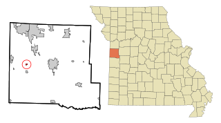
Blairstown is a city in Henry County, Missouri, United States. The population was 97 at the 2010 census.

<span class="mw-page-title-main">Calhoun, Missouri</span> City in Missouri, United States

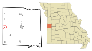
Calhoun is a city in Henry County, Missouri, United States. The population was 469 at the 2010 census.

<span class="mw-page-title-main">Alba, Missouri</span> City in Missouri, United States

Alba is a city in Jasper County, Missouri, United States. The population was 544 at the 2020 census.

<span class="mw-page-title-main">Cave, Missouri</span> Populated Place in Missouri, United States

Cave is a populated place in Lincoln County, Missouri, United States. The population was 5 at the 2010 census. With a 2020 population of 5, it is the 939th largest city in Missouri and the 19481st largest city in the United States. Cave is currently declining at a rate of 0.00% annually and its population has decreased by 0.00% since the most recent census, which recorded a population of 5 in 2010.

<span class="mw-page-title-main">Linneus, Missouri</span> City in Missouri, United States

Linneus is a small city in Linn County, Missouri, United States. The population was 281 at the 2020 census. It is the county seat of Linn County.

<span class="mw-page-title-main">Purdin, Missouri</span> City in Missouri, United States

Purdin is a city in northwest Linn County, Missouri, United States. The population was 141 at the 2020 census.

<span class="mw-page-title-main">Chamois, Missouri</span> City in Missouri, United States

Chamois is a city in Osage County, Missouri, United States. The population was 377 at the 2020 census. It is part of the Jefferson City, Missouri Metropolitan Statistical Area.

<span class="mw-page-title-main">Pleasant Hope, Missouri</span> City in Missouri, United States

Pleasant Hope is a city in Polk County, Missouri, United States. The population was 614 at the 2010 census. It is part of the Springfield, Missouri Metropolitan Statistical Area.

<span class="mw-page-title-main">Shelbyville, Missouri</span> City in Missouri, United States

Shelbyville is a city in Shelby County, Missouri, United States. The population was 518 at the 2020 census. It is the county seat of Shelby County.

<span class="mw-page-title-main">West Alton, Missouri</span> City in Missouri, United States

West Alton is a city in St. Charles County, Missouri, United States. The population was 359 at the 2020 census. It is located at the tip of the peninsula formed by the confluence of the Missouri and Mississippi Rivers and is directly across Alton, Illinois.

<span class="mw-page-title-main">Northwoods, Missouri</span> City in Missouri, United States

Northwoods is a city in St. Louis County, Missouri, United States. The population was 4,227 at the 2010 census.

<span class="mw-page-title-main">Velda City, Missouri</span> City in Missouri, United States

Velda City is a city in St. Louis County, Missouri, United States. The population was 1,420 at the 2010 census.

<span class="mw-page-title-main">Braymer, Missouri</span> City in Missouri, United States

Braymer is a city in southeast Caldwell County, Missouri. The population was 737 at the 2020 census.

<span class="mw-page-title-main">Lake Annette, Missouri</span> City in Missouri, United States

Lake Annette is a city in Cass County, Missouri, United States. The population was 100 at the 2010 census. It is part of the Kansas City metropolitan area.

<span class="mw-page-title-main">Ionia, Missouri</span> Village in Missouri, United States

Ionia is a village in northern Benton and southern Pettis counties in the U.S. state of Missouri. The population was 88 at the 2010 census.

<span class="mw-page-title-main">Blackburn, Missouri</span> City in Missouri, United States

Blackburn is a city in Lafayette and Saline counties in the U.S. state of Missouri and is part of the Kansas City metropolitan area. The population was 249 at the 2010 census.

References

  1. "ArcGIS REST Services Directory". United States Census Bureau. Retrieved August 28, 2022.
  2. 1 2 U.S. Geological Survey Geographic Names Information System: Miami, Missouri
  3. 1 2 "U.S. Census website". United States Census Bureau . Retrieved 2008-01-31.
  4. 1 2 "Saline County Place Names, 1928–1945". The State Historical Society of Missouri. Archived from the original on June 24, 2016. Retrieved December 22, 2016.
  5. "Post Offices". Jim Forte Postal History. Retrieved 22 December 2016.
  6. Eaton, David Wolfe (1918). How Missouri Counties, Towns and Streams Were Named. The State Historical Society of Missouri. p. 361.
  7. "National Register Information System". National Register of Historic Places . National Park Service. July 9, 2010.
  8. "US Gazetteer files: 2010, 2000, and 1990". United States Census Bureau. 2011-02-12. Retrieved 2011-04-23.
  9. "US Gazetteer files 2010". United States Census Bureau. Archived from the original on 2012-01-25. Retrieved 2012-07-08.
  10. "Census of Population and Housing". Census.gov. Retrieved June 4, 2015.
  11. "U.S. Census website". United States Census Bureau . Retrieved 2012-07-08.